Country:
 Canada
Region:
City:
Latitude and Longitude:
Time Zone:
Postal Code:
IP information under different IP Channel
ip-api
Country
Region
City
ASN
Time Zone
ISP
Blacklist
Proxy
Latitude
Longitude
Postal
Route
IPinfo
Country
Region
City
ASN
Time Zone
ISP
Blacklist
Proxy
Latitude
Longitude
Postal
Route
MaxMind
Country
Region
City
ASN
Time Zone
ISP
Blacklist
Proxy
Latitude
Longitude
Postal
Route
Luminati
Country
CARegion
on
City
walkerton
ASN
Time Zone
America/Toronto
ISP
WIGHT-AS
Latitude
Longitude
Postal
db-ip
Country
Region
City
ASN
Time Zone
ISP
Blacklist
Proxy
Latitude
Longitude
Postal
Route
ipdata
Country
Region
City
ASN
Time Zone
ISP
Blacklist
Proxy
Latitude
Longitude
Postal
Route
Popular places and events near this IP address
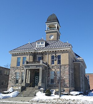
Walkerton, Ontario
Town in Ontario, Canada
Distance: Approx. 563 meters
Latitude and longitude: 44.13111111,-81.15055556
Walkerton is a town in the municipality of Brockton, Bruce County, Ontario, Canada. It is the site of Brockton's municipal offices and is the county seat. Walkerton is located on the Saugeen River, at the junction of King's Highway 9 and the former King's Highway 4 and is 75 km southwest of Owen Sound.

Brockton, Ontario
Municipality in Ontario, Canada
Distance: Approx. 6596 meters
Latitude and longitude: 44.16666667,-81.21666667
Brockton is a municipality in the Canadian province of Ontario, located in Bruce County. As of 2016, the population was 9,461. The current municipality was formed on January 1, 1999, by amalgamating the former township of Brant, former township of Greenock and the town of Walkerton.
Walkerton E. coli outbreak
2000 water contamination in Ontario, Canada
Distance: Approx. 349 meters
Latitude and longitude: 44.13333333,-81.15
The Walkerton E. coli outbreak was the result of a contamination of the drinking water supply of Walkerton, Ontario, Canada, with E. coli and Campylobacter jejuni bacteria. The water supply was contaminated as a result of improper water treatment following heavy rainfall in late April and early May 2000, that had drawn bacteria from the manure of nearby cattle used to fertilize crops into the shallow aquifer of a nearby well. The first reported case was on May 17.
CIBU-FM
Radio station in Wingham, Ontario
Distance: Approx. 6933 meters
Latitude and longitude: 44.09055556,-81.20694444
CIBU-FM is a Canadian radio station, which broadcasts at 94.5 FM in Wingham, Ontario. The station broadcasts a classic hits format with the brand name Cool 94.5. In 2003, the CRTC denied the application by Blackburn Radio.

CKNX-FM
Radio station in Wingham, Ontario, Canada
Distance: Approx. 6933 meters
Latitude and longitude: 44.09055556,-81.20694444
CKNX-FM is a Canadian radio station, which broadcasts at 101.7 FM in Wingham, Ontario. The station broadcasts a hot adult contemporary format as 101.7 The One. The station was formerly known as FM102 before summer 2006.

Hanover Saugeen Airport
Airport in Ontario, Canada
Distance: Approx. 7117 meters
Latitude and longitude: 44.15805556,-81.06333333
Hanover Saugeen Airport (ICAO: CYHS) is located 1.6 nautical miles (3.0 km; 1.8 mi) west northwest of Hanover, Ontario, Canada. The airport is classified as an airport of entry by Nav Canada and is staffed by the Canada Border Services Agency (CBSA). CBSA officers at this airport can handle general aviation aircraft only, with no more than 15 passengers.
Lake Rosalind (Ontario)
Distance: Approx. 8808 meters
Latitude and longitude: 44.1736,-81.0501
Lake Rosalind is a small inland lake located in Bruce County, Ontario, Canada between the towns of Hanover and Walkerton. Lake Rosalind and the interconnected Marl Lake to its south are manmade lakes that were created by the excavation of marl for local cement plants in the early 1900s and the construction of dams later in 1939 and 1946. Both lakes are relatively shallow and small in area (38 hectares and 14 hectares, respectively).
Maple Hill, Bruce County, Ontario
Dispersed rural community in Ontario, Canada
Distance: Approx. 5554 meters
Latitude and longitude: 44.14472222,-81.07833333
Maple Hill is an dispersed rural community in the township municipality of Brockton, Bruce County, Ontario, Canada. The settlement is located on Grey/Bruce Road 4, between Walkerton and Hanover. The Saugeen River flows south of Maple Hill, and Ruhl Creek, a tributary of the Saugeen, flows east of the community.
Walkerton District Secondary School
School in Walkerton, Ontario, Canada
Distance: Approx. 1794 meters
Latitude and longitude: 44.1192,-81.1456
Walkerton District Secondary School (WDSS) was a public high school in the town of Walkerton, Ontario, Canada. The school was replaced in 2012 when Walkerton District Secondary School, Brant Public School and Walkerton Public School amalgamated into one new K–12 school called Walkerton District Community School.

Walkerton District Community School
Community school in Walkerton, Ontario, Canada
Distance: Approx. 2029 meters
Latitude and longitude: 44.11712,-81.14846
Walkerton District Community School is a public K–12 school in Walkerton, Ontario, Canada.
Ruhl Creek
River in Ontario, Canada
Distance: Approx. 5908 meters
Latitude and longitude: 44.14083333,-81.07305556
Ruhl Creek (French: ruisseau Ruhl) is a stream in the township municipality of Brockton, Bruce County in Southwestern Ontario, Canada. It is in the Lake Huron drainage basin and is a right tributary of the Saugeen River.
Ruhl Lake
Lake in Ontario, Canada
Distance: Approx. 7473 meters
Latitude and longitude: 44.17083333,-81.06722222
Ruhl Lake (French: lac Ruhl) is a lake in the township municipality of Brockton, Bruce County in Southwestern Ontario, Canada. It is in the Lake Huron drainage basin and is the source of Ruhl Creek. The lake has an area of 2.97 hectares (7.3 acres) and lies at an elevation of 277 metres (909 ft).
Weather in this IP's area
clear sky
13 Celsius
13 Celsius
13 Celsius
17 Celsius
1014 hPa
93 %
1014 hPa
984 hPa
10000 meters
3.43 m/s
6.09 m/s
147 degree
8 %
07:10:00
19:25:46