Country:
 USA
USARegion:
City:
Latitude and Longitude:
Time Zone:
Postal Code:
IP information under different IP Channel
ip-api
Country
Region
City
ASN
Time Zone
ISP
Blacklist
Proxy
Latitude
Longitude
Postal
Route
IPinfo
Country
Region
City
ASN
Time Zone
ISP
Blacklist
Proxy
Latitude
Longitude
Postal
Route
MaxMind
Country
Region
City
ASN
Time Zone
ISP
Blacklist
Proxy
Latitude
Longitude
Postal
Route
Luminati
Country
USASN
Time Zone
America/Chicago
ISP
HURRICANE
Latitude
Longitude
Postal
db-ip
Country
Region
City
ASN
Time Zone
ISP
Blacklist
Proxy
Latitude
Longitude
Postal
Route
ipdata
Country
Region
City
ASN
Time Zone
ISP
Blacklist
Proxy
Latitude
Longitude
Postal
Route
Popular places and events near this IP address

Orem, Utah
City in Utah, United States
Distance: Approx. 3449 meters
Latitude and longitude: 40.29888889,-111.69638889
Orem is a city in Utah County, Utah, United States, in the northern part of the state. It is adjacent to Provo, Lindon, and Vineyard and is approximately 45 miles south of Salt Lake City. Orem is one of the principal cities of the Provo-Orem, Utah Metropolitan Statistical Area, which includes all of Utah and Juab counties.

Orem High School
School in Utah, USA
Distance: Approx. 2989 meters
Latitude and longitude: 40.29222222,-111.68416667
Orem High School is a high school in Orem, Utah, part of the Alpine School District. It was originally built in 1956, and has since undergone major renovations. The old school building was torn down and a replacement was built in what was the former building's parking lot, in 2010.
Timpanogos High School
Public school in Orem, Utah
Distance: Approx. 3094 meters
Latitude and longitude: 40.32333333,-111.69166667
Timpanogos High School is a public high school in Orem, Utah, United States. Opened to its first students in August 1996, it became part of the Alpine School District of Utah County. The school mascot is the Timberwolf and the official school colors are blue, green, grey, and white.
Timpanogos Storytelling Festival
Distance: Approx. 1893 meters
Latitude and longitude: 40.32472222,-111.64583333
The Timpanogos Storytelling Festival takes place the weekend after Labor Day at the end of each summer in Lehi, Utah. The festival draws a combined attendance of about 26,000 people each year, making it one of the largest storytelling festival in the United States. The festival typically lasts two days and invites professional storytellers from throughout the United States.

The Shops at Riverwoods
Shopping center in Provo, Utah, United States
Distance: Approx. 1352 meters
Latitude and longitude: 40.29888889,-111.65777778
The Shops At Riverwoods is located at 4801 North University Ave. (US Highway 189) in Provo, Utah at the base of the Wasatch Mountains near the entrance to Provo Canyon. The Shops at Riverwoods is at the center of the Riverwoods Community, a 120-acre (0.49 km2) village containing 186,667 square feet (17,341.9 m2) of retail space, 143 residences, retail, restaurants, and entertainment venues.

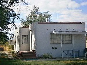
Olmsted Station Powerhouse
United States historic place
Distance: Approx. 691 meters
Latitude and longitude: 40.31583333,-111.65388889
The Olmsted Power Station is a historic building located in Orem, Utah, United States. It is listed on the National Register of Historic Places. The hydropower plant was dedicated on April 12, 1904 and decommissioned on September 21, 2015.

Carter–Terry–Call House
Historic residence in Orem, Utah, United States
Distance: Approx. 3461 meters
Latitude and longitude: 40.2825,-111.67527778
The Carter–Terry–Call House is a historic residence in Orem, Utah, United States, that is listed on the National Register of Historic Places (NRHP).

Alexander and Nellie P. Cordner House
Historic house in Utah, United States
Distance: Approx. 3260 meters
Latitude and longitude: 40.28944444,-111.685
The Alexander and Nellie P. Cordner House is a historic Victorian Eclectic house located at 415 S. 400 E. in Orem, Utah. Built in 1909, the 1+1⁄2-story brick house has projecting bays and an asymmetrical facade. It was listed on the National Register of Historic Places in 1998.

Cordner–Calder House
Historic house in Utah, United States
Distance: Approx. 2477 meters
Latitude and longitude: 40.29138889,-111.67277778
The Cordner–Calder House at 305 S. 900 E. in Orem, Utah is a Victorian-style house which was built in 1894 by William Cordner and was expanded around 1910. The home is associated with two families, the Cordners and the Calders, both of which were "prominent fruit growers on the Provo Bench" whose "participation and influence in the growth of Orem is reflected in this house". It was built on what was once part of a 160 acres (65 ha) tract patented by Irish immigrant Thomas Cordner in 1886.

McBride-Sims Garage
United States historic place
Distance: Approx. 3399 meters
Latitude and longitude: 40.30833333,-111.69888889
The McBride-Sims Garage at 600 N. State St. in Orem, Utah is a brick building built in c.1920, in what is termed Early Commercial architecture. It has also been known as Big John's Country Store.

Lars and Christina Olsen House
Historic house in Orem, Utah, United States
Distance: Approx. 3018 meters
Latitude and longitude: 40.28944444,-111.68055556
The Lars and Christina Olsen House is a historic residence in southeastern Orem, Utah, United States, that is listed on the National Register of Historic Places (NRHP).
Alvin and Grace Washburn House
Historic residence in Orem, Utah, United States
Distance: Approx. 3316 meters
Latitude and longitude: 40.31138889,-111.69805556
The Alvin and Grace Washburn House is a historic residence in Orem, Utah, United States, that is listed on the National Register of Historic Places (NRHP).
Weather in this IP's area
light rain
5 Celsius
3 Celsius
3 Celsius
6 Celsius
1014 hPa
88 %
1014 hPa
849 hPa
10000 meters
2.06 m/s
100 %
07:41:02
18:41:58