166.130.47.76 - IP Lookup: Free IP Address Lookup, Postal Code Lookup, IP Location Lookup, IP ASN, Public IP
Country:
Region:
City:
Location:
Time Zone:
Postal Code:
IP information under different IP Channel
ip-api
Country
Region
City
ASN
Time Zone
ISP
Blacklist
Proxy
Latitude
Longitude
Postal
Route
Luminati
Country
ASN
Time Zone
America/Chicago
ISP
ATT-MOBILITY-LLC-AS20057
Latitude
Longitude
Postal
IPinfo
Country
Region
City
ASN
Time Zone
ISP
Blacklist
Proxy
Latitude
Longitude
Postal
Route
IP2Location
166.130.47.76Country
Region
pennsylvania
City
doylestown
Time Zone
America/New_York
ISP
Language
User-Agent
Latitude
Longitude
Postal
db-ip
Country
Region
City
ASN
Time Zone
ISP
Blacklist
Proxy
Latitude
Longitude
Postal
Route
ipdata
Country
Region
City
ASN
Time Zone
ISP
Blacklist
Proxy
Latitude
Longitude
Postal
Route
Popular places and events near this IP address
Bucks County, Pennsylvania
County in Pennsylvania, United States
Distance: Approx. 1005 meters
Latitude and longitude: 40.34,-75.11
Bucks County is a county in the Commonwealth of Pennsylvania. As of the 2020 census, the population was 646,538, making it the fourth-most populous county in Pennsylvania. Its county seat is Doylestown.

Doylestown, Pennsylvania
City in Bucks County, Pennsylvania
Distance: Approx. 2431 meters
Latitude and longitude: 40.31277778,-75.12888889
Doylestown is a borough in and the county seat of Bucks County, Pennsylvania, United States. As of the 2020 census, the borough population was 8,300. Doylestown is located 20 miles (32 km) northwest of Trenton, 25 miles (40 km) north of Center City Philadelphia, and 27 miles (43 km) southeast of Allentown.
Doylestown Township, Pennsylvania
Township in Pennsylvania, United States
Distance: Approx. 2354 meters
Latitude and longitude: 40.3129,-75.127
Doylestown Township is a township in Bucks County, Pennsylvania, United States. The population was 17,565 at the 2010 census. Adjacent to the county seat, the township hosts many county offices and the county correctional facility.
Fonthill (house)
Historic house in Pennsylvania, United States
Distance: Approx. 1371 meters
Latitude and longitude: 40.321158,-75.122902
Fonthill, also known as Fonthill Castle, was the home of the American archeologist and tile maker Henry Chapman Mercer, in Doylestown, Pennsylvania.

Moravian Pottery and Tile Works
United States historic place
Distance: Approx. 1208 meters
Latitude and longitude: 40.32305556,-75.12361111
The Moravian Pottery & Tile Works (MPTW) is a history museum which is located in Doylestown, Pennsylvania. It is owned by the County of Bucks, and operated by TileWorks of Bucks County, a 501c3 non-profit organization. The museum was individually listed on the National Register of Historic Places in 1972, and was later included in a National Historic Landmark District along with the Mercer Museum and Fonthill.
The Fountain House (Doylestown, Pennsylvania)
Historic house in Pennsylvania, United States
Distance: Approx. 2781 meters
Latitude and longitude: 40.31,-75.13083333
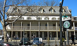
The Fountain House is located in the borough of Doylestown, Pennsylvania, in the central commercial district. The four-story building is steeped in local history and is a major landmark of the Bucks County area. It was added to the National Register of Historic Places in 1972.

Doylestown Airport
Airport
Distance: Approx. 458 meters
Latitude and longitude: 40.33305556,-75.12194444
Doylestown Airport (IATA: DYL, ICAO: KDYL, FAA LID: DYL) is a public airport in Bucks County, Pennsylvania, owned by the Bucks County Airport Authority (BCAA). It is two nautical miles north of Doylestown, Pennsylvania and has a single fixed-base operator, Leading Edge Aviation, Civil Air Patrol squadron 907, flight training, and aircraft rentals.

Pugh Dungan House
United States historic place
Distance: Approx. 2785 meters
Latitude and longitude: 40.31027778,-75.13166667
Pugh Dungan House is a historic home located in Doylestown, Bucks County, Pennsylvania. It was built about 1830, and is a 2+1⁄2-story, five-bay, stuccoed brick and fieldstone dwelling in the Federal style. It features a single bay, pedimented portico supported by Doric order columns.
James-Lorah House
Historic house in Pennsylvania, United States
Distance: Approx. 2517 meters
Latitude and longitude: 40.31277778,-75.13111111
The James-Lorah House, also known as the Judge Chapman House and VIA House, is an historic American home that is located in Doylestown, Bucks County, Pennsylvania. It was added to the National Register of Historic Places in 1972.
Oscar Hammerstein II Farm
Historic house in Pennsylvania, United States
Distance: Approx. 2559 meters
Latitude and longitude: 40.30972222,-75.1125
The Oscar Hammerstein II Farm, also known as the Highland Farm, is an historic home and farm complex that is located in Doylestown, Bucks County, Pennsylvania. It was added to the National Register of Historic Places in 1988.

Dyerstown Historic District
Historic district in Pennsylvania, United States
Distance: Approx. 1253 meters
Latitude and longitude: 40.34111111,-75.12611111
Dyerstown Historic District is a national historic district located in Dyerstown, Plumstead Township, Bucks County, Pennsylvania. The district includes 17 contributing buildings and 3 contributing structures in the crossroads village of Dyerstown. It is a largely residential district, with dwellings dating to the turn of the 19th century.

Fonthill, Mercer Museum and Moravian Pottery and Tile Works
United States historic place
Distance: Approx. 1873 meters
Latitude and longitude: 40.31694444,-75.125
Fonthill, Mercer Museum and Moravian Pottery and Tile Works is a National Historic Landmark District located at Doylestown, Bucks County, Pennsylvania. It consists of three properties built by Henry Chapman Mercer (1856-1930) in a distinctive application of the principles of the Arts and Crafts movement, which are also notable for the early use of poured concrete: Fonthill, the Mercer Museum, and the Moravian Pottery and Tile Works. All three are now museum properties of the Bucks County Historical Society.
Weather in this IP's area
clear sky
-9 Celsius
-16 Celsius
-10 Celsius
-8 Celsius
1027 hPa
61 %
1027 hPa
1011 hPa
10000 meters
4.63 m/s
310 degree


