Country:
Region:
City:
Latitude and Longitude:
Time Zone:
Postal Code:
IP information under different IP Channel
ip-api
Country
Region
City
ASN
Time Zone
ISP
Blacklist
Proxy
Latitude
Longitude
Postal
Route
Luminati
Country
ASN
Time Zone
Asia/Seoul
ISP
LG CNS
Latitude
Longitude
Postal
IPinfo
Country
Region
City
ASN
Time Zone
ISP
Blacklist
Proxy
Latitude
Longitude
Postal
Route
db-ip
Country
Region
City
ASN
Time Zone
ISP
Blacklist
Proxy
Latitude
Longitude
Postal
Route
ipdata
Country
Region
City
ASN
Time Zone
ISP
Blacklist
Proxy
Latitude
Longitude
Postal
Route
Popular places and events near this IP address
Samsung Tower Palace 3 – Tower G
Residential in Seoul, South Korea
Distance: Approx. 467 meters
Latitude and longitude: 37.48716389,127.05325833
Tower G, or simply Tower Palace Three, is a 73-floor luxury residential skyscraper in Seoul, South Korea. The structure was originally designed to be 93 stories high, but was later scaled down due to zoning rights imposed by city regulations. A notable feature of this structure is the implementation of the Y-shaped tripartite floor geometry which maximizes views and floor space.

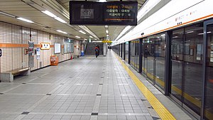
Yangjae station
Station of the Seoul Metropolitan Subway
Distance: Approx. 1434 meters
Latitude and longitude: 37.48444444,127.03388889
Yangjae (Seocho-gu Office) Station is a station on the Seoul Subway Line 3 and Shinbundang Line. It was the southern terminus of Line 3 until October 30, 1993, when the line was extended to Suseo station, and it became a transfer station with the Shinbundang Line on October 28, 2011. It is located in Yangjae-dong, Seocho and Gangnam District, Seoul.

Maebong station
Distance: Approx. 458 meters
Latitude and longitude: 37.48691,127.04671
Maebong Station is a station on the Seoul Subway Line 3. It is located in Dogok-dong, Gangnam-gu, Seoul and was named after the nearby Maebongsan mountain.

Samsung Tower Palace
Apartment towers in Seoul, South Korea
Distance: Approx. 591 meters
Latitude and longitude: 37.4886,127.05296389
The Samsung Tower Palace (Korean: 삼성 타워팰리스) is a group of seven towers, lettered A-G. They are located in Dogok-dong, Gangnam District, Seoul, South Korea. They range from 42 to 72 floors, all built between 2002 and 2004, and all used as luxury residential complexes. Tower Palace "G", which is 73 floors and 264 metres (866 feet) high, was the tallest building in Korea since 2004 but was surpassed by the Northeast Asia Trade Tower in 2009.

Dogok station
Train station in Seoul, South Korea
Distance: Approx. 911 meters
Latitude and longitude: 37.49083056,127.05538333
Dogok Station (Korean: 도곡역) is a station on Seoul Subway Line 3 and the Suin–Bundang Line in Gangnam District, Seoul. This station serves one of the most affluent neighborhoods in Korea; the Samsung Tower Palace complex, which includes one of the tallest buildings in South Korea, has a direct passageway link with the station. Another set of high-wealth residential apartments - the Dongbu Centreville - is also linked by an underground passageway.

Hanti station
Distance: Approx. 1391 meters
Latitude and longitude: 37.49611111,127.05277778
Hanti Station (Korean: 한티역) is a station on the Suin–Bundang Line, a commuter rail line of Korail. The name of this station is taken from that of a former village in the vicinity, and has meaning "great hill" in the native Korean language. Daechi (大峙), the neighborhood in which the station is located, is the Chinese translation of this name.

Guryong station
Metro station in Seoul, South Korea
Distance: Approx. 862 meters
Latitude and longitude: 37.48666667,127.05916667
Guryong station (Korean: 구룡역) is a station on the Suin–Bundang Line of the Seoul Metropolitan Subway network in South Korea. It is in the Gaepo-dong area of the Gangnam District of Seoul. The station opened on October 24, 2004.

Gaepo-dong station
Distance: Approx. 1524 meters
Latitude and longitude: 37.48888889,127.06611111
Gaepo-dong Station (Korean: 개포동역) is a station on the Suin–Bundang Line, a commuter rail line of Korail.
Sookmyung Girls' High School
Private school in Seoul, South Korea
Distance: Approx. 823 meters
Latitude and longitude: 37.4907289,127.0533366
Sookmyung Girls' High School (Korean: 숙명여자고등학교; Hanja: 淑明女子高等學校) is a private girls high school located in Gangnam-gu, Seoul, South Korea.

Torch Trinity Graduate University
Christian school in Seoul, South Korea
Distance: Approx. 1545 meters
Latitude and longitude: 37.47916667,127.03361111
Torch Trinity Graduate University (TTGU; Korean: 횃불트리니티신학대학원대학교) is an evangelical graduate school and seminary in Yangjae-dong, Seocho District, Seoul, South Korea. It was formerly called Torch Trinity Graduate School of Theology (TTGST). The university commits itself to the cause of Christian missions, with an emphasis on training future leaders of the church from all over the world.
Guryong Village
Shanty town in Sudogwon, South Korea
Distance: Approx. 1495 meters
Latitude and longitude: 37.4765,127.0643
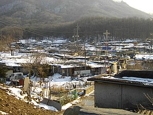
Guryong Village (Korean: 구룡마을) is a shanty town in Seoul, South Korea. It is just across a six-lane motorway from Dogok-dong of the affluent Gangnam District. It has been called "the last slum in Seoul's glitzy Gangnam district", "the last shanty town in Gangnam", and "the last remaining urban slum in Seoul", although this claim has been treated skeptically due to the continued existence of at least two other notable areas.

Korea Foreign School
School in South Korea
Distance: Approx. 809 meters
Latitude and longitude: 37.48473889,127.04102222
Korea Foreign School (KFS) is a non-profit private coeducational day-school in the Gangnam Area of Seoul, South Korea. KFS is established and operated under the Seoul Metropolitan Office of Education. Korea Foreign School educates children from grade 1 through grade 10.
Weather in this IP's area
broken clouds
7 Celsius
6 Celsius
7 Celsius
8 Celsius
1032 hPa
49 %
1032 hPa
1029 hPa
10000 meters
2.06 m/s
340 degree
75 %
07:15:41
17:19:00
