Country:
Region:
City:
Latitude and Longitude:
Time Zone:
Postal Code:
IP information under different IP Channel
ip-api
Country
Region
City
ASN
Time Zone
ISP
Blacklist
Proxy
Latitude
Longitude
Postal
Route
Luminati
Country
Region
nj
City
northbrunswick
ASN
Time Zone
America/New_York
ISP
SILVERSKY-INC
Latitude
Longitude
Postal
IPinfo
Country
Region
City
ASN
Time Zone
ISP
Blacklist
Proxy
Latitude
Longitude
Postal
Route
db-ip
Country
Region
City
ASN
Time Zone
ISP
Blacklist
Proxy
Latitude
Longitude
Postal
Route
ipdata
Country
Region
City
ASN
Time Zone
ISP
Blacklist
Proxy
Latitude
Longitude
Postal
Route
Popular places and events near this IP address

Ansonia, Connecticut
City in Connecticut, United States
Distance: Approx. 1002 meters
Latitude and longitude: 41.34333333,-73.06861111
Ansonia is a city in New Haven County, Connecticut, United States. Located on the Naugatuck River, it is immediately north of Derby, and about 12 miles (19 km) northwest of New Haven. The city is part of the Naugatuck Valley Planning Region.

Derby, Connecticut
City in Connecticut, United States
Distance: Approx. 1868 meters
Latitude and longitude: 41.32666667,-73.08222222
Derby is a city in New Haven County, Connecticut, United States, approximately 8 miles (13 km) west-northwest of New Haven. It is located in southwest Connecticut at the confluence of the Housatonic and Naugatuck rivers. It shares borders with the cities of Ansonia to the north and Shelton to the southwest, and the towns of Orange to the south, Seymour to the northwest, and Woodbridge to the east.
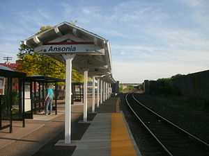
Ansonia station
Metro-North Railroad station in Connecticut
Distance: Approx. 107 meters
Latitude and longitude: 41.3442,-73.0799
Ansonia station is a commuter rail station on the Waterbury Branch of the Metro-North Railroad's New Haven Line, located in Ansonia, Connecticut.

David Humphreys House
Historic house in Connecticut, United States
Distance: Approx. 1446 meters
Latitude and longitude: 41.33111111,-73.075
The General David Humphreys House is a historic house museum at 37 Elm Street in Ansonia, Connecticut. Built in the 1690s, it was the birthplace of the American Revolutionary War Colonel David Humphreys. It is now owned by the Derby Historical Society and serves as its headquarters.
St. Joseph Church (Ansonia, Connecticut)
Church in Connecticut, United States
Distance: Approx. 818 meters
Latitude and longitude: 41.34013889,-73.07183333
St. Joseph Parish is a church designated for Polish immigrants in Ansonia, Connecticut, United States. Founded in 1925, it is one of the Polish-American Roman Catholic parishes in New England in the Archdiocese of Hartford.

Osbornedale State Park
Distance: Approx. 1855 meters
Latitude and longitude: 41.33611111,-73.10055556
Osbornedale State Park is a public recreation area occupying 417 acres (169 ha) on the east bank of the Housatonic River primarily in the town of Derby, Connecticut, with a small portion in Ansonia. The state park includes the historic Osborne Homestead, the Kellogg Environmental Center, and an extensive system of hiking trails. The park is managed by the Connecticut Department of Energy and Environmental Protection.

United States Post Office–Ansonia Main
United States historic place
Distance: Approx. 171 meters
Latitude and longitude: 41.34305556,-73.07861111
The U.S. Post Office-Ansonia Main, also known as the Ansonia Main Post Office, is located at 237 Main Street in Ansonia, Connecticut. Designed by Oscar Wenderoth and completed in 1914, it is one of the more architecturally sophisticated buildings in Ansonia's central business district. The building was listed on the National Register of Historic Places in 1985.

Ansonia Library
United States historic place
Distance: Approx. 370 meters
Latitude and longitude: 41.34527778,-73.07694444
The Ansonia Library is the public library serving Ansonia, Connecticut. It is located at 53 South Cliff, in an architecturally distinguished Richardsonian Romanesque building designed by Connecticut architect George Keller and completed in 1892 as a gift from Caroline Phelps Stokes. It was listed on the National Register of Historic Places on August 23, 1985.
Griffin Hospital
Hospital in Connecticut, USA
Distance: Approx. 1102 meters
Latitude and longitude: 41.335889,-73.089189
Griffin Hospital is a 160-bed community hospital founded in 1909 and located in Derby, Connecticut. The hospital serves more than 130,000 residents in the Lower Naugatuck Valley. Griffin Hospital is Derby's top employer and one of New Haven County's largest employers.
Derby High School (Connecticut)
US high school
Distance: Approx. 1805 meters
Latitude and longitude: 41.3338,-73.098
Derby High School is a public secondary education school for grades 9–12, it is located at 75 Chatfield Street in Derby. It is the only public secondary education school in Derby and is one of five public schools in the city. The current school building was built in 1967, and up until 2010 housed Derby Middle and High Schools together.

Richard Mansfield House
Historic house in Connecticut, United States
Distance: Approx. 934 meters
Latitude and longitude: 41.33972222,-73.07055556
The Richard Mansfield House is a historic house at 35 Jewett Street in Ansonia, Connecticut. Built at the turn of the 17th-century, it is one of the community's oldest surviving buildings, and is noted for its association with a prominent early Episcopal minister. It was listed on the National Register of Historic Places in 1971.

Upper Main Street Historic District (Ansonia, Connecticut)
Historic district in Connecticut, United States
Distance: Approx. 164 meters
Latitude and longitude: 41.34472222,-73.07972222
The Upper Main Street Historic District encompasses a collection of mainly late-19th-century commercial buildings on Main Street in downtown Ansonia, Connecticut. Extending south from Maple Street, the district exemplifies the rapid commercial growth of the city at that time. Its most prominent feature is the Ansonia Opera House, built 1870.
Weather in this IP's area
few clouds
16 Celsius
15 Celsius
14 Celsius
17 Celsius
1013 hPa
50 %
1013 hPa
1010 hPa
10000 meters
3.58 m/s
5.36 m/s
213 degree
13 %
06:32:47
16:39:29
