165.140.205.250 - IP Lookup: Free IP Address Lookup, Postal Code Lookup, IP Location Lookup, IP ASN, Public IP
Country:
Region:
City:
Location:
Time Zone:
Postal Code:
ISP:
ASN:
language:
User-Agent:
Proxy IP:
Blacklist:
IP information under different IP Channel
ip-api
Country
Region
City
ASN
Time Zone
ISP
Blacklist
Proxy
Latitude
Longitude
Postal
Route
db-ip
Country
Region
City
ASN
Time Zone
ISP
Blacklist
Proxy
Latitude
Longitude
Postal
Route
IPinfo
Country
Region
City
ASN
Time Zone
ISP
Blacklist
Proxy
Latitude
Longitude
Postal
Route
IP2Location
165.140.205.250Country
Region
ontario
City
north woolwich
Time Zone
America/Toronto
ISP
Language
User-Agent
Latitude
Longitude
Postal
ipdata
Country
Region
City
ASN
Time Zone
ISP
Blacklist
Proxy
Latitude
Longitude
Postal
Route
Popular places and events near this IP address

Woolwich, Ontario
Township in Ontario, Canada
Distance: Approx. 7591 meters
Latitude and longitude: 43.56666667,-80.48333333
The Township of Woolwich (local pronunciation: IPA /ˈwʊl̴ɪt͡ʃ/) is a rural township in Southwestern Ontario. The municipality is located in the northeastern part of Waterloo Region and is made up of 10 small communities, with Elmira, Ontario the largest and St. Jacobs, Ontario the second largest.

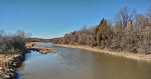
Conestogo River
River in Ontario, Canada
Distance: Approx. 7292 meters
Latitude and longitude: 43.53833333,-80.48638889
The Conestogo River is a river in Waterloo Region and Wellington County in Southwestern Ontario, Canada. The river was named by Mennonite settlers after the Conestoga River in Pennsylvania. In the 1800s there were several different spellings of the name of the river and of the nearby settlement of Conestogo, Ontario but the name ending in "o" became official.

Ariss, Ontario
Unincorporated rural community in Ontario, Canada
Distance: Approx. 4557 meters
Latitude and longitude: 43.57527778,-80.365
Ariss is an unincorporated rural community in Guelph/Eramosa Township, Wellington County, Ontario, Canada.

Maryhill, Ontario
Unincorporated rural community in Ontario, Canada
Distance: Approx. 942 meters
Latitude and longitude: 43.53388889,-80.39
Maryhill is an unincorporated rural community in the township of Woolwich, Waterloo Region, Ontario, Canada. The population was 576 in 2016. Hopewell Creek flows through the settlement.

Winterbourne, Ontario
Unincorporated community in Ontario, Canada
Distance: Approx. 6321 meters
Latitude and longitude: 43.5575,-80.47111111
Winterbourne () is a village located to the east of the Grand River in the township of Woolwich in the Regional Municipality of Waterloo, Ontario, Canada. It is located just northeast of the city of Waterloo. The fine stonework of the Scottish stonemasons can be seen in many of the older buildings throughout the settlement.

Breslau, Ontario
Unincorporated community in Ontario, Canada
Distance: Approx. 7446 meters
Latitude and longitude: 43.47527778,-80.4125
Breslau (ˈbɹɛzlɑː) is a community located within the township of Woolwich, part of the Waterloo Regional Municipality in Ontario Canada. Separated from the city of Kitchener by the Grand River, Breslau is named after the former German city of Breslau, now Wrocław, capital of Poland's Lower Silesia. It is located at the junction of Highway 7 and Waterloo Regional Road 17.

Wellington Brewery
Distance: Approx. 6162 meters
Latitude and longitude: 43.5333,-80.3205
Wellington Brewery is a brewery in Guelph, Ontario, Canada. It was established in 1985 and was one of the first North American breweries to revive the ancient technique of brewing cask-conditioned cask ale. Phil Gosling was the founder.
Woodland Christian High School
Independent school in Breslau, Ontario, Canada
Distance: Approx. 5557 meters
Latitude and longitude: 43.49333333,-80.41611111
Woodland Christian High School (WCHS) is a secondary school located in Breslau, Ontario, Canada. Founded in 1976 by a group of churches in the Cambridge area, Woodland provides Christian-based education. During the beginning years, it operated from several Church facilities in the Cambridge and the Kitchener–Waterloo areas.
Bloomingdale, Ontario
Distance: Approx. 6412 meters
Latitude and longitude: 43.509439,-80.462463
Bloomingdale is an unincorporated community in Ontario, Canada. It is recognized as a designated place by Statistics Canada.

Weissenburg, Ontario
Unincorporated rural community in Ontario, Canada
Distance: Approx. 3725 meters
Latitude and longitude: 43.57444444,-80.4
Weissenburg is an unincorporated rural community in Woolwich Township, Waterloo, Ontario, Canada. Weissenburg is located at the crossroads of Line 86 and Sideroad 16.

St. John's-Kilmarnock School
Independent boarding school in Breslau, Ontario, Canada
Distance: Approx. 3543 meters
Latitude and longitude: 43.5107,-80.3831
St. John's Kilmarnock School (often called SJK School or SJK) is an independent school in Waterloo Region, Ontario, operating under the International Baccalaureate program. The School is located on a 36-acre natural campus offering enriched educational programming for students from Junior Kindergarten to Grade 12 through its International Baccalaureate (IB) curriculum.
Breslau GO Station
Future railway station in Woolwich, Ontario, Canada
Distance: Approx. 6214 meters
Latitude and longitude: 43.48527778,-80.39583333
Breslau GO Station is a planned GO Transit train station to be built by Metrolinx near the community of Breslau in Woolwich, Ontario, as part of GO Transit's Regional Express Rail (RER) expansion program. The preliminary plan is to provide approximately 1000 parking spaces. A kiss and ride area and a bus loop are also planned to be provided.
Weather in this IP's area
overcast clouds
-7 Celsius
-14 Celsius
-8 Celsius
-7 Celsius
1030 hPa
70 %
1030 hPa
985 hPa
10000 meters
8.75 m/s
330 degree
100 %
