Country:
Region:
City:
Latitude and Longitude:
Time Zone:
Postal Code:
IP information under different IP Channel
ip-api
Country
Region
City
ASN
Time Zone
ISP
Blacklist
Proxy
Latitude
Longitude
Postal
Route
IPinfo
Country
Region
City
ASN
Time Zone
ISP
Blacklist
Proxy
Latitude
Longitude
Postal
Route
MaxMind
Country
Region
City
ASN
Time Zone
ISP
Blacklist
Proxy
Latitude
Longitude
Postal
Route
Luminati
Country
Region
nm
City
albuquerque
ASN
Time Zone
America/Denver
ISP
STATE-NM
Latitude
Longitude
Postal
db-ip
Country
Region
City
ASN
Time Zone
ISP
Blacklist
Proxy
Latitude
Longitude
Postal
Route
ipdata
Country
Region
City
ASN
Time Zone
ISP
Blacklist
Proxy
Latitude
Longitude
Postal
Route
Popular places and events near this IP address

Santa Fe County, New Mexico
County in New Mexico, United States
Distance: Approx. 5353 meters
Latitude and longitude: 35.51,-105.98
Santa Fe County (Spanish: Condado de Santa Fe; meaning Holy faith in Spanish) is a county located in the U.S. state of New Mexico. As of the 2020 census, the population was 154,823, making it New Mexico's third-most populous county, after Bernalillo County and Doña Ana County. Its county seat is Santa Fe, the state capital.

Cañada de los Alamos, New Mexico
CDP in New Mexico, United States
Distance: Approx. 8818 meters
Latitude and longitude: 35.59444444,-105.87
Cañada de los Alamos is a census-designated place (CDP) in Santa Fe County, New Mexico, United States. It is part of the Santa Fe, New Mexico Metropolitan Statistical Area. The population was 434 at the 2010 census.

Eldorado at Santa Fe, New Mexico
CDP in New Mexico, United States
Distance: Approx. 1912 meters
Latitude and longitude: 35.52361111,-105.94583333
Eldorado at Santa Fe, locally known as Eldorado, is a census-designated place (CDP) in Santa Fe County, New Mexico, United States. It is part of the Santa Fe, New Mexico Metropolitan Statistical Area. The population was 6,130 at the 2010 census.

Lamy, New Mexico
CDP in New Mexico, United States
Distance: Approx. 6343 meters
Latitude and longitude: 35.49472222,-105.87083333
Lamy is a census-designated place (CDP) in Santa Fe County, New Mexico, United States. Its population was 218 at the 2010 census. It is located approximately 18 miles (29 km) south of the city of Santa Fe.

Bobcat Bite
Restaurant in Santa Fe, New Mexico
Distance: Approx. 6433 meters
Latitude and longitude: 35.5825,-105.89722222
Bobcat Bite is a restaurant that is located in Santa Fe, New Mexico, off of the Old Las Vegas Highway. The location itself has hosted two businesses, both of which have gone by the name "Bobcat Bite". The original Bobcat Bite specialized in the preparation of steak, chops, and hamburgers.
Galisteo Basin
Basin in New Mexico
Distance: Approx. 8830 meters
Latitude and longitude: 35.45888889,-105.97
The Galisteo Basin is a surface basin and a closely related groundwater basin in north-central New Mexico. Its primary watercourse is the Galisteo River or Galisteo Creek, a perennial stream, for part of its course, that flows from the eastern highlands down into the Rio Grande about three miles above the Santo Domingo Pueblo. The Galisteo basin covers approximately 467,200 acres and runs from San Miguel County in the east, across Santa Fe County, and into Sandoval County at its westernmost point, the Rio Grande.

Lamy station
Train station in Lamy, New Mexico, U.S.
Distance: Approx. 6853 meters
Latitude and longitude: 35.4809,-105.88
Lamy station is an Amtrak station at Santa Fe County Road 33, 152 Old Lamy Trail in Lamy, New Mexico, United States. It is served by the Southwest Chief. It is also the southern terminus for the Sky Railway.

Seton Village
United States historic place
Distance: Approx. 7719 meters
Latitude and longitude: 35.59888889,-105.93166667
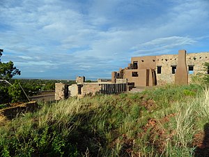
Seton Village is a National Historic Landmark District in a rural residential area south of Santa Fe in Santa Fe County, New Mexico, United States. It encompasses a residential settlement and educational facility established in 1930 by Ernest Thompson Seton (1860-1946), an educator and conservationist best known as a founder of the Boy Scouts of America. The district includes the remains of Seton's 32-room home and other residential and educational buildings constructed mostly between 1930 and 1945.
Academy for the Love of Learning
Distance: Approx. 7804 meters
Latitude and longitude: 35.59972222,-105.93027778
The Academy for the Love of Learning is a non-profit organization conceived by American composers Leonard Bernstein and Aaron Stern. The Academy was incorporated as a 501(c)3 in 1998. Its campus is located in southeast Santa Fe, NM, on the former estate of Ernest Thompson Seton.
Cañoncito, Santa Fe County, New Mexico
Unincorporated community in Santa Fe County, New Mexico, United States
Distance: Approx. 6444 meters
Latitude and longitude: 35.54583333,-105.85777778
Cañoncito is an unincorporated community in Santa Fe County, New Mexico, United States. Cañoncito is located on Interstate 25, 11.5 miles (18.5 km) southeast of Santa Fe. Nuestra Señora de Luz Church and Cemetery, which is listed on the National Register of Historic Places, is located in Cañoncito.

Apache Canyon Railroad Bridge
United States historic place
Distance: Approx. 6710 meters
Latitude and longitude: 35.51361111,-105.85472222
The Apache Canyon Railroad Bridge, located in Santa Fe County, New Mexico near Lamy, New Mexico, is a deck plate girder bridge built in 1892. It was listed on the National Register of Historic Places in 1979. It is located 3 miles (4.8 km) northeast of Lamy over Galisteo Creek.
Sunlit Hills, New Mexico
Census-designated place in New Mexico, United States
Distance: Approx. 7376 meters
Latitude and longitude: 35.59583333,-105.92111111
Sunlit Hills is an unincorporated community and census-designated place (CDP) in Santa Fe County, New Mexico, United States. It was first listed as a CDP prior to the 2020 census. The CDP is north of the geographic center of Santa Fe County and is bordered to the west by Seton Village, to the northwest by Arroyo Hondo, to the north by Conejo, and to the northeast by Santa Fe Foothills.
Weather in this IP's area
light rain
8 Celsius
5 Celsius
7 Celsius
8 Celsius
1018 hPa
93 %
1018 hPa
799 hPa
10000 meters
4.12 m/s
220 degree
100 %
07:13:51
18:22:56
