164.59.208.2 - IP Lookup: Free IP Address Lookup, Postal Code Lookup, IP Location Lookup, IP ASN, Public IP
Country:
Region:
City:
Location:
Time Zone:
Postal Code:
IP information under different IP Channel
ip-api
Country
Region
City
ASN
Time Zone
ISP
Blacklist
Proxy
Latitude
Longitude
Postal
Route
Luminati
Country
ASN
Time Zone
Europe/Berlin
ISP
Bayer AG
Latitude
Longitude
Postal
IPinfo
Country
Region
City
ASN
Time Zone
ISP
Blacklist
Proxy
Latitude
Longitude
Postal
Route
IP2Location
164.59.208.2Country
Region
nordrhein-westfalen
City
leverkusen
Time Zone
Europe/Berlin
ISP
Language
User-Agent
Latitude
Longitude
Postal
db-ip
Country
Region
City
ASN
Time Zone
ISP
Blacklist
Proxy
Latitude
Longitude
Postal
Route
ipdata
Country
Region
City
ASN
Time Zone
ISP
Blacklist
Proxy
Latitude
Longitude
Postal
Route
Popular places and events near this IP address

Leverkusen
City in North Rhine-Westphalia, Germany
Distance: Approx. 379 meters
Latitude and longitude: 51.03333333,6.98333333
Leverkusen (German: [ˈleːvɐˌkuːzn̩] ) is a city in North Rhine-Westphalia, Germany, on the eastern bank of the Rhine. To the south, Leverkusen borders the city of Cologne, and to the north the state capital, Düsseldorf. The city is part of the Rhine-Ruhr Metropolitan Region, one of Europe's largest urban areas.

BayArena
Football stadium
Distance: Approx. 1555 meters
Latitude and longitude: 51.03833333,7.00222222
BayArena (German pronunciation: [ˈbaɪʔaˌʁeːnaː]) is a football stadium in Leverkusen, North Rhine-Westphalia, Germany, which has been the home ground of Bundesliga club Bayer 04 Leverkusen since 1958.

Leverkusen-Bürrig water tower
Distance: Approx. 963 meters
Latitude and longitude: 51.03861111,6.98305556
Water Tower Leverkusen-Bürrig is a 72-metre-high (236 ft) water tower built in 1978 in Leverkusen-Bürrig. It has a water reservoir of two chambers each of 4000 cubic metres, with a diameter of 42 metres. It has an observation deck for visitors.

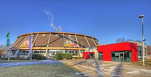
Ostermann-Arena
Distance: Approx. 1707 meters
Latitude and longitude: 51.03944444,7.00361111
Ostermann-Arena (formerly Wilhelm Dopatka Halle and Smidt-Arena) is an indoor sporting arena located in Leverkusen, Germany. The capacity of the arena is 3,500 people. It is home to the Bayer Giants Leverkusen basketball team.

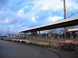
Leverkusen Mitte station
Railway station in Leverkusen, Germany
Distance: Approx. 535 meters
Latitude and longitude: 51.0316,6.9916
Leverkusen Mitte (Bahnhof Leverkusen Mitte) is a railway station on the Cologne–Duisburg railway, located in Leverkusen, Germany. It is classified by Deutsche Bahn as a category 4 station. It is served by the S6 line of the Rhine-Ruhr S-Bahn at 20-minute intervals.

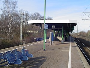
Leverkusen Chempark station
Railway station in Germany
Distance: Approx. 2246 meters
Latitude and longitude: 51.01137,6.9967
Leverkusen Chempark, known as Bayerwerk until 2013. is a railway station on the Cologne–Duisburg railway, situated on the border of Leverkusen and Cologne in the German state of North Rhine-Westphalia. It is named after the nearby Bayer chemical production plants.

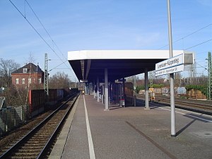
Leverkusen-Küppersteg station
Railway station in Leverkusen, Germany
Distance: Approx. 1777 meters
Latitude and longitude: 51.04579,6.98812
Leverkusen-Küppersteg is a railway station on the Cologne–Duisburg railway, situated in Leverkusen in western Germany. It is classified by Deutsche Bahn as a category 5 station. It is served by the S6 line of the Rhine-Ruhr S-Bahn at 20-minute intervals.

Mutzbach
River in Germany
Distance: Approx. 1073 meters
Latitude and longitude: 51.0353,6.9972
Mutzbach is a river of North Rhine-Westphalia, Germany. It flows into the Dhünn in Leverkusen.

Leverkusen-Manfort station
Railway station in Germany
Distance: Approx. 2152 meters
Latitude and longitude: 51.031034,7.01509
Leverkusen-Manfort station is a through station in the district of Manfort of the city of Leverkusen in the German state of North Rhine-Westphalia. It was named after the nearby town of Schlebusch and opened on 25 August 1867 on the Gruiten–Köln-Deutz railway, which was completed between the former Bergisch-Märkische Railway Company (BME) station in Mülheim and Opladen by the BME on 1 May 1868. It received its current name in December 2021.

RTHC Bayer Leverkusen
Sports club in Leverkusen, Germany
Distance: Approx. 2034 meters
Latitude and longitude: 51.01805556,7.00638889
Ruder Tennis Hockey Club Bayer Leverkusen (RTHC Bayer Leverkusen e.V.) is a German rowing, field hockey and tennis club, one of the projects supported by Bayer AG and with 2500 members, it is additionally one of the largest sports clubs in Leverkusen. To take care of the number of athletes, the club has 18 full-time employees and 20 coaches and trainers. The sports facilities of RTHC Bayer Leverkusen are at three locations.

Bayer-Hochhaus
Commercial offices in Leverkusen, Germany
Distance: Approx. 1836 meters
Latitude and longitude: 51.0136,6.9816
Bayer-Hochhaus was a 32-storey, 122 m (400 ft) skyscraper in Leverkusen, Germany. When completed in 1963, it was the tallest building in Germany for nine years until 1972 when City-Hochhaus Leipzig was built. It was demolished in 2012.

2021 Leverkusen explosion
Industrial disaster in Leverkusen, Germany
Distance: Approx. 1955 meters
Latitude and longitude: 51.013,6.9914
An explosion occurred at Chempark, an industrial park for chemical factories in Leverkusen, North Rhine-Westphalia, Germany, on 27 July 2021, at 09:35 local time, sending a pall of smoke over the city. The city of Leverkusen stated that the explosion, which caused a fire, occurred in storage tanks for solvents. In a first statement, the Cologne fire department said that the air pollution measurements did not show any kind of abnormality, the smoke had gone down and that they would continue to measure the air for toxins.
Weather in this IP's area
clear sky
2 Celsius
2 Celsius
2 Celsius
2 Celsius
1040 hPa
95 %
1040 hPa
1028 hPa
10000 meters
0.77 m/s
0.61 m/s
14 degree
8 %