Country:
Region:
City:
Latitude and Longitude:
Time Zone:
Postal Code:
IP information under different IP Channel
ip-api
Country
Region
City
ASN
Time Zone
ISP
Blacklist
Proxy
Latitude
Longitude
Postal
Route
Luminati
Country
Region
14
City
oulu
ASN
Time Zone
Europe/Helsinki
ISP
Cinia Oy
Latitude
Longitude
Postal
IPinfo
Country
Region
City
ASN
Time Zone
ISP
Blacklist
Proxy
Latitude
Longitude
Postal
Route
db-ip
Country
Region
City
ASN
Time Zone
ISP
Blacklist
Proxy
Latitude
Longitude
Postal
Route
ipdata
Country
Region
City
ASN
Time Zone
ISP
Blacklist
Proxy
Latitude
Longitude
Postal
Route
Popular places and events near this IP address

Oulun Energia Areena
Ice sport venue in Oulu, Finland
Distance: Approx. 4576 meters
Latitude and longitude: 65.00833333,25.495
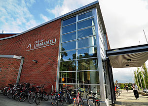
Oulu Ice Hall (Finnish: Oulun jäähalli), previously known as Raksilan jäähalli and called Oulun Energia Areena since 2006 for sponsorship reasons, is an ice sport arena in the Raksila Sports Centre, located in the Raksila district of Oulu, Finland. It is operated by the City of Oulu. The arena is best known as an ice hockey venue and the home of Liiga team Oulun Kärpät.
Oulu University Hospital
Hospital in Oulu, FI
Distance: Approx. 3683 meters
Latitude and longitude: 65.0075,25.51861111
Oulu University Hospital (OUH, Finnish: Oulun yliopistollinen sairaala, OYS) is a university hospital in Oulu, Finland. It is the northernmost of the five university hospitals in Finland. The Oulu University Hospital is affiliated with the University of Oulu, and it is used as a teaching hospital by the Faculty of Medicine.

Intiö
District of Oulu in Finland
Distance: Approx. 4988 meters
Latitude and longitude: 65.0162,25.5
Intiö is a district of the city centre area of Oulu, Finland. It is located on the southern bank of the Oulu River in between Myllytulli and Värttö districts. Most of the area in Intiö is taken by the old military barracks area, which is nowadays used by Luovi Vocational College, and the Oulu Cemetery.
Oulujoki Church
Church in Oulu, Finland
Distance: Approx. 2497 meters
Latitude and longitude: 65.00555556,25.56277778
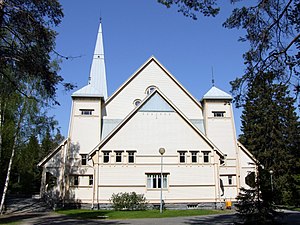
The Oulujoki Church is an evangelical Lutheran church in Kirkkokangas neighbourhood in Oulu, Finland. The wooden church, named the Church of the Holy Spirit, was built for the former Oulu rural municipality in 1907–1908. It was designed in the Art Nouveau style by architect Viktor J. Sucksdorff.

Raksila
District of Oulu in Finland
Distance: Approx. 4456 meters
Latitude and longitude: 65.008,25.4976
Raksila is a District of the city centre area of Oulu, Finland. It is bounded by the Oulu railway station to the west, the Oulu Cemetery in the Intiö district to the north, the Finnish national road 4 to the east and the Finnish national road 22 to the south. The western part of Raksila is mainly residential area with some high-rise apartment buildings and a few blocks of older wooden townhouses.

Oulu Swimming Pool
Indoor swimming pool in Oulu, Finland
Distance: Approx. 4499 meters
Latitude and longitude: 65.0092,25.4987
Oulu Swimming Pool is an indoor swimming pool in the Raksila neighbourhood in Oulu, Finland. It is the biggest of the three indoor swimming pools in Oulu and one of the biggest in Finland. The swimming pool designed by architect Risto Harju was completed in 1974.

Kontinkangas
District of Oulu in Finland
Distance: Approx. 3470 meters
Latitude and longitude: 65.0061,25.5217
Kontinkangas is a district of Oulu, Finland. It is located to the east of the National road 4 and to the north of the National road 22 about two kilometers from the city centre. Its neighbouring districts are Kaukovainio, Raksila, Peltola and Oulunsuu.

Karjasilta
District of Oulu in Finland
Distance: Approx. 4217 meters
Latitude and longitude: 65.0017,25.4939
Karjasilta is a district in the Höyhtyä area in the city of Oulu, Finland. The district close to the city centre is bordered by the Raksila district to the north, Finnish national road 4 to the east, the Vanhatulli and Limingantulli districts to the west and the Nokela and Höyhtyä districts to the south. Karjasilta is mainly a residential area with detached housing and apartment blocks built in the 1940s and 1950s.
Oulujoki (municipality)
Former municipality in Oulu Province, Finland
Distance: Approx. 2671 meters
Latitude and longitude: 65.0072,25.5636
Oulujoki (formerly Oulun maalaiskunta or Oulu Rural Municipality) is a former municipality of Finland. The municipality had a population of 5,230 (1963) and covered a land area of 606.1 square kilometres (234.0 sq mi). Its neighbouring municipalities were Kempele, Kiiminki, Muhos, Oulu, Tyrnävä, Utajärvi and Ylikiiminki.

OYS Psychiatry
Hospital in Northern Ostrobothnia, Finland
Distance: Approx. 4482 meters
Latitude and longitude: 65.015811,25.515644
OYS Psychiatry is the unit of psychiatry of the Oulu University Hospital (OYS), mainly located in the Peltola city district in Oulu, Finland. It provides psychiatric special health care, emergency- and crisis services, outpatient care, and other services for the member municipalities and the whole catchment area for highly specialized medical care (erityisvastuualue) of the Northern Ostrobothnia Hospital District, as well as for the insurance companies and judiciaries of the said district. It is the most important psychiatric hospital in Northern Finland.
Kastelli community centre
Community centre in Oulu, Finland
Distance: Approx. 3093 meters
Latitude and longitude: 65.0022,25.5239
Kastelli community centre (Kastellin monitoimitalo in Finnish) located in the district of Kontinkangas in Oulu, Finland is a multipurpose building that houses the city's public daycare, basic education, high school and library services as well as a youth center "huudi".

Lämsänjärvi
Small lake in Oulu, Finland
Distance: Approx. 1874 meters
Latitude and longitude: 64.99611111,25.54611111
Lämsänjärvi is a small lake located in the district of Oulunsuu in Oulu, Finland. There is a public beach on the northeast side of the lake which is maintained by the city and a church operated camp building on the west side which was built in 1936. The lake used to be very shallow overgrown swamp water but it was dredged in the early 1980s and converted in to its current form.
Weather in this IP's area
clear sky
-3 Celsius
-3 Celsius
-3 Celsius
-3 Celsius
1030 hPa
93 %
1030 hPa
1028 hPa
10000 meters
1.03 m/s
08:37:39
15:25:46


