164.40.169.41 - IP Lookup: Free IP Address Lookup, Postal Code Lookup, IP Location Lookup, IP ASN, Public IP
Country:
Region:
City:
Location:
Time Zone:
Postal Code:
ISP:
ASN:
language:
User-Agent:
Proxy IP:
Blacklist:
IP information under different IP Channel
ip-api
Country
Region
City
ASN
Time Zone
ISP
Blacklist
Proxy
Latitude
Longitude
Postal
Route
db-ip
Country
Region
City
ASN
Time Zone
ISP
Blacklist
Proxy
Latitude
Longitude
Postal
Route
IPinfo
Country
Region
City
ASN
Time Zone
ISP
Blacklist
Proxy
Latitude
Longitude
Postal
Route
IP2Location
164.40.169.41Country
Region
trnavsky kraj
City
galanta
Time Zone
Europe/Bratislava
ISP
Language
User-Agent
Latitude
Longitude
Postal
ipdata
Country
Region
City
ASN
Time Zone
ISP
Blacklist
Proxy
Latitude
Longitude
Postal
Route
Popular places and events near this IP address
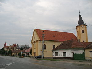
Galanta
Town in Slovakia
Distance: Approx. 149 meters
Latitude and longitude: 48.18888889,17.72638889
Galanta (Hungarian: Galánta, German: Gallandau) is a town with about 15,000 inhabitants in the Trnava Region of Slovakia. It is situated 50 km due east of the Slovak capital Bratislava.

Galanta District
District in Trnava Region, Slovakia
Distance: Approx. 87 meters
Latitude and longitude: 48.18944444,17.72666667
Galanta District (okres Galanta) is a district in the Trnava Region of western Slovakia. The district lies on the lowland area. Through the district area flows river Váh and its level is regulated by dam in Kráľová nad Váhom.
Sládkovičovo
Town in Slovakia
Distance: Approx. 6413 meters
Latitude and longitude: 48.20527778,17.64416667
Sládkovičovo (until 1948 Diosek, German: Diosek, Hungarian: Diószeg) is a town in the Galanta District, Trnava Region in southwestern Slovakia.

Čierny Brod
Village in Slovakia
Distance: Approx. 6735 meters
Latitude and longitude: 48.15,17.65944444
Čierny Brod (Hungarian: Vízkelet) is a village and municipality in Galanta District of the Trnava Region of south-west Slovakia.

Gáň
Municipality in Slovakia
Distance: Approx. 4890 meters
Latitude and longitude: 48.23333333,17.71666667
Gáň (Hungarian: Gány) is a village and municipality in Galanta District of the Trnava Region of south-west Slovakia.
Kajal (village)
Village in Slovakia
Distance: Approx. 4475 meters
Latitude and longitude: 48.18444444,17.78722222
Kajal (Hungarian: Nemeskajal, until 1899 Kajal) is a village and municipality in Galanta District of the Trnava Region of south-west Slovakia.
Košúty
Village in Slovakia
Distance: Approx. 5754 meters
Latitude and longitude: 48.16666667,17.65833333
Košúty (Hungarian: Nemeskosút, until 1899 Kosút) is a village and municipality in Galanta District of the Trnava Region of south-west Slovakia.
Matúškovo
Village in Slovakia
Distance: Approx. 2505 meters
Latitude and longitude: 48.16777778,17.73277778
Matúškovo (formerly Takšoň; Hungarian: Taksony, until 1899 Taksonyfalva) is a village and municipality in Galanta District of the Trnava Region of south-west Slovakia.

Mostová
Village in Slovakia
Distance: Approx. 6696 meters
Latitude and longitude: 48.14083333,17.67555556
Mostová (Hungarian: Hidaskürt) is a village and municipality in Galanta District of the Trnava Region of south-west Slovakia.
Topoľnica
Village in Slovakia
Distance: Approx. 5465 meters
Latitude and longitude: 48.17083333,17.79527778
Topoľnica (Hungarian: Tósnyárasd) is a village and municipality in Galanta District of the Trnava Region of south-west Slovakia.
Veľká Mača
Village in Slovakia
Distance: Approx. 6390 meters
Latitude and longitude: 48.24194444,17.69083333
Veľká Mača (Hungarian: Nagymácséd) is a village and municipality in Galanta District of the Trnava Region of south-west Slovakia.

Renaissance castle in Galanta
Castle in Galanta, Slovakia
Distance: Approx. 721 meters
Latitude and longitude: 48.19555556,17.7325
The Esterházy of Galanta castle is a renaissance castle. It is one of the most important historical buildings of Galanta, Slovakia. Originally, the residency of the Esterházy family, a branch called the Esterházy "of Galanta".
Weather in this IP's area
overcast clouds
0 Celsius
0 Celsius
0 Celsius
0 Celsius
1035 hPa
95 %
1035 hPa
1019 hPa
10000 meters
0.62 m/s
0.71 m/s
82 degree
100 %


