Country:
 India
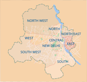
IndiaRegion:
City:
Latitude and Longitude:
Time Zone:
Postal Code:
IP information under different IP Channel
ip-api
Country
Region
City
ASN
Time Zone
ISP
Blacklist
Proxy
Latitude
Longitude
Postal
Route
IPinfo
Country
Region
City
ASN
Time Zone
ISP
Blacklist
Proxy
Latitude
Longitude
Postal
Route
MaxMind
Country
Region
City
ASN
Time Zone
ISP
Blacklist
Proxy
Latitude
Longitude
Postal
Route
Luminati
Country
INASN
Time Zone
Asia/Kolkata
ISP
National Informatics Centre
Latitude
Longitude
Postal
db-ip
Country
Region
City
ASN
Time Zone
ISP
Blacklist
Proxy
Latitude
Longitude
Postal
Route
ipdata
Country
Region
City
ASN
Time Zone
ISP
Blacklist
Proxy
Latitude
Longitude
Postal
Route
Popular places and events near this IP address

Dr. Akhilesh Das Gupta Institute of Professional Studies
Distance: Approx. 1203 meters
Latitude and longitude: 28.678,77.261
Dr. Akhilesh Das Gupta Institute of Professional Studies, formerly known as Dr. Akhilesh Das Gupta Institute of Technology & Management (ADGITM), is a private engineering college in Delhi, India.
Nili Chhatri
Hindu temple in India
Distance: Approx. 1486 meters
Latitude and longitude: 28.662,77.241
Nili Chhatri Temple (Neeli Chhatri) is an ancient Hindu temple in New Delhi, India dedicated to Shiva. It is believed that the eldest Pandava brother, Prince Yudhishthira of Mahabharata, established the temple and the Nigambodh Ghat adjacent to it, and conducted Aswamedha Yajna from here. The temple located in the Yamuna bazaar area close to the Baharadur Shahi Gate of Salimgarh Fort, on Ring Road (Mahatma Gandhi Marg) close to the banks of the Yamuna river exists even today.
Nigambodh Ghat
Hindu temple in India
Distance: Approx. 1580 meters
Latitude and longitude: 28.66465028,77.23692278
Nigambodh Ghat is located on the banks of the Yamuna river coast in New Delhi, situated on the Ring Road, Delhi at the back of the historic Red Fort. It consists of a series of bathing and ceremonial stepped piers leading to the waters of the river. It is most known for being the oldest burning ghat in Delhi for performing Antyesti (Antim Sanskar), Hindu funeral rites and also one of its busiest with 50–60 pyres burning every day.

Shahdara district
District of Delhi in India
Distance: Approx. 1691 meters
Latitude and longitude: 28.67330235,77.26768968
Shahdara District is an administrative and revenue district of Delhi, India, situated near the banks of Yamuna river. The district headquarters is Nand Nagri. The Shadara District also has residential area.

Salimgarh Fort
Building in India
Distance: Approx. 1634 meters
Latitude and longitude: 28.661,77.24
Salimgarh Fort (Salim's Fort) was built in 1546 AD, in Delhi, in a former island of the Yamuna River, by Salim Shah Suri, son of Sher Shah Suri. There was a pause in Mughal rule when in 1540 AD Sher Shah Suri defeated the Mughal emperor Humayun (and ousted him from Delhi) and established the Sur dynasty rule in Delhi. Sur dynasty rule lasted till 1555 AD when Humayun regained his kingdom by defeating Sikander Suri, the last ruler of the dynasty.

Delhi IT Park
IT Park complex in Delhi
Distance: Approx. 26 meters
Latitude and longitude: 28.6722859,77.2503039
The Delhi IT Park is an IT park complex developed by Delhi Metro Rail Corporation (DMRC). It is a Software Technology Park situated in Shastri Park close to the metro station. The IT Park complex comprises three separate blocks.
Gandhi Nagar, Delhi
Neighbourhood of Delhi in East Delhi, India
Distance: Approx. 1456 meters
Latitude and longitude: 28.660504,77.256328
Gandhi Nagar is a residential area in the East Delhi district of Delhi in the Trans-Yamuna area. It is most known for Gandhi Nagar Market, which is Asia's biggest readymade garments/textile market. Gandhi Nagar has many shops and factories.
Yamuna Pushta
Neighbourhood of Delhi in India
Distance: Approx. 1542 meters
Latitude and longitude: 28.6589,77.24738
Yamuna Pushta is the Pushta (embankment) on both sides of the Yamuna River in Delhi, starting from the ITO bridge and up to the Salimgarh Fort. It has also been home to riverbed cultivators, and over 100,000 residents in a string of slum colonies (shantytown) for some 40 years, mostly on the western banks, like those near the Nigambodh Ghat (cremation ghats) near Old Delhi and a few on the eastern banks like those near Sakarpur village in East Delhi. Many of these slums were being demolished in 2004, after court orders which were part of the beautification drive of the Government ahead of the 2010 Commonwealth Games and for creating a "green belt".

Seelampur metro station
Metro station in Delhi, India
Distance: Approx. 1620 meters
Latitude and longitude: 28.66980556,77.26669444
The Seelampur metro station is located on the Red Line of the Delhi Metro.

Shastri Park metro station
Metro station in Delhi, India
Distance: Approx. 480 meters
Latitude and longitude: 28.66819444,77.25011111
Shastri Park is an at-grade metro station and is the depot station on the Red Line of the Delhi Metro. This is the station which holds all the metro trainsets running under Red Line of Delhi Metro.

Princes' quarter (Red Fort)
Distance: Approx. 1668 meters
Latitude and longitude: 28.658887,77.243261
The Princes' quarter is an area located in the Red Fort of Delhi, India. The quarter of the imperial princes dates back to the late Mughal Empire period. The one structure that has survived has been altered throughout course of time, therefore losing its original appearance.

Shahi Burj (Red Fort)
Distance: Approx. 1678 meters
Latitude and longitude: 28.658566,77.243834
The Shahi Burj (Urdu: Emperor's Tower) is a three-storey octagonal tower of the Red Fort in Delhi. The tower is located at the northeastern corner of the imperial enclosure. The water feeding, the Nahr-i-Bihisht, is channeled up from the river with a hydraulic system through the tower and then carried by channels into various other buildings of the fort.
Weather in this IP's area
haze
26 Celsius
26 Celsius
26 Celsius
26 Celsius
1010 hPa
65 %
1010 hPa
987 hPa
3000 meters
06:24:49
17:46:24