163.182.168.118 - IP Lookup: Free IP Address Lookup, Postal Code Lookup, IP Location Lookup, IP ASN, Public IP
Country:
 USA
USARegion:
City:
Location:
Time Zone:
Postal Code:
ISP:
ASN:
language:
User-Agent:
Proxy IP:
Blacklist:
IP information under different IP Channel
ip-api
Country
Region
City
ASN
Time Zone
ISP
Blacklist
Proxy
Latitude
Longitude
Postal
Route
db-ip
Country
Region
City
ASN
Time Zone
ISP
Blacklist
Proxy
Latitude
Longitude
Postal
Route
IPinfo
Country
Region
City
ASN
Time Zone
ISP
Blacklist
Proxy
Latitude
Longitude
Postal
Route
IP2Location
163.182.168.118Country
usRegion
new york
City
latham
Time Zone
America/New_York
ISP
Language
User-Agent
Latitude
Longitude
Postal
ipdata
Country
Region
City
ASN
Time Zone
ISP
Blacklist
Proxy
Latitude
Longitude
Postal
Route
Popular places and events near this IP address

Shaker High School
High school in Latham, , New York, United States
Distance: Approx. 1919 meters
Latitude and longitude: 42.7357,-73.7476
Shaker High School is a public high school in Latham, Albany County, New York, United States, and is the only high school operated by the North Colonie Central School District. It is part of the North Colonie Central Schools school district and is partly fed by Shaker Middle School.
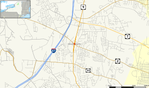
Latham, New York
Hamlet and CDP in New York, United States
Distance: Approx. 584 meters
Latitude and longitude: 42.74694444,-73.75888889
Latham is a hamlet and census-designated place in Albany County, New York, United States. It is located along U.S. Route 9 in the town of Colonie, a dense suburb north of Albany. In addition, Interstate 87 and U.S. Route 7 also run through the town itself.

Latham Circle Mall
Shopping mall in New York, United States
Distance: Approx. 150 meters
Latitude and longitude: 42.74638889,-73.76416667
Latham Circle Mall was an enclosed shopping mall located adjacent to the Latham Circle (the intersection of US 9 and NY 2) in Latham, New York. Built in 1957 as Latham Corners Shopping Center, the mall was renovated several times in its history, most notably in 1977 when it became a fully enclosed and temperature-controlled shopping mall. Around the mid 2000s, the mall started to lose tenants, eventually becoming a dead mall.

Catholic Central School (Latham, New York)
School in Latham, New York
Distance: Approx. 1686 meters
Latitude and longitude: 42.7580575,-73.75283086
Catholic Central School was a private, centrally located pre-K-12 regional Catholic school in Latham, New York, within the Roman Catholic Diocese of Albany. It was formed in 2022 with the merger of Saint Ambrose elementary school in Latham with Catholic Central High School in Troy, New York. The new school is located on the grounds of the former Saint Ambrose School.
Latham Circle
Road junction
Distance: Approx. 454 meters
Latitude and longitude: 42.74813889,-73.76097222
The Latham Circle or Latham Traffic Circle is the intersection of U.S. Route 9 (US 9) and New York State Route 2 (NY 2) within the town of Colonie, New York in Albany County.
Newtonville, New York
Hamlet in New York, United States
Distance: Approx. 2553 meters
Latitude and longitude: 42.72416667,-73.75833333
Newtonville is a hamlet in the town of Colonie in Albany County, New York, United States. Located along U.S. Route 9, the hamlet is just south of Latham and north of Loudonville. Colonie Town Hall is located in the hamlet of Newtonville.

Newtonville United Methodist Church
Historic church in New York, United States
Distance: Approx. 2493 meters
Latitude and longitude: 42.72444444,-73.76
Newtonville United Methodist Church is a historic United Methodist church located on Loudon Road at Maxwell Road in Newtonville, Albany County, New York. There has been a Methodist congregation meeting at the present site of the church since 1828. Three area congregations merged to the Newtonville location in 1858, and the church was called Asbury Chapel.
Reformed Dutch Church of Rensselaer in Watervliet
Historic church in New York, United States
Distance: Approx. 536 meters
Latitude and longitude: 42.74777778,-73.75972222
Reformed Dutch Church of Rensselaer in Watervliet (also known as Component No. 19) is a historic Reformed Dutch church at 210 Old Loudon Road in the hamlet of Latham, town of Colonie, Albany County, New York. It was built in 1817 in a vernacular Greek Revival style.

Casparus F. Pruyn House
Historic house in New York, United States
Distance: Approx. 1911 meters
Latitude and longitude: 42.73194444,-73.77861111
Casparus F. Pruyn House is a historic home located in the hamlet of Newtonville within the town of Colonie in Albany County, New York. It is a two-story, rectangular five bay wide, center entrance dwelling in a late Federal and early Greek Revival style. It was built between 1824 and 1836.

Verdoy Schoolhouse
United States historic place
Distance: Approx. 1780 meters
Latitude and longitude: 42.73269444,-73.77722222
Verdoy Schoolhouse, also known as District No. 7 Schoolhouse, is a historic one-room school building located at Newtonville in Albany County, New York. It was built in 1910 and is an asymmetrical frame building.

Goodrich School
United States historic place
Distance: Approx. 2479 meters
Latitude and longitude: 42.7291,-73.7469
Goodrich School is a historic school building located in Colonie in Albany County, New York. It consists of a one-story, gable roofed rectangular brick building built about 1922 with a one-story, rectangular hipped roof wing dated to about 1926. On the south side are a series of two additions completed during the 1950s.
Starlite Music Theatre
Theatre in Latham, New York, U.S.
Distance: Approx. 2322 meters
Latitude and longitude: 42.76416667,-73.75111111
The Starlite Music Theatre was a 3,000-capacity theatre in the round located in the Latham area of the Town of Colonie. Also known as the Latham Coliseum, it opened as the Colonie Coliseum in 1958 with a production of the classic musical Damn Yankees, and was demolished in 2012. Some notable performances at the venue included Diana Ross, Rodney Dangerfield, Eddie Murphy, Three Dog Night, Pat Benatar, America, "Weird Al" Yankovic, B.B. King, Bob Hope & Kelly Garret, Little Richard, Howie Mandel, Gallagher, The Beach Boys, Mac Davis, Harry Chapin, and Kenny Rogers & Dolly Parton.
Weather in this IP's area
mist
0 Celsius
-3 Celsius
-1 Celsius
1 Celsius
1005 hPa
93 %
1005 hPa
993 hPa
805 meters
2.57 m/s
20 degree
100 %