Country:
Region:
City:
Latitude and Longitude:
Time Zone:
Postal Code:
IP information under different IP Channel
ip-api
Country
Region
City
ASN
Time Zone
ISP
Blacklist
Proxy
Latitude
Longitude
Postal
Route
Luminati
Country
Region
13
City
kameido
ASN
Time Zone
Asia/Tokyo
ISP
Tokyo Bay Network Co.,Ltd.
Latitude
Longitude
Postal
IPinfo
Country
Region
City
ASN
Time Zone
ISP
Blacklist
Proxy
Latitude
Longitude
Postal
Route
db-ip
Country
Region
City
ASN
Time Zone
ISP
Blacklist
Proxy
Latitude
Longitude
Postal
Route
ipdata
Country
Region
City
ASN
Time Zone
ISP
Blacklist
Proxy
Latitude
Longitude
Postal
Route
Popular places and events near this IP address
Sumida, Tokyo
Special ward in Kantō, Japan
Distance: Approx. 1321 meters
Latitude and longitude: 35.7,139.81666667
Sumida (墨田区, Sumida-ku) is a special ward in the Tokyo Metropolis in Japan. The English translation of its Japanese self-designation is Sumida City. As of 1 March 2023, the ward has an estimated population of 277,058 and a population density of 20,120 persons per km2.

Kameido Station
Railway station in Tokyo, Japan
Distance: Approx. 712 meters
Latitude and longitude: 35.6977,139.8264
Kameido Station (亀戸駅, Kameido-eki) is a railway station in Kōtō, Tokyo, Japan, operated by East Japan Railway Company (JR East) and the private railway operator Tobu Railway.

Hirai Station (Tokyo)
Railway station in Tokyo, Japan
Distance: Approx. 1123 meters
Latitude and longitude: 35.70638889,139.8425
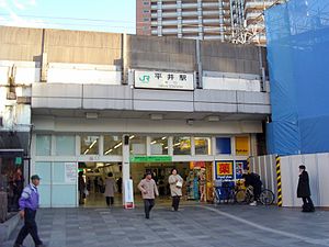
Hirai Station (平井駅, Hirai-eki) is a railway station in Edogawa, Tokyo, Japan, operated by the East Japan Railway Company (JR East).

Omurai Station
Railway station in Tokyo, Japan
Distance: Approx. 879 meters
Latitude and longitude: 35.7104,139.8274
Omurai Station (小村井駅, Omurai-eki) is a railway station on the Tobu Kameido Line in Sumida, Tokyo, Japan, operated by the private railway operator Tobu Railway.

Higashi-Azuma Station
Railway station in Tokyo, Japan
Distance: Approx. 443 meters
Latitude and longitude: 35.7069,139.8318
Higashi-Azuma Station (東あずま駅, Higashi-Azuma-eki) is a railway station in Sumida, Tokyo, Japan, operated by Tobu Railway.

Kameidosuijin Station
Railway station in Tokyo, Japan
Distance: Approx. 399 meters
Latitude and longitude: 35.7003,139.8337
Kameidosuijin Station (亀戸水神駅, Kameido-suijin-eki) is a railway station in Kōtō, Tokyo, Japan, operated by Tobu Railway.

Ojima Station
Metro station in Tokyo, Japan
Distance: Approx. 1524 meters
Latitude and longitude: 35.689885,139.835641
Ojima Station (大島駅, Ōjima-eki) is a railway station in Kōtō, Tokyo, Japan. Its station number is S-15. The station opened on December 21, 1978.
Brillia Tower Tokyo
Residential building in Tokyo, Japan
Distance: Approx. 1358 meters
Latitude and longitude: 35.700439,139.816116
The Brillia Tower Tokyo (Brilliaタワー東京) is a residential building in the Sumida special ward of Tokyo, Japan. Completed in June 2006, it stands at 159 m (522 ft) tall.

Sumida City Gymnasium
Sports venue in Tokyo, Japan
Distance: Approx. 1300 meters
Latitude and longitude: 35.69941667,139.81711111
Sumida City Gymnasium (墨田区総合体育館) is a multi-purpose arena in Sumida, Tokyo, Japan. It is the home venue for Fugador Sumida from the Japanese futsal league, and also is the secondary venue for the Sun Rockers Shibuya basketball team.

Kameido Tenjin Shrine
Distance: Approx. 917 meters
Latitude and longitude: 35.703,139.82066
Kameido Tenjin Shrine is a Japanese Tenman-gu shrine located in Kameido, Koto Ward, Tokyo. The shrine is dedicated to Sugawara no Michizane, a 9th-century Japanese scholar.
Tokyo Metropolitan Bokutoh Hospital
Hospital in Tokyo, Japan
Distance: Approx. 1439 meters
Latitude and longitude: 35.6946,139.8187
Tokyo Metropolitan Bokutoh Hospital (東京都立墨東病院) is located in Kotobashi, Sumida, Tokyo, Japan. It has 765 beds and is run by the Tokyo Metropolitan Government.

Shurin College of Foreign Languages
Language school in Tokyo, Japan
Distance: Approx. 1221 meters
Latitude and longitude: 35.69266,139.82628
Shurin College of Foreign Languages is a language school in Tokyo, Japan. It offers courses for Japanese-Korean translation, Japanese-Chinese translation, and Business Japanese lessons. It is founded in 1988.
Weather in this IP's area
few clouds
15 Celsius
15 Celsius
14 Celsius
16 Celsius
1023 hPa
69 %
1023 hPa
1022 hPa
10000 meters
2.06 m/s
290 degree
20 %
06:05:31
16:42:55


