Country:
Region:
City:
Latitude and Longitude:
Time Zone:
Postal Code:
IP information under different IP Channel
ip-api
Country
Region
City
ASN
Time Zone
ISP
Blacklist
Proxy
Latitude
Longitude
Postal
Route
Luminati
Country
Region
tx
City
austin
ASN
Time Zone
America/Chicago
ISP
CITY-OF-AUSTIN
Latitude
Longitude
Postal
IPinfo
Country
Region
City
ASN
Time Zone
ISP
Blacklist
Proxy
Latitude
Longitude
Postal
Route
db-ip
Country
Region
City
ASN
Time Zone
ISP
Blacklist
Proxy
Latitude
Longitude
Postal
Route
ipdata
Country
Region
City
ASN
Time Zone
ISP
Blacklist
Proxy
Latitude
Longitude
Postal
Route
Popular places and events near this IP address

Lipscomb University Austin Center
Private Christian seminary in Texas
Distance: Approx. 3326 meters
Latitude and longitude: 30.3439,-97.7117
Lipscomb University Austin Center, formerly known as the Austin Graduate School of Theology, and the Institute for Christian Studies, was a private Christian seminary associated with the Churches of Christ and located in Austin, Texas. It was accredited by the Southern Association of Colleges and Schools Commission on Colleges to award bachelor's and master's degrees. On January 1, 2021, the merger with Lipscomb University was completed and Austin Graduate School of Theology became known as Lipscomb University Austin Center (LUAC).
KTXZ
Radio station in West Lake Hills, Texas
Distance: Approx. 3230 meters
Latitude and longitude: 30.36055556,-97.65305556
KTXZ (1560 AM) is a radio station, licensed to West Lake Hills, Texas, and is owned by Encino Broadcasting LLC. The station airs a Tejano music format. A transmitter site is located in Northeast Austin and the station has studios along Loop 360 in Southwest Austin. KTXZ was purchased by Encino Broadcasting LLC, along with KELG and KOKE on September 24, 2007.
Copperfield, Austin, Texas
Neighborhood near Pflugerville
Distance: Approx. 3757 meters
Latitude and longitude: 30.3883,-97.6589
The neighborhood of Copperfield is located in the American city of north Austin, Texas (78753). The neighborhood was established as a planned community in 1982.

Juan Navarro High School
School in the United States
Distance: Approx. 2102 meters
Latitude and longitude: 30.36027778,-97.70777778
Juan Navarro Early College High School (formerly Sidney Lanier High School) was established in 1961 as the sixth high school in the Austin Independent School District (AISD) and was originally located in the building which today houses Burnet Middle School. Lanier was named in honor of the Southern poet and Confederate veteran Sidney Lanier. The current campus, opened in 1966, is located on Payton Gin Road.
Saint John, Austin, Texas
Neighborhood in Austin, Texas, United States
Distance: Approx. 3978 meters
Latitude and longitude: 30.33,-97.698
Saint John (alternately Saint John's) is a neighborhood of Austin, Texas within the 78752 zip code. Geographically, the neighborhood straddles Interstate 35. It is bounded on the west by Middle Fiskville Road and Twincrest, on the south by U.S. 290, on the north by Anderson Lane, and on the east by Cameron Road.

Aynesworth–Wright House
Historic house in Texas, United States
Distance: Approx. 2681 meters
Latitude and longitude: 30.368261,-97.65886983
The Aynesworth–Wright House is a historic Austin, Texas, house, built in 1852 and listed on the National Register of Historic Places. It is now located at Pioneer Farms, 10621 Pioneer Farms Drive.

Texas Property and Casualty Insurance Guaranty Association
Insurance guarantee association in Texas
Distance: Approx. 4115 meters
Latitude and longitude: 30.3756479,-97.7271787
The Texas Property and Casualty Insurance Guaranty Association (TPCIGA) is the state-designated insurance guaranty association for property insurance and casualty insurance claims in Texas, United States. It is headquartered in North Burnet–Gateway, Austin.

Walnut Creek Metropolitan Park
Public park in Austin, Texas, USA
Distance: Approx. 3974 meters
Latitude and longitude: 30.4,-97.686
Walnut Creek Metropolitan Park is a 293-acre (119 ha) public park in Northeast Austin, Texas. The park features 15 miles of hiking trails, multiple softball fields, a swimming pool, a playground, and numerous barbecue pits and picnic tables. It is notable for having a large off-leash area for dogs, and is also popular with local mountain bikers for its extensive network of trails.

Q2 Stadium
Soccer stadium in Austin, Texas, United States
Distance: Approx. 4110 meters
Latitude and longitude: 30.3877,-97.7195
Q2 Stadium is a soccer-specific stadium located in the North Burnet section of North Austin, Texas, United States. It is the home of Austin FC, a Major League Soccer (MLS) team that began play in 2021. The stadium hosted its first event on June 16, 2021, an international friendly between the United States women's national team and Nigeria.
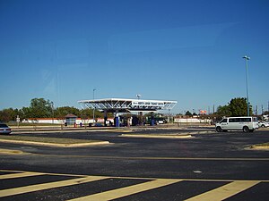
North Lamar Transit Center
Distance: Approx. 2945 meters
Latitude and longitude: 30.35,-97.7122
North Lamar Transit Center is a Capital Metropolitan Transportation Authority bus station in Austin, Texas. It is located on North Lamar Boulevard on the north side of U.S. Route 183. The station features a park and ride lot and is served by several local bus routes as well as CapMetro Rapid Route 801.

McKalla station
Hybrid rail station in Austin, Texas
Distance: Approx. 3978 meters
Latitude and longitude: 30.3878,-97.7176
McKalla station is a CapMetro Rail hybrid rail station in Austin, Texas, United States. The station was built to provide convenient access to Q2 Stadium. Ground broke on construction on July 18, 2022, and the new station opened on February 24, 2024, coinciding with the first home match of Austin FC's 2024 season.

Pioneer Farms
Living history museum in Austin, Texas
Distance: Approx. 2665 meters
Latitude and longitude: 30.3684592,-97.6590796
Pioneer Farms (formerly known as the Jourdan-Bachman Pioneer Farm or pluralized, the Jourdan-Bachman Pioneer Farms) is a living history museum in Austin, Texas. The site was originally granted to a settler, James O. Rice, in the fall of 1844 as part of a larger land acquisition. Frederick and Harriet Jourdan moved into what is now known as Pioneer Farms in 1852 and would later build a farm about 2,000 acres large.
Weather in this IP's area
clear sky
17 Celsius
16 Celsius
15 Celsius
19 Celsius
1020 hPa
44 %
1020 hPa
995 hPa
10000 meters
4.12 m/s
340 degree
06:55:22
17:35:03
