Country:
Region:
City:
Latitude and Longitude:
Time Zone:
Postal Code:
IP information under different IP Channel
ip-api
Country
Region
City
ASN
Time Zone
ISP
Blacklist
Proxy
Latitude
Longitude
Postal
Route
Luminati
Country
ASN
Time Zone
America/Chicago
ISP
NEXUSTEK-LASASN01
Latitude
Longitude
Postal
IPinfo
Country
Region
City
ASN
Time Zone
ISP
Blacklist
Proxy
Latitude
Longitude
Postal
Route
db-ip
Country
Region
City
ASN
Time Zone
ISP
Blacklist
Proxy
Latitude
Longitude
Postal
Route
ipdata
Country
Region
City
ASN
Time Zone
ISP
Blacklist
Proxy
Latitude
Longitude
Postal
Route
Popular places and events near this IP address
Irvine High School
Public secondary school in Irvine, California, United States
Distance: Approx. 1433 meters
Latitude and longitude: 33.7026,-117.7824
Irvine High School is a public high school, located in the city of Irvine in Orange County, California, United States. It is part of the Irvine Unified School District. The school is located in the El Camino Real neighborhood in the north-central part of the city.
Pacific Coast High School
Public high school in Tustin, California, United States
Distance: Approx. 1961 meters
Latitude and longitude: 33.72,-117.80444444
Pacific Coast High School (PCHS) is a public high school in Tustin, California, United States. It is part of the Orange County Department of Education.

Arnold O. Beckman High School
Public school in the United States
Distance: Approx. 283 meters
Latitude and longitude: 33.7176,-117.78246
Arnold O. Beckman High School is a public school in Irvine, California, United States, serving 3,013 students from grades 9 through 12. The $94 million facility was opened on August 30, 2004. The World Languages Building - a new, $17 million, two-story, 30,000-square-foot facility - was unveiled on September 1, 2015.

The Market Place (Orange County, California)
Shopping mall in California, United States
Distance: Approx. 1349 meters
Latitude and longitude: 33.7238,-117.7945
The Market Place (also known as the Tustin Market Place or the Tustin/Irvine Market Place) is an outdoor shopping center located in Orange County, California. Opened in 1988, the center is located along Jamboree Road and Interstate 5, straddling the borders of Irvine and Tustin. The Market Place features 140 tenants including Athleta, Amazon Fresh, Lazy Dog Restaurant & Bar, Nordstrom Rack, REI, Sephora and Texas de Brazil.
Tustin station
Passenger train station in Tustin, California, United States
Distance: Approx. 2197 meters
Latitude and longitude: 33.708,-117.806
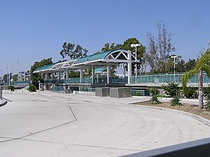
Tustin station is a Metrolink train station in Tustin, California, United States. The station is located in a shopping plaza at the intersection of Jamboree Road and Edinger Avenue. Between October 2010 and September 2011, the parking lot was closed to all cars to facilitate the construction of a five-level, 733-space parking structure.

Jamboree Road
Arterial road in Orange County, California
Distance: Approx. 2649 meters
Latitude and longitude: 33.70282392,-117.80828357
Jamboree Road is a 15.8-mile (25.4 km) long major arterial road through Orange County, California, running through the cities of Newport Beach, Irvine, Tustin, and Orange.

Northwood, Irvine, California
Distance: Approx. 2547 meters
Latitude and longitude: 33.7126,-117.7567
Northwood is a community encompassing the northern portions of the city of Irvine, in Orange County, California.
Northwood Community Park
Distance: Approx. 1595 meters
Latitude and longitude: 33.711284,-117.767506
Northwood Community Park is located in the Northwood, Irvine, California, United States. The park, built in 1980 on the site of a former citrus packing facility, is also known as "Castle Park" because it contains a children's fort structure. The park features Winslow Field—named for resident Chuck Winslow in 1982—which hosts PONY baseball games, and Northwood Gratitude and Honor Memorial, a war memorial.

Heritage Park, Irvine
City park in Irvine, California
Distance: Approx. 1704 meters
Latitude and longitude: 33.70097245,-117.77786251
Heritage Park is located in the city of Irvine in Orange County, California. The park sits next to Heritage Park Regional Library on the corner of Yale and Walnut Avenue(s), and is adjacent to Irvine High School. It was for decades recognized by its iconic wooden "water tower" slide, which stood three stories tall.

Northwood Gratitude and Honor Memorial
Distance: Approx. 1599 meters
Latitude and longitude: 33.7102,-117.7679
The Northwood Gratitude and Honor Memorial is a memorial in Irvine, California, to American troops who died in the wars in Iraq and Afghanistan. The names on the memorial come from US DoD casualty records for Operation Enduring Freedom, Operation Iraqi Freedom, and Operation New Dawn. Located at Northwood Community Park, on the corner of Yale and Bryan in Northwood, Irvine, California, it is the only known memorial in the United States dedicated to listing by name all American service men and women killed in the conflicts in Afghanistan and Iraq.

William Woollett Jr. Aquatics Center
Distance: Approx. 1617 meters
Latitude and longitude: 33.70111111,-117.78083333
The William Woollett Jr. Aquatics Center is an aquatics venue located in Irvine, California, United States. The City of Irvine operates year-round municipal programs in aquatic facility.

Frances Packing House
United States historic place
Distance: Approx. 1980 meters
Latitude and longitude: 33.71083333,-117.76333333
The Frances Packing House in Orange County, California near Irvine, California is a historic packing house that was built in 1916. It was listed on the National Register of Historic Places (NRHP) in 1977. The packing house closed in 1971, and the building was demolished in 1977.
Weather in this IP's area
clear sky
18 Celsius
16 Celsius
15 Celsius
19 Celsius
1013 hPa
43 %
1013 hPa
1009 hPa
10000 meters
1.34 m/s
2.24 m/s
222 degree
06:24:44
16:47:36
