162.255.136.120 - IP Lookup: Free IP Address Lookup, Postal Code Lookup, IP Location Lookup, IP ASN, Public IP
Country:
Region:
City:
Location:
Time Zone:
Postal Code:
ISP:
ASN:
language:
User-Agent:
Proxy IP:
Blacklist:
IP information under different IP Channel
ip-api
Country
Region
City
ASN
Time Zone
ISP
Blacklist
Proxy
Latitude
Longitude
Postal
Route
db-ip
Country
Region
City
ASN
Time Zone
ISP
Blacklist
Proxy
Latitude
Longitude
Postal
Route
IPinfo
Country
Region
City
ASN
Time Zone
ISP
Blacklist
Proxy
Latitude
Longitude
Postal
Route
IP2Location
162.255.136.120Country
Region
georgia
City
alpharetta
Time Zone
America/New_York
ISP
Language
User-Agent
Latitude
Longitude
Postal
ipdata
Country
Region
City
ASN
Time Zone
ISP
Blacklist
Proxy
Latitude
Longitude
Postal
Route
Popular places and events near this IP address

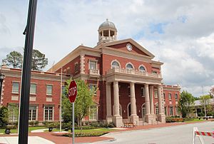
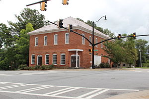
Alpharetta, Georgia
City in Georgia, United States
Distance: Approx. 5232 meters
Latitude and longitude: 34.07527778,-84.29416667
Alpharetta is a city in northern Fulton County, Georgia, United States, and part of the Atlanta metropolitan area. As of the 2020 U.S. census, Alpharetta's population was 65,818; in 2010, the population had been 57,551.
Milton, Georgia
City in Fulton County, Georgia, United States
Distance: Approx. 1147 meters
Latitude and longitude: 34.1321631,-84.300666
Milton is a city in Fulton County, Georgia, United States, located about 30 miles (48 km) north of downtown Atlanta. Incorporated on December 1, 2006, the population was 41,296 as of the 2020 census. Milton is one of the wealthiest cities in the state of Georgia and is known for its high quality of life, excellent schools, and affluent community.

Independence High School (Georgia)
Alternative school in Alpharetta, Georgia, United States
Distance: Approx. 4918 meters
Latitude and longitude: 34.07812,-84.30111
Independence High School was an alternative high school in the historic district of Roswell, Georgia, United States. It was located on the old Milton High School campus.
Crabapple, Georgia
Distance: Approx. 5216 meters
Latitude and longitude: 34.09,-84.33861111
Centered today at the crossroads of Georgia Highways 140 and 372 (also known as "the Silos area"), Crabapple, Georgia, is one of the oldest parts of Fulton County, Georgia. Originally part of Cherokee County, Georgia, (created 1832), Crabapple was part of the land contributed in 1857 to form Milton County, Georgia. The first permanent settlement at Crabapple was made in 1874, with the community taking its name from a crabapple tree near the original town site.

Milton High School (Georgia)
Public high school in Milton, Fulton County, Georgia, United States
Distance: Approx. 4443 meters
Latitude and longitude: 34.09841,-84.33621
Milton High School is a high school in Milton, Georgia, United States.
Lionheart School
Independent school, special education school in Alpharetta, Georgia, United States
Distance: Approx. 5773 meters
Latitude and longitude: 34.07052,-84.30273
The Lionheart School is a 501(c)(3) non-profit independent school for children ages 5 to 21 with autism or other disorders of relating and communicating. The school was established in 2000 and is located in Alpharetta, Georgia, United States. Lionheart was awarded SACS/SAIS (Southern Association of Colleges and Schools/ Southern Association of Independent Schools) Accreditation in 2008.

Hopewell, Fulton County, Georgia
Unincorporated community in Georgia, U.S.
Distance: Approx. 3577 meters
Latitude and longitude: 34.15277778,-84.28555556
Hopewell is an unincorporated community in Fulton County, Georgia, United States. It lies at an elevation of 1122 feet (342 m). The community was so named on account of first settlers' optimistic spirit.
Taste of Alpharetta
Distance: Approx. 5229 meters
Latitude and longitude: 34.0753,-84.2944
Taste of Alpharetta is a festival/event where over 60 restaurants offer a wide range of foods. Established in 1991, it's located in Alpharetta, Georgia and drew over 60,000 people one year. Restaurants typically sell small "tasting" size portions which are typical of the restaurants' offerings from tables and tents.

Avalon (Alpharetta, Georgia)
Mixed-use development in Alpharetta, Georgia, US
Distance: Approx. 6038 meters
Latitude and longitude: 34.0706,-84.2773
Avalon is a mixed-use development in Alpharetta, Georgia. Phase I of the 86-acre (35 ha) site includes 500,000 square feet (46,000 m2) of retail space, a 12-screen Regal Cinemas theater, 105,000 square foot of Class A office space over retail, 101 single-family residences and 250 luxury rental homes. Phase I opened In October 2014 drawing shoppers away from North Point Mall.

Crooked Creek, Milton, Georgia
Neighborhood of Milton in Georgia, US
Distance: Approx. 2859 meters
Latitude and longitude: 34.1275,-84.26713889
Crooked Creek is a neighborhood located in Milton, Georgia (formerly Alpharetta). Surrounded by the Iron Horse Golf Club, it has 640 homes on over 500 acres of rolling hills.

Cambridge High School (Georgia)
Public high school in Milton, Fulton County, Georgia, United States
Distance: Approx. 2094 meters
Latitude and longitude: 34.1182,-84.2753
Cambridge High School is a public high school in Milton, Georgia and a school of the Fulton County School System. The 17th high school to open in the district and relieving Alpharetta High School and Milton High School, it opened in August 2012.
The Gathering at South Forsyth
Proposed indoor arena and mixed-use development in Forsyth County, Georgia, United States
Distance: Approx. 6174 meters
Latitude and longitude: 34.103462,-84.234447
The Gathering at South Forsyth is a proposed mixed-use development in the Atlanta metropolitan area to be located in Forsyth County, Georgia near the city of Alpharetta. The centerpiece of the development is an 18,000-seat arena, intended to bring a National Hockey League franchise back to the Atlanta area. The Gathering at South Forsyth is modeled after The Battery Atlanta, a mixed-use development in Cobb County anchored by Truist Park, home of the Atlanta Braves of Major League Baseball.
Weather in this IP's area
overcast clouds
9 Celsius
8 Celsius
8 Celsius
10 Celsius
1014 hPa
96 %
1014 hPa
976 hPa
10000 meters
1.81 m/s
7.82 m/s
270 degree
100 %
