162.252.134.224 - IP Lookup: Free IP Address Lookup, Postal Code Lookup, IP Location Lookup, IP ASN, Public IP
Country:
Region:
City:
Location:
Time Zone:
Postal Code:
IP information under different IP Channel
ip-api
Country
Region
City
ASN
Time Zone
ISP
Blacklist
Proxy
Latitude
Longitude
Postal
Route
Luminati
Country
Region
nb
City
fredericton
ASN
Time Zone
America/Moncton
ISP
PNB-TRANSIT
Latitude
Longitude
Postal
IPinfo
Country
Region
City
ASN
Time Zone
ISP
Blacklist
Proxy
Latitude
Longitude
Postal
Route
IP2Location
162.252.134.224Country
Region
new brunswick
City
sackville
Time Zone
America/Moncton
ISP
Language
User-Agent
Latitude
Longitude
Postal
db-ip
Country
Region
City
ASN
Time Zone
ISP
Blacklist
Proxy
Latitude
Longitude
Postal
Route
ipdata
Country
Region
City
ASN
Time Zone
ISP
Blacklist
Proxy
Latitude
Longitude
Postal
Route
Popular places and events near this IP address

Mount Allison University
Liberal arts university in Sackville, New Brunswick, Canada
Distance: Approx. 2403 meters
Latitude and longitude: 45.89861111,-64.37361111
Mount Allison University (also Mount A or MtA) is a Canadian primarily undergraduate liberal arts university located in Sackville, New Brunswick, founded in 1839. Mount Allison was the first university in the British Empire to award a baccalaureate to a woman (Grace Annie Lockhart, B.Sc., 1875). It was also the first university in Canada to grant a bachelor of arts to a woman (Harriet Starr Stewart in 1882).

Sackville, New Brunswick
Place in New Brunswick, Canada
Distance: Approx. 2512 meters
Latitude and longitude: 45.9,-64.36666667
Sackville is a former town in southeastern New Brunswick, Canada. It held town status prior to 2023 and is now part of the town of Tantramar. Sackville is home to Mount Allison University, a primarily undergraduate liberal arts university.
CHMA-FM
Radio station at Mount Allison University in Sackville, New Brunswick
Distance: Approx. 2412 meters
Latitude and longitude: 45.89857778,-64.37340833
CHMA-FM is a radio station broadcasting at 106.9 MHz in Sackville, New Brunswick, Canada. It is a campus/community station functioning as the campus radio station of Mount Allison University and the community radio station of Sackville, New Brunswick.

Sackville station
Railway station in New Brunswick, Canada
Distance: Approx. 3449 meters
Latitude and longitude: 45.89027778,-64.36722222
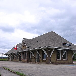
The Sackville station is an inter-city railway station in Sackville, New Brunswick. It is operated by Via Rail. The station was staffed until October 2012.
Captain George Anderson House
Distance: Approx. 2060 meters
Latitude and longitude: 45.9016,-64.3748
The Captain George Anderson House, also called the Octagonal House, is an octagon house now located in Sackville, New Brunswick. It was built in 1855 by Captain George Anderson, a mariner and shipbuilder. It was later deeded to his father, Captain Titus Anderson and stayed in the Anderson family until 1901.
Upper Sackville, New Brunswick
Community in New Brunswick, Canada
Distance: Approx. 2991 meters
Latitude and longitude: 45.92944444,-64.34913889
Upper Sackville is a Canadian rural community in Westmorland County, New Brunswick.
Middle Sackville, New Brunswick
Community in New Brunswick, Canada
Distance: Approx. 1791 meters
Latitude and longitude: 45.92247222,-64.36208333
Middle Sackville is a Canadian rural community in Westmorland County, New Brunswick.
Tantramar Regional High School
Public high school in Sackville, New Brunswick, Canada
Distance: Approx. 1529 meters
Latitude and longitude: 45.91021,-64.36919
Tantramar Regional High School, is a Canadian secondary school located in Sackville, New Brunswick. Tantramar Regional High School is home to the Tantramar Wetlands Centre, a program that aims to provide outdoor education for students. The Tantramar Wetlands Centre was founded in 1998, by Ducks Unlimited Canada, the Canadian Wildlife Service, New Brunswick's Department of Natural Resources, the Town of Sackville and the School District, who teamed up to create the wetlands.
Ogden Mill, New Brunswick
Community in New Brunswick, Canada
Distance: Approx. 322 meters
Latitude and longitude: 45.916527,-64.382029
Ogden Mill is a Canadian rural community in Westmorland County, New Brunswick.
Sackville Memorial Hospital
Hospital in New Brunswick, Canada
Distance: Approx. 3055 meters
Latitude and longitude: 45.89248,-64.37344
Sackville Memorial Hospital is a Canadian hospital located in the town of Sackville, New Brunswick. It is operated by Horizon Health Network. It is an acute care community hospital and provides services to the following area of Westmorland County: Sackville Parish (Sackville and surrounding areas) Dorchester Parish (Dorchester and surrounding areas) Botsford Parish (Strait Shores and surrounding areas) The first baby officially born at the Sackville Hospital when it opened in 1988 was Jessica Laurie Hutchinson, born April 13, 1988.

Sackville Methodist/United Church
Distance: Approx. 2608 meters
Latitude and longitude: 45.8983,-64.3683
Sackville Methodist/United Church was a 140-year-old historic landmark in the heart of Sackville, New Brunswick, Canada that was demolished in September 2015 in spite of opposition from many local residents and Heritage Canada's National Trust which placed the church on its top ten list of endangered places. The church, built in 1875, was expanded in 1898 in the shape of a Greek cross designed by the noted architect H.H. Mott. Four-metre stained glass “rose” windows, created by J.C. Spence & Sons, adorned the four points of the cross.

Tantramar, New Brunswick
Town in New Brunswick, Canada
Distance: Approx. 2512 meters
Latitude and longitude: 45.9,-64.36666667
Tantramar is a town in the Canadian province of New Brunswick. It was formed through the 2023 New Brunswick local governance reforms.
Weather in this IP's area
broken clouds
-2 Celsius
-4 Celsius
-2 Celsius
-0 Celsius
1014 hPa
90 %
1014 hPa
1012 hPa
10000 meters
1.91 m/s
2.95 m/s
97 degree
59 %