162.251.243.25 - IP Lookup: Free IP Address Lookup, Postal Code Lookup, IP Location Lookup, IP ASN, Public IP
Country:
 USA
USARegion:
City:
Location:
Time Zone:
Postal Code:
ISP:
ASN:
language:
User-Agent:
Proxy IP:
Blacklist:
IP information under different IP Channel
ip-api
Country
Region
City
ASN
Time Zone
ISP
Blacklist
Proxy
Latitude
Longitude
Postal
Route
db-ip
Country
Region
City
ASN
Time Zone
ISP
Blacklist
Proxy
Latitude
Longitude
Postal
Route
IPinfo
Country
Region
City
ASN
Time Zone
ISP
Blacklist
Proxy
Latitude
Longitude
Postal
Route
IP2Location
162.251.243.25Country
usRegion
new york
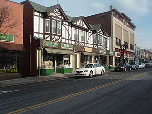
City
suffern
Time Zone
America/New_York
ISP
Language
User-Agent
Latitude
Longitude
Postal
ipdata
Country
Region
City
ASN
Time Zone
ISP
Blacklist
Proxy
Latitude
Longitude
Postal
Route
Popular places and events near this IP address

Montebello, New York
Village in New York, United States
Distance: Approx. 723 meters
Latitude and longitude: 41.1275,-74.11916667
Montebello (Italian: "beautiful mountain") is an incorporated village in Ramapo, Rockland County, New York, United States. It is located north of Suffern, east of Hillburn, south of Wesley Hills, and west of Airmont. The population was 4,507 at the 2020 census.
Ramapo, New York
Town in New York, United States
Distance: Approx. 2349 meters
Latitude and longitude: 41.12194444,-74.08333333
Ramapo is a town in Rockland County, New York, United States. It was originally formed as New Hampstead, in 1791, and became Ramapo in 1828. It shares its name with the Ramapo River.
Viola, New York
Census-designated place in New York, United States
Distance: Approx. 2287 meters
Latitude and longitude: 41.12638889,-74.08333333
Viola is a hamlet and census-designated place in the town of Ramapo, Rockland County, New York, United States. It is located north of Airmont, east of Montebello, south of Wesley Hills, and west of Hillcrest. The population was 6,868 at the 2010 census.

Rockland Community College
Public college in Suffern, New York, US
Distance: Approx. 2043 meters
Latitude and longitude: 41.13243889,-74.08741944
Rockland Community College (RCC) is a public community college in Rockland County, New York. It is part of the State University of New York. The college, established in 1959, became the 18th community college to join the SUNY system.

Suffern High School
Public school in New York state
Distance: Approx. 823 meters
Latitude and longitude: 41.13416667,-74.10972222
Suffern High School is a public high school in the Suffern Central School District (formerly known as the Ramapo Central School District) located in Suffern, New York. The school's mascot is a mountain lion (Mountie). Its yearbook is the Panorama.
Ezras Torah Fund
Distance: Approx. 1460 meters
Latitude and longitude: 41.11380556,-74.11297222
The Ezras Torah Fund was founded on August 25, 1915 (15 Elul, 5675) at a meeting in Congregation Mishkan Israel in the Lower East Side of New York. The meeting was conducted by members of the Agudas HaRabbanim and the Vaad HaRabbanim of New York. It was an outgrowth of the Central Relief Committee (CRC) that was created to assist Orthodox Jews in Europe during World War I. The CRC had been founded in late 1914 by the Union of Orthodox Jewish Congregations of America with much help from the aforementioned rabbinical organizations.
Good Samaritan Hospital (Suffern)
Hospital in New York, U.S.
Distance: Approx. 2669 meters
Latitude and longitude: 41.11166667,-74.13527778
Good Samaritan Hospital is a non-profit, 286-bed hospital in Suffern, New York. It provides emergency, medical, surgical, obstetrical, gynecological, and acute care services. The hospital is home to a cardiovascular program, cancer treatment services, wound and hyperbaric institute and maternal/child services that includes a children's diagnostic center.
Alisa M. Flatow Yeshiva High School
Private school
Distance: Approx. 2305 meters
Latitude and longitude: 41.111475,-74.129088
Bat Torah - The Alisa M. Flatow Yeshiva High School was a private Jewish day school located in Suffern, New York. In May 2011, the school had planned to move to the Teaneck Jewish Center. On July 25, 2011, it was reported that the school would not be opening for the 2011–2012 academic year.
Tallman, New York
Distance: Approx. 1960 meters
Latitude and longitude: 41.11111111,-74.1
Tallman is a hamlet in the town of Ramapo, Rockland County, New York, United States, located north of the state of New Jersey; east of Suffern; south of Montebello and west of Airmont. It is located north-northwest of New York City.

John A. DeBaun Mill
United States historic place
Distance: Approx. 1673 meters
Latitude and longitude: 41.1125,-74.10444444
John A. DeBaun Mill is a historic grist mill located at Tallman in Rockland County, New York. It was built about 1845 and is a two-story, four by two bay, heavy timber frame, clapboard sheathed main block on a rubble stone foundation. The main block is flanked by large shed roofed one story wings.
Yeshiva Shaarei Torah
Mesivta (high school) school in the United States
Distance: Approx. 1765 meters
Latitude and longitude: 41.12356,-74.09
Yeshiva Shaarei Torah or Shaarei Torah of Rockland is a mesivta (Orthodox Jewish high school) in Suffern, New York.
Mesivta Ohel Torah
Jewish high school in the US
Distance: Approx. 2026 meters
Latitude and longitude: 41.123091,-74.086943
Mesivta Ohel Torah (lit. 'Tent of Torah'), also known as Yeshiva High School of Monsey is an Orthodox Jewish yeshiva in Monsey, New York, United States.
Weather in this IP's area
scattered clouds
-3 Celsius
-3 Celsius
-4 Celsius
-2 Celsius
1027 hPa
58 %
1027 hPa
1007 hPa
10000 meters
0.45 m/s
2.68 m/s
269 degree
40 %