162.251.243.194 - IP Lookup: Free IP Address Lookup, Postal Code Lookup, IP Location Lookup, IP ASN, Public IP
Country:
Region:
City:
Location:
Time Zone:
Postal Code:
ISP:
ASN:
language:
User-Agent:
Proxy IP:
Blacklist:
IP information under different IP Channel
ip-api
Country
Region
City
ASN
Time Zone
ISP
Blacklist
Proxy
Latitude
Longitude
Postal
Route
db-ip
Country
Region
City
ASN
Time Zone
ISP
Blacklist
Proxy
Latitude
Longitude
Postal
Route
IPinfo
Country
Region
City
ASN
Time Zone
ISP
Blacklist
Proxy
Latitude
Longitude
Postal
Route
IP2Location
162.251.243.194Country
Region
maryland
City
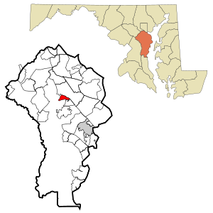
millersville
Time Zone
America/New_York
ISP
Language
User-Agent
Latitude
Longitude
Postal
ipdata
Country
Region
City
ASN
Time Zone
ISP
Blacklist
Proxy
Latitude
Longitude
Postal
Route
Popular places and events near this IP address

Arden on the Severn, Maryland
Census-designated place in Maryland, United States
Distance: Approx. 3817 meters
Latitude and longitude: 39.07111111,-76.59027778
Arden on the Severn is a census-designated place (CDP) in Anne Arundel County, Maryland. The population was 1,880 at the 2020 census. Its homes offer residents private waterfront beaches including private docks and boat slips as well as access to four private community beaches.

South Gate, Maryland
Former census-designated place in Maryland, United States
Distance: Approx. 4166 meters
Latitude and longitude: 39.13222222,-76.63111111
South Gate was a census-designated place (CDP) in Anne Arundel County, Maryland, United States, for the 2000 census, at which time its population was 28,672. It was added primarily to the Glen Burnie CDP for the 2010 census.
Old Mill High School
Public, secondary school in the United States
Distance: Approx. 3088 meters
Latitude and longitude: 39.12277778,-76.62833333
Old Mill High School is a public high school in Millersville, Maryland, serving students in grades 9 through 12. It was occupied in 1975 and is administered by Anne Arundel County Public Schools (AACPS). The school was built to alleviate overcrowding at Arundel and Severna Park High Schools.
Gambrills, Maryland
Census-designated place in Maryland, U.S.
Distance: Approx. 3172 meters
Latitude and longitude: 39.085,-76.65527778
Gambrills refers to two neighboring places in Anne Arundel County, Maryland, United States, located in the Annapolis metro area: the unincorporated community of Gambrills, and the Gambrills census-designated place (CDP). The area was named after Augustine Gambrill, a plantation owner. The CDP covers an expansive range that falls within the communities of Crofton, Waugh Chapel, and Odenton.
Indian Creek School
College-preparatory, day school in Crownsville, Maryland, United States
Distance: Approx. 3676 meters
Latitude and longitude: 39.06472222,-76.60611111
Indian Creek School is a coeducational, university-preparatory school in Crownsville, Maryland. It serves students from pre-kindergarten through grade 12.
Archbishop Spalding High School
Private, coeducational school in Severn, Maryland, US
Distance: Approx. 3931 meters
Latitude and longitude: 39.12472222,-76.64694444
Archbishop Spalding High School is a private, Catholic co-educational high school located in Severn, Maryland, USA. It is located in the Roman Catholic Archdiocese of Baltimore. Most of its students live in Annapolis, Crownsville, Arnold, Pasadena, Severna Park, Crofton, Millersville, Glen Burnie, or Davidsonville in Anne Arundel County. Some also travel from southern Baltimore County, east Prince George's County and parts of Howard County.

Kinder Farm Park
Park in Anne Arundel County, Maryland, US
Distance: Approx. 3246 meters
Latitude and longitude: 39.1014984,-76.584409
Kinder Farm Park is a park located in rural Millersvile, Anne Arundel County, Maryland, United States. The park contains 288 acres (1.17 km2) and is operated by Anne Arundel County Recreation and Parks. It is open year-round.
Chesapeake Baptist College
College in Severn, Maryland, United States
Distance: Approx. 3658 meters
Latitude and longitude: 39.11138889,-76.65833333
Chesapeake Baptist College & Seminary is an independent Baptist school located in Severn, Maryland, United States. The school is devoted primarily to training pastors, missionaries, evangelists, and school teachers.
Cross Roads Church
Historic church in Maryland, United States
Distance: Approx. 4075 meters
Latitude and longitude: 39.05944444,-76.62861111
Baldwin Hall, also known as the Cross Roads Church, was built as the Severn Crossroads Methodist Episcopal Church and is currently a historic church at Millersville, Anne Arundel County, Maryland. It is a one-story gable-front frame structure in the Italianate and Carpenter Gothic-styles built in 1861. It was moved about 1930 and again in 1981.
Rockbridge Academy
Private school in Crownsville, Maryland, USA
Distance: Approx. 3719 meters
Latitude and longitude: 39.0644,-76.6058
Rockbridge Academy is a private, nonprofit, K–12, classical Christian school near Annapolis in Anne Arundel County, Maryland. Founded in 1995, the school has approximately 380 pupils on roll.

Howard's Adventure
Former plantation and US Navy farm
Distance: Approx. 3172 meters
Latitude and longitude: 39.085,-76.65527778
Howard's Adventure was a former slave plantation located in Gambrills, Maryland in Anne Arundel County. The historic estate was the homestead for the prominent Hammond family of the region. The property was later purchased by the United States Naval Academy, who would operate a dairy on the site for over eighty years.
Severn Run High School
Public high school in Severn, Maryland, United States
Distance: Approx. 3467 meters
Latitude and longitude: 39.122,-76.6425
Severn Run High School is a public high school in Severn, Maryland, serving students in grades 9 through 12. It is administered by Anne Arundel County Public Schools (AACPS). The school was opened in 2024 to alleviate overcrowding at Old Mill High School, North County High School and Meade High School.
Weather in this IP's area
few clouds
-2 Celsius
-2 Celsius
-3 Celsius
1 Celsius
1024 hPa
69 %
1024 hPa
1020 hPa
10000 meters
20 %
