162.251.112.19 - IP Lookup: Free IP Address Lookup, Postal Code Lookup, IP Location Lookup, IP ASN, Public IP
Country:
Region:
City:
Location:
Time Zone:
Postal Code:
IP information under different IP Channel
ip-api
Country
Region
City
ASN
Time Zone
ISP
Blacklist
Proxy
Latitude
Longitude
Postal
Route
Luminati
Country
Region
pa
City
lewistown
ASN
Time Zone
America/New_York
ISP
MIFFLIN-COUNTY-WIRELESS
Latitude
Longitude
Postal
IPinfo
Country
Region
City
ASN
Time Zone
ISP
Blacklist
Proxy
Latitude
Longitude
Postal
Route
IP2Location
162.251.112.19Country
Region
pennsylvania
City
lewistown
Time Zone
America/New_York
ISP
Language
User-Agent
Latitude
Longitude
Postal
db-ip
Country
Region
City
ASN
Time Zone
ISP
Blacklist
Proxy
Latitude
Longitude
Postal
Route
ipdata
Country
Region
City
ASN
Time Zone
ISP
Blacklist
Proxy
Latitude
Longitude
Postal
Route
Popular places and events near this IP address
Highland Park, Pennsylvania
CDP in Pennsylvania, United States
Distance: Approx. 1796 meters
Latitude and longitude: 40.61944444,-77.56611111
Highland Park is a census-designated place (CDP) in Mifflin County, Pennsylvania, United States. The population was 1,446 at the time of the 2000 census.

Lewistown, Pennsylvania
Borough in Pennsylvania, United States
Distance: Approx. 724 meters
Latitude and longitude: 40.5975,-77.57333333
Lewistown is a borough in and the county seat of Mifflin County, Pennsylvania, United States. It is the principal city of the Lewistown, PA Micropolitan Statistical Area, which encompasses all of Mifflin County. It lies along the Juniata River, 61 miles (98 km) northwest of Harrisburg.

Main Line of Public Works
United States historic place
Distance: Approx. 528 meters
Latitude and longitude: 40.59916667,-77.57138889
The Main Line of Public Works was a package of legislation passed by the Commonwealth of Pennsylvania in 1826 to establish a means of transporting freight between Philadelphia and Pittsburgh. It funded the construction of various long-proposed canal and road projects, mostly in southern Pennsylvania, that became a canal system and later added railroads. Built between 1826 and 1834, it established the Pennsylvania Canal System and the Allegheny Portage Railroad.
Lewistown Area High School
High school in Lewistown, Pennsylvania, United States
Distance: Approx. 1375 meters
Latitude and longitude: 40.5944,-77.5614
Lewistown Area High School was founded in September 1976 and was one of two high schools in Mifflin County, Pennsylvania. It served residents of the Borough of Lewistown and communities to the borough's south and west. It was part of the Mifflin County School District.

Lewistown station
Distance: Approx. 1890 meters
Latitude and longitude: 40.5882,-77.5803
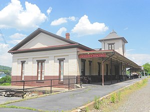
Lewistown station is an Amtrak railway station located about 60 miles northwest of Harrisburg, Pennsylvania at PA 103 and Helen Street in Lewistown, Mifflin County, Pennsylvania. The station is actually located across the Juniata River from Lewistown proper, a little less than one mile south of the center of the borough. It is currently only served by Amtrak's Pennsylvanian, which operates once per day in each direction, though until 2005, Lewistown was served by a second daily train, the Three Rivers (a replacement service for the legendary Broadway Limited), an extended version of the Pennsylvanian that terminated in Chicago.
Embassy Theatre (Lewistown, Pennsylvania)
United States historic place
Distance: Approx. 856 meters
Latitude and longitude: 40.59694444,-77.57611111
The Embassy Theatre is a historic theatre building located on South Main Street in Lewistown, Mifflin County, Pennsylvania. It is a 1927 motion picture / vaudeville theatre, and is an excellent surviving example of theatre architecture of the 1920s. The original National Theatre building was built in 1916, and gutted in 1927 to be rebuilt as the Embassy.
WLUI
Radio station in Pennsylvania, United States
Distance: Approx. 704 meters
Latitude and longitude: 40.60722222,-77.57888889
WLUI (670 AM) is an oldies radio station broadcasting in Lewistown, Pennsylvania, and serving State College, Pennsylvania. It also can be heard in northern parts of Maryland and parts of southern New York state, as well as parts of eastern Pennsylvania. The daytime-only station previously operated a news/talk format featuring Joy Browne, Glenn Beck, Rush Limbaugh, and Sean Hannity.
Kishacoquillas Creek
Distance: Approx. 1126 meters
Latitude and longitude: 40.594077,-77.574992
Kishacoquillas Creek (pronounced Kish-e-kō-kwil´-lis) is a 24.0-mile-long (38.6 km) tributary of the Juniata River in Mifflin County, Pennsylvania in the United States. Kishacoquillas Creek (named for a friendly Native American inhabitant) drains the Kishacoquillas Valley, running along the foot of the Jacks Mountain ridge where it intersects with Honey Creek before passing through the Mann Narrows water gap and joins the Juniata River at the borough of Lewistown.
Montgomery Ward Building (Lewistown, Pennsylvania)
United States historic place
Distance: Approx. 638 meters
Latitude and longitude: 40.59833333,-77.57361111
The Montgomery Ward Building is an historic, American department store building that is located in Lewistown, Mifflin County, Pennsylvania. It was added to the National Register of Historic Places in 1984.
Mifflin County Courthouse
United States historic place
Distance: Approx. 780 meters
Latitude and longitude: 40.5975,-77.57555556
The Mifflin County Historic Courthouse is an historic, American courthouse building that is located in Lewistown, Mifflin County, Pennsylvania. The building was added to the National Register of Historic Places in 1976.

McCoy House (Lewistown, Pennsylvania)
Historic house in Pennsylvania, United States
Distance: Approx. 714 meters
Latitude and longitude: 40.59805556,-77.57527778
McCoy House is a historic home located at Lewistown, Mifflin County, Pennsylvania, across from the Mifflin County Courthouse. It was built between 1836 and 1843, and is a 2+1⁄2-story, brick and frame dwelling in the Federal style. It has a gable roof and a double chimney linked at the base.
Wollner Building
United States historic place
Distance: Approx. 638 meters
Latitude and longitude: 40.59833333,-77.57361111
The Wollner Building is an historic, American commercial building that is located in Lewistown, Mifflin County, Pennsylvania, on Monument Square across from the Mifflin County Courthouse. It was added to the National Register of Historic Places in 1984.
Weather in this IP's area
light rain
17 Celsius
17 Celsius
16 Celsius
18 Celsius
1004 hPa
88 %
1004 hPa
986 hPa
10000 meters
6.17 m/s
11.83 m/s
140 degree
100 %


