Country:
Region:
City:
Latitude and Longitude:
Time Zone:
Postal Code:
IP information under different IP Channel
ip-api
Country
Region
City
ASN
Time Zone
ISP
Blacklist
Proxy
Latitude
Longitude
Postal
Route
Luminati
Country
Region
il
City
palosheights
ASN
Time Zone
America/Chicago
ISP
OFFSITE-1
Latitude
Longitude
Postal
IPinfo
Country
Region
City
ASN
Time Zone
ISP
Blacklist
Proxy
Latitude
Longitude
Postal
Route
db-ip
Country
Region
City
ASN
Time Zone
ISP
Blacklist
Proxy
Latitude
Longitude
Postal
Route
ipdata
Country
Region
City
ASN
Time Zone
ISP
Blacklist
Proxy
Latitude
Longitude
Postal
Route
Popular places and events near this IP address

Palos Heights, Illinois
City in Illinois, United States
Distance: Approx. 477 meters
Latitude and longitude: 41.66527778,-87.79722222
Palos Heights is a city in Cook County, Illinois, United States. It is a southwest suburb of Chicago. Per the 2020 census, the population was 12,068.

Worth, Illinois
Village in Illinois, United States
Distance: Approx. 3005 meters
Latitude and longitude: 41.68888889,-87.79277778
Worth is a village in Cook County, Illinois, United States, a suburb of Chicago. Per the 2020 census, the population was 10,970.

Trinity Christian College
Private Christian college in Palos Heights, Illinois, U.S.
Distance: Approx. 1188 meters
Latitude and longitude: 41.66894444,-87.78297222
Trinity Christian College is a private Christian college in Palos Heights, Illinois. It was founded in 1959 by a group of Chicago businessmen who wanted to establish a college providing students with a Christian higher education in a Reformed tradition as a college in Illinois. The college offers degrees in more than 70 programs of study.
WRDZ (AM)
Radio station in La Grange, Illinois
Distance: Approx. 2961 meters
Latitude and longitude: 41.67472222,-87.7625
WRDZ (1300 kHz) is a silent AM radio station licensed to La Grange, Illinois, and serving the Chicago metropolitan area. The station, which began broadcasting in 1950, is owned and operated by Walter Kotaba's Polnet Communications. By day, WRDZ is powered at 4,500 watts.

Helen Morgan (singer)
American jazz singer and actress
Distance: Approx. 3344 meters
Latitude and longitude: 41.689717,-87.778503
Helen Morgan (née Riggins; August 2, 1900 – October 9, 1941) was an American singer and actress who worked in films and on the stage. A quintessential torch singer, she made a big splash in the Chicago club scene in the 1920s. She starred as Julie LaVerne in the original Broadway production of Hammerstein and Kern's musical Show Boat in 1927, as well as in the 1932 Broadway revival of the musical, and appeared in two film adaptations, a part-talkie made in 1929 (prologue only) and a full-sound version made in 1936, becoming firmly associated with the role.
Holy Sepulchre Cemetery (Alsip, Illinois)
Cemetery in Worth Township, Illinois
Distance: Approx. 3354 meters
Latitude and longitude: 41.6868947,-87.7711808
Holy Sepulchre Cemetery is a Roman Catholic cemetery of the Archdiocese of Chicago, located in the village of Alsip, Illinois, in Worth Township, southwest of Chicago.

George E. Gorman
American politician
Distance: Approx. 3413 meters
Latitude and longitude: 41.689081,-87.774697
George Edmund Gorman (April 13, 1873 – January 13, 1935) was a U.S. Representative from Illinois.

Worth station
Commuter rail station in Worth, Illinois
Distance: Approx. 3289 meters
Latitude and longitude: 41.6914,-87.7959
Worth is a station on Metra's SouthWest Service in Worth, Illinois. The station is 17.8 miles (28.6 km) away from Chicago Union Station, the northern terminus of the line. In Metra's zone-based fare system, Worth is in zone 3.

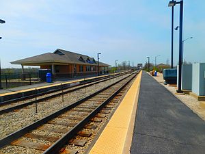
Palos Heights station
Commuter rail station in Palos Heights, Illinois
Distance: Approx. 2507 meters
Latitude and longitude: 41.682,-87.8073
Palos Heights is a station on Metra's SouthWest Service in Palos Heights, Illinois. The station is 18.6 miles (29.9 km) away from Chicago Union Station, the northern terminus of the line. The station opened in 2004.

Palos Park station
Commuter rail station in Palos Park, Illinois
Distance: Approx. 2341 meters
Latitude and longitude: 41.669,-87.8202
Palos Park is a station on Metra's SouthWest Service in Palos Park, Illinois. The station is 19.8 miles (31.9 km) away from Chicago Union Station, the northern terminus of the line. In Metra's zone-based fare system, Palos Park is in zone 4.
ReFrame Ministries
Electronic media ministry of the Christian Reformed Church
Distance: Approx. 1511 meters
Latitude and longitude: 41.672408,-87.782206
ReFrame Ministries, formerly Back to God Ministries International is the electronic media ministry of the Christian Reformed Church. Founded in 1939 as the weekly radio ministry program "The Back to God Hour", in 2015 the organization produces radio programs, TV broadcasts, and Internet websites in 10 languages, including children's dramas, daily devotionals, Bible resources, family resources, and cultural reflections. It operates from the Christian Reformed Church Headquarters in Grand Rapids, Michigan, and in Burlington, Ontario.
Calumet Feeder Canal
Canal in Illinois, United States
Distance: Approx. 2773 meters
Latitude and longitude: 41.66805556,-87.76138889
The Calumet Feeder Canal was a short canal in Illinois, operated during the mid-19th century. It connected the Little Calumet River to the Illinois and Michigan (I&M) Canal, and ran from Blue Island, where the Little Calumet made a hairpin turn toward Lake Michigan, to meet the I&M canal at Sag Bridge. The canal was completed in 1849, and covered 16.75 miles (26.96 km).
Weather in this IP's area
moderate rain
18 Celsius
18 Celsius
17 Celsius
18 Celsius
1008 hPa
93 %
1008 hPa
986 hPa
10000 meters
4.02 m/s
8.05 m/s
210 degree
100 %
06:28:40
16:40:54