162.249.60.17 - IP Lookup: Free IP Address Lookup, Postal Code Lookup, IP Location Lookup, IP ASN, Public IP
Country:
Region:
City:
Location:
Time Zone:
Postal Code:
ISP:
ASN:
language:
User-Agent:
Proxy IP:
Blacklist:
IP information under different IP Channel
ip-api
Country
Region
City
ASN
Time Zone
ISP
Blacklist
Proxy
Latitude
Longitude
Postal
Route
db-ip
Country
Region
City
ASN
Time Zone
ISP
Blacklist
Proxy
Latitude
Longitude
Postal
Route
IPinfo
Country
Region
City
ASN
Time Zone
ISP
Blacklist
Proxy
Latitude
Longitude
Postal
Route
IP2Location
162.249.60.17Country
Region
virginia
City
sterling
Time Zone
America/New_York
ISP
Language
User-Agent
Latitude
Longitude
Postal
ipdata
Country
Region
City
ASN
Time Zone
ISP
Blacklist
Proxy
Latitude
Longitude
Postal
Route
Popular places and events near this IP address

Kunzang Palyul Choling
Buddhist center in Maryland
Distance: Approx. 3458 meters
Latitude and longitude: 39.08135,-77.38284
Kunzang Palyul Choling (KPC) is an organization for Buddhist study and practice in the Nyingma tradition (Palyul lineage) that is located in Poolesville, Maryland and Sedona, Arizona, with smaller groups in Santa Barbara, California and across Australia. KPC was founded by Jetsunma Ahkon Lhamo and later given to Penor Rinpoche. KPC was Penor Rinpoche's first Dharma Center in the US. Guidestar non-profit tracker lists its transparency as a platinum level, candid organization.
Dominion High School
Public school in Sterling, Virginia
Distance: Approx. 3254 meters
Latitude and longitude: 39.0263,-77.3735
Dominion High School is a public secondary school in Sterling, an unincorporated area in Loudoun County, Virginia, United States. Dominion High School first opened in 2003, receiving students from Potomac Falls High School and Park View High School. Dominion's student body lives primarily in the communities of Sugarland Run and Lowes Island.
Potomac Falls High School
Public school in Sterling, Virginia
Distance: Approx. 246 meters
Latitude and longitude: 39.05194444,-77.39027778
Potomac Falls High School is a public secondary school in Sterling, Virginia unincorporated area in Loudoun County. The school is part of the Loudoun County Public Schools system.

Dulles Town Center
Shopping mall in Dulles, Virginia
Distance: Approx. 3414 meters
Latitude and longitude: 39.03213889,-77.42383333
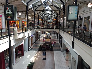
Dulles Town Center is a two-level enclosed shopping mall in Sterling in Loudoun County, Virginia. It is located five miles (8.0 km) north of Washington Dulles International Airport. It is part of the Dulles Town Center census-designated place for population statistical purposes.
Sharpshin Island
Island on the Potomac River in Montgomery County, Maryland, US
Distance: Approx. 2438 meters
Latitude and longitude: 39.06483056,-77.37081944
Sharpshin Island is an island on the Potomac River in Montgomery County, Maryland, near Algonkian Regional Park. It is 5.3 acres (2.1 ha) in area, but is very narrow, measuring only 50 ft (15 m) across at its broadest point. Because of its plentiful shoreline, it provides habitat for waterfowl, molluscs, crustaceans, amphibians, and reptiles.

Loudoun Academy of Science
Magnet school
Distance: Approx. 3266 meters
Latitude and longitude: 39.02594444,-77.374
The Academy of Science (AOS) is a STEM program for high school students enrolled in Loudoun County Public Schools. The program was previously located in Dominion High School. During the summer of 2018, the Academy of Science joined the Monroe Advanced Technical Academy (MATA) and the new Academy of Engineering and Technology (AET) to form the Academies of Loudoun (ACL).

Countryside, Virginia
Census-designated place in Virginia
Distance: Approx. 1895 meters
Latitude and longitude: 39.04777778,-77.41444444
Countryside is a census-designated place in Loudoun County, Virginia, United States. The population as of the 2010 census was 10,072. It is located about 27 miles (43 km) northwest of Washington and is bounded by the Potomac River to the north, and by Route 7 (Leesburg Pike) to the south.
McKee-Beshers Wildlife Management Area
Distance: Approx. 2178 meters
Latitude and longitude: 39.070831,-77.391456
McKee-Beshers Wildlife Management Area is a Wildlife Management Area in Montgomery County, Maryland. It is a large contiguous forest of varied habitat, situated between the Potomac River and the Chesapeake & Ohio Canal to the south, and Seneca Creek State Park to the east. Acres of sunflowers are planted each year at McKee-Beshers WMA to attract game birds.

Cascades, Virginia
Census-designated place in Virginia
Distance: Approx. 876 meters
Latitude and longitude: 39.04833333,-77.38361111
Cascades is a census-designated place (CDP) in Loudoun County, Virginia, United States. The population as of the 2010 United States Census was 11,912. Along with nearby Countryside and Lowes Island, it is considered one of the three main components of the Potomac Falls community (ZIP code 20165) within Sterling, Virginia.
Sugarland Run, Virginia
Census-designated place in Virginia
Distance: Approx. 2170 meters
Latitude and longitude: 39.0375,-77.37527778
Sugarland Run is a planned community and census-designated place in Loudoun County, Virginia, United States. The population at the 2010 census was 11,799. In 2020, it was estimated to be 12,956.

Broad Run Bridge and Tollhouse
United States historic place
Distance: Approx. 3501 meters
Latitude and longitude: 39.04666667,-77.43305556
The Broad Run Bridge and Tollhouse were built for the Leesburg Turnpike Company in Loudoun County, Virginia. The stone bridge, built about 1820, was a permanent replacement for a series of wood bridges at the location, with at least three that had been washed away between 1771 and 1803. The bridge spanned Broad Run on two arches with prominent conical buttresses.
Algonkian Regional Park
Distance: Approx. 1437 meters
Latitude and longitude: 39.05844,-77.37915
Algonkian Regional Park is located on the Potomac River in Sterling, Virginia at Cascades, Virginia. The 838-acre park is owned and operated by the Northern Virginia Regional Park Authority (NOVA Parks) and contains open fields, picnic shelters, rental cottages, an event center for weddings and meetings, a boat launch with access to the Potomac River, the Volcano Island water park open from May to September, and an 18-hole golf course. The park is bisected by the Potomac Heritage Trail.
Weather in this IP's area
broken clouds
1 Celsius
-1 Celsius
-0 Celsius
3 Celsius
1007 hPa
49 %
1007 hPa
994 hPa
10000 meters
1.79 m/s
4.02 m/s
251 degree
80 %
