162.248.78.115 - IP Lookup: Free IP Address Lookup, Postal Code Lookup, IP Location Lookup, IP ASN, Public IP
Country:
Region:
City:
Location:
Time Zone:
Postal Code:
IP information under different IP Channel
ip-api
Country
Region
City
ASN
Time Zone
ISP
Blacklist
Proxy
Latitude
Longitude
Postal
Route
Luminati
Country
Region
zh
ASN
Time Zone
Europe/Amsterdam
ISP
xTom GmbH
Latitude
Longitude
Postal
IPinfo
Country
Region
City
ASN
Time Zone
ISP
Blacklist
Proxy
Latitude
Longitude
Postal
Route
IP2Location
162.248.78.115Country
Region
noord-holland
City
amsterdam
Time Zone
Europe/Amsterdam
ISP
Language
User-Agent
Latitude
Longitude
Postal
db-ip
Country
Region
City
ASN
Time Zone
ISP
Blacklist
Proxy
Latitude
Longitude
Postal
Route
ipdata
Country
Region
City
ASN
Time Zone
ISP
Blacklist
Proxy
Latitude
Longitude
Postal
Route
Popular places and events near this IP address
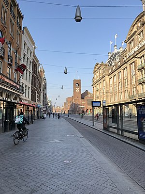
Damrak
Avenue in Amsterdam between Centraal and Dam Square
Distance: Approx. 326 meters
Latitude and longitude: 52.37611111,4.89722222
The Damrak is an avenue and partially filled in canal at the centre of Amsterdam, Netherlands, running between Amsterdam Centraal in the north and Dam Square in the south. It is the main street where people arriving at the station enter the centre of the city. Also, it is one of the two GVB tram routes from the station into the centre, with lines 4, 9, 16, and 25 running down it.

Amsterdam Centraal station
Railway station in the Netherlands
Distance: Approx. 19 meters
Latitude and longitude: 52.37833333,4.9
Amsterdam Centraal station (Dutch: Station Amsterdam Centraal [staːˈɕɔn ˌɑmstərˈdɑm sɛnˈtraːl]; abbreviation: Asd) is the largest railway station in Amsterdam, North Holland, the Netherlands. A major international railway hub, it is used by 192,000 passengers a day, making it the second busiest railway station in the country after Utrecht Centraal and the most visited Rijksmonument of the Netherlands. National and international railway services at Amsterdam Centraal are provided by NS (Nederlandse Spoorwegen), the principal rail operator in the Netherlands.
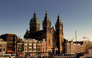
Basilica of Saint Nicholas, Amsterdam
Church in Amsterdam, Netherlands
Distance: Approx. 239 meters
Latitude and longitude: 52.37647222,4.90113889
The Basilica of Saint Nicholas (Dutch: Basiliek van de Heilige Nicolaas) is located in the Old Centre district of Amsterdam, Netherlands, very close to Amsterdam's main railway station. St, Nicholas is the patron saint of both the church and the city of Amsterdam. The basilica is the city's primary Roman Catholic church.
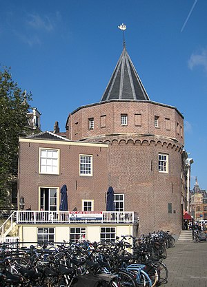
Schreierstoren
Tower in Amsterdam, the Netherlands
Distance: Approx. 276 meters
Latitude and longitude: 52.37644,4.90227
The Schreierstoren (English incorrectly translated as: Weeper's Tower or Tower of Tears), originally part of the medieval city wall of Amsterdam, the Netherlands, was built in the 15th century. It is located at the Prins Hendrikkade 94 in the city center of Amsterdam. It was the location from which Henry Hudson set sail on his journey to Northern America.
Binger Filmlab
Distance: Approx. 358 meters
Latitude and longitude: 52.3775,4.895
Binger Filmlab, formerly the Maurits Binger Film Institute, is an Amsterdam-based international feature-film and documentary development centre where screenwriters, directors, producers and script editors from around the world can be coached and supported by mentors and advisors. Binger opened its doors in 1996 as a post-academic training facility for film professionals. Its venue is situated at Arie Biemondstraat 111 in Amsterdam.
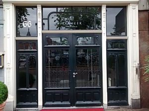
Restaurant Vermeer
Restaurant in Amsterdam, Netherlands
Distance: Approx. 222 meters
Latitude and longitude: 52.37654444,4.90063333
Restaurant Vermeer is a restaurant located in the NH Barbizon Palace hotel at the Prins Hendrikkade in Amsterdam, Netherlands. It is a fine dining restaurant that received its first Michelin star in 1993. It later lost and regained its star, then scored two stars in 2003.
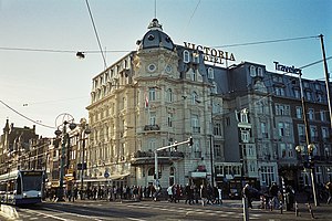
Victoria Hotel, Amsterdam
Hotel in Amsterdam
Distance: Approx. 233 meters
Latitude and longitude: 52.3769,4.8978
The Victoria Hotel is a major hotel in Amsterdam, Netherlands. It is on the corner of the Damrak and Prins Hendrikkade, close to Amsterdam Centraal station. The Victoria Hotel is one of the oldest hotels in The Netherlands.
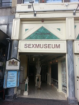
Sexmuseum Amsterdam
Sex museum in Amsterdam, Netherlands
Distance: Approx. 283 meters
Latitude and longitude: 52.3765923,4.8972585
The Sexmuseum or the Temple of Venus (Dutch: Venustempel) is a sex museum located in Amsterdam, Netherlands. The museum was opened in 1985. It had 675,000 visitors in 2015, making it one of the most visited museums in the Netherlands.
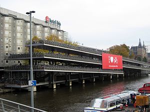
Fietsflat
Free bicycle parking facility in Amsterdam
Distance: Approx. 224 meters
Latitude and longitude: 52.37926,4.896941
The Fietsflat is a 3-storey free-to-use public bicycle parking facility in Amsterdam. It is located on Stationseiland island next to Amsterdam Central Station and can accommodate 2500 bicycles. The name is derived from fiets (bicycle) and flat, an originally English word which the Dutch use to denote multi-level apartment complexes.
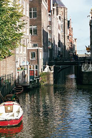
Oudezijds Kolk
Canal in Amsterdam
Distance: Approx. 277 meters
Latitude and longitude: 52.376169,4.901414
The Oudezijds Kolk is a short and narrow canal/lock in Amsterdam between the Oudezijds Voorburgwal and the Oosterdok.
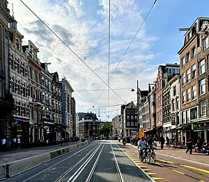
Martelaarsgracht
Canal in Amsterdam
Distance: Approx. 258 meters
Latitude and longitude: 52.377889,4.896344
Martelaarsgracht (Martyr's Canal) is a street and former canal in Amsterdam, the Netherlands.

The Queen's Head (Amsterdam)
Gay bar in Amsterdam
Distance: Approx. 338 meters
Latitude and longitude: 52.3756272,4.8984045
The Queen's Head is a gay bar located at Zeedijk 20 in the centre of Amsterdam. It opened in 1998 and is known for its drag queen bingo evenings.
Weather in this IP's area
light intensity shower rain
6 Celsius
1 Celsius
6 Celsius
6 Celsius
1006 hPa
77 %
1006 hPa
1006 hPa
10000 meters
9.26 m/s
310 degree
40 %