162.246.203.16 - IP Lookup: Free IP Address Lookup, Postal Code Lookup, IP Location Lookup, IP ASN, Public IP
Country:
Region:
City:
Location:
Time Zone:
Postal Code:
IP information under different IP Channel
ip-api
Country
Region
City
ASN
Time Zone
ISP
Blacklist
Proxy
Latitude
Longitude
Postal
Route
Luminati
Country
Region
ca
City
losangeles
ASN
Time Zone
America/Los_Angeles
ISP
Viewqwest Pte Ltd
Latitude
Longitude
Postal
IPinfo
Country
Region
City
ASN
Time Zone
ISP
Blacklist
Proxy
Latitude
Longitude
Postal
Route
IP2Location
162.246.203.16Country
Region
california
City
palo alto
Time Zone
America/Los_Angeles
ISP
Language
User-Agent
Latitude
Longitude
Postal
db-ip
Country
Region
City
ASN
Time Zone
ISP
Blacklist
Proxy
Latitude
Longitude
Postal
Route
ipdata
Country
Region
City
ASN
Time Zone
ISP
Blacklist
Proxy
Latitude
Longitude
Postal
Route
Popular places and events near this IP address

Castilleja School
Private, college-prep school in Palo Alto, California, United States
Distance: Approx. 528 meters
Latitude and longitude: 37.4388,-122.1517
Castilleja School is an independent school for girls in grades six through twelve, located in Palo Alto, California. Castilleja is the only non-sectarian all-girls middle and high school in the San Francisco Bay Area. The faculty consists of approximately 70 full-time and part-time women and men.

HP Garage
United States historic place
Distance: Approx. 444 meters
Latitude and longitude: 37.44307,-122.15481
The HP Garage is a private museum where the company Hewlett-Packard (HP) was founded. It is located at 367 Addison Avenue in Palo Alto, California. It is considered to be the "Birthplace of Silicon Valley".
Professorville
Historic district in Palo Alto, California, United States
Distance: Approx. 427 meters
Latitude and longitude: 37.4416057,-122.1541309
Professorville is a registered historic district in Palo Alto, California containing homes that were built by Stanford University professors. The historic district is bounded by Addison Avenue, Waverley Street, Kingsley Avenue, and Ramona Street. The community considers the district to be larger and bounded by Addison Avenue on the northwest, Cowper Street on the northeast, Embarcadero Road on the southeast, and Emerson Street on the southwest.
Palo Alto Unified School District
Public school district in Palo Alto, California
Distance: Approx. 557 meters
Latitude and longitude: 37.43835,-122.14886
The Palo Alto Unified School District is a public school district located near Stanford University in Palo Alto, California. It consists of twelve primary schools, three middle schools, two high schools, with a third opening Fall of 2024, and an adult school.

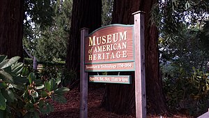
Museum of American Heritage
Palo Alto museum for 1750s-1950s electrical and mechanical technology and inventions
Distance: Approx. 695 meters
Latitude and longitude: 37.444411,-122.157543
The Museum of American Heritage (MOAH) is a museum in Palo Alto, California. It is dedicated to the preservation and display of electrical and mechanical technology and inventions from the 1750s through the 1950s. The museum has a large collection of artifacts that are generally not accessible to the public.

Norris House
Historic house in California, United States
Distance: Approx. 105 meters
Latitude and longitude: 37.4425,-122.14916667
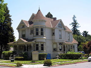
The Norris House is a historic house located at 1247 Cowper St. in Palo Alto, California. The house was built in 1927 for Kathleen Norris, a novelist and columnist who was once the highest-paid female author in the United States, and her husband Charles Gilman Norris, also a noted novelist.
T. B. Downing House
Historic house in California, United States
Distance: Approx. 614 meters
Latitude and longitude: 37.44638889,-122.15555556
The T. B. Downing House is a historic house located at 706 Cowper St. in Palo Alto, California. The Queen Anne style house was built in 1894 for T. B. Downing, who served on Palo Alto's first city council.
Pettigrew House
Historic house in California, United States
Distance: Approx. 230 meters
Latitude and longitude: 37.44152778,-122.14847222
The Pettigrew House is a historic house located at 1336 Cowper St. in Palo Alto, California. Architect George Washington Smith designed the Spanish Colonial Revival house, which was built in 1925.

Palo Alto Junior Museum and Zoo
Distance: Approx. 489 meters
Latitude and longitude: 37.4438,-122.1443
Palo Alto Junior Museum and Zoo is located in Palo Alto, California and part of the City of Palo Alto's Community Services Department (CSD). It was founded in 1934 by Josephine O’Hara in the basement of a local elementary school. The small zoo holds approximately 200 species of mostly indigenous wildlife such as bobcats, raccoons, hedgehogs, ducks, bats, snakes and more.

Theophilus Allen House
Historic house in California, United States
Distance: Approx. 261 meters
Latitude and longitude: 37.44388889,-122.14694444
The Theophilus Allen House is a historic house in Palo Alto, California, U.S.. It was built in 1905 for Theophilus Allen, the founder of the Palo Alto Christian Science Church. It was designed in the American Craftsman style by architect Alfred W. Smith.
Palo Alto Medical Clinic
United States historic place
Distance: Approx. 657 meters
Latitude and longitude: 37.44361111,-122.15722222
Palo Alto Medical Clinic, also known as the Roth Building (structure built in 1932) was a former medical clinic. The building is located at 300 Homer street, at the corner of Bryant street in Palo Alto, California. It is listed on the National Register of Historic Places listings in Santa Clara County, California since 2010.

Woman's Club of Palo Alto
United States historic place
Distance: Approx. 618 meters
Latitude and longitude: 37.44611111,-122.15583333
Woman's Club of Palo Alto (founded 1894, and active to present day) is a civic, cultural, philanthropic and social club, initially founded on June 20, 1894 by 24 women in Palo Alto, California. The building that currently houses the club is historical and built in 1916 in a Tudor-Craftsman style, and is located at 475 Homer Avenue in Palo Alto. The building was listed in the National Register of Historic Places in 2014.
Weather in this IP's area
clear sky
13 Celsius
12 Celsius
11 Celsius
15 Celsius
1022 hPa
77 %
1022 hPa
1007 hPa
10000 meters
3.6 m/s
60 degree


