162.246.161.159 - IP Lookup: Free IP Address Lookup, Postal Code Lookup, IP Location Lookup, IP ASN, Public IP
Country:
Region:
City:
Location:
Time Zone:
Postal Code:
ISP:
ASN:
language:
User-Agent:
Proxy IP:
Blacklist:
IP information under different IP Channel
ip-api
Country
Region
City
ASN
Time Zone
ISP
Blacklist
Proxy
Latitude
Longitude
Postal
Route
db-ip
Country
Region
City
ASN
Time Zone
ISP
Blacklist
Proxy
Latitude
Longitude
Postal
Route
IPinfo
Country
Region
City
ASN
Time Zone
ISP
Blacklist
Proxy
Latitude
Longitude
Postal
Route
IP2Location
162.246.161.159Country
Region
california
City
el segundo
Time Zone
America/Los_Angeles
ISP
Language
User-Agent
Latitude
Longitude
Postal
ipdata
Country
Region
City
ASN
Time Zone
ISP
Blacklist
Proxy
Latitude
Longitude
Postal
Route
Popular places and events near this IP address

El Segundo, California
City in California, United States
Distance: Approx. 106 meters
Latitude and longitude: 33.92138889,-118.40611111
El Segundo ( EL sə-GUN-doh, Spanish: [el seˈɣundo]; Spanish for 'The Second') is a city in Los Angeles County, California, United States. Located on Santa Monica Bay, it was incorporated on January 18, 1917, and is part of the South Bay Cities Council of Governments. The population was 16,731 as of the 2020 census, a 0.5% increase from 16,654 in the 2010 census.
Boeing Satellite Development Center
Satellite manufacturing division of Boeing
Distance: Approx. 1518 meters
Latitude and longitude: 33.9296521,-118.3917403
The Boeing Satellite Development Center is a major business unit of Boeing Defense, Space & Security. It brought together Boeing satellite operations with that of GM Hughes Electronics' Space and Communications division in El Segundo, California.

JetBlue Flight 292
2005 aviation incident in the US
Distance: Approx. 1699 meters
Latitude and longitude: 33.93583333,-118.39722222
JetBlue Flight 292 was a scheduled flight from Bob Hope Airport in Burbank, California, to John F. Kennedy International Airport in New York City. On September 21, 2005, Captain Scott Burke executed an emergency landing in the Airbus A320-232 at Los Angeles International Airport after the nose gear jammed in an abnormal position. No one was injured.

Toyota Sports Performance Center
Distance: Approx. 1612 meters
Latitude and longitude: 33.92166667,-118.38805556
The Toyota Sports Performance Center is a practice facility for the Los Angeles Kings, and the Ontario Reign, located on 555 North Nash Street in El Segundo, California. The $24 million, 135,000 square feet (12,500 m2) facility broke ground on April 28, 1999, and officially opened on March 5, 2000. The facility is located on the grounds of the Grand Avenue Corporate Center.
Maddux Air Lines
Distance: Approx. 2177 meters
Latitude and longitude: 33.94158333,-118.40861111
Maddux Air Lines was an airline based in Southern California that operated Ford Tri-motors in California, Arizona, and Mexico in the late 1920s.
Mariposa station (Los Angeles Metro)
Light rail station in El Segundo, California
Distance: Approx. 1669 meters
Latitude and longitude: 33.9235,-118.3875
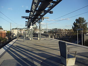
Mariposa station is an elevated light rail station on the K Line of the Los Angeles Metro Rail system. It is located over Mariposa Avenue, after which the station is named, alongside Nash Street in El Segundo, California. It opened with the commencement of Green Line service on August 12, 1995.
El Segundo station
Light rail station in El Segundo, California
Distance: Approx. 1843 meters
Latitude and longitude: 33.916,-118.387
El Segundo station is an elevated light rail station on the K Line of the Los Angeles Metro Rail system. It is located over El Segundo Boulevard, after which the station is named, near its intersection with Nash Street in El Segundo, California. It opened with the commencement of Green Line service on August 12, 1995.

El Segundo High School
Public high school in the United States
Distance: Approx. 845 meters
Latitude and longitude: 33.925,-118.414
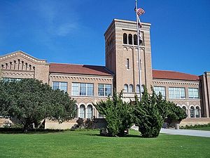
El Segundo High School, or ESHS, is a four-year public high school located in El Segundo, California. It is the only secondary school incorporated by El Segundo Unified School District. First built in 1927, the school campus contains 5 main buildings built from a brick facade.

Recreation Park (El Segundo)
Park in El Segundo, California, United States
Distance: Approx. 649 meters
Latitude and longitude: 33.9211,-118.4124
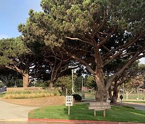
Recreation Park. is a public, urban park in El Segundo, California, a suburb of Los Angeles. Located adjacent to Downtown El Segundo, Recreation Park is bordered by Pine Street on the North, Eucalyptus Drive on the West, and houses on the South and East.
UCLA Health Training Center
Indoor arena and basketball facility in El Segundo, California, United States
Distance: Approx. 2012 meters
Latitude and longitude: 33.9237,-118.383789
UCLA Health Training Center is an indoor arena and basketball practice facility located in El Segundo, California. It hosts the South Bay Lakers of the NBA G League. The facility also serves as the training center for the Los Angeles Lakers of the National Basketball Association (NBA).

Automobile Driving Museum
Automotive museum in El Segundo, California
Distance: Approx. 1266 meters
Latitude and longitude: 33.924643,-118.392109
The Automobile Driving Museum is an automotive museum located at 610 Lairport Street, El Segundo, California, USA. The museum is nonprofit 501(c)(3) organization, founded in 2002 (2002) by car collectors Stanley Zimmerman and architect Earl Rubenstein. Its mission is to "collect, preserve, exhibit and ride in historic vehicles." It contains about 130 classic, antique, and vintage automobiles created between 1886 and 2000, of which roughly half are on display at any time. Visitors are permitted to touch and sit in most cars, and on Sunday Car Rides, experience driving around in classic vehicles.

Scattergood Generating Station
Power station in Los Angeles
Distance: Approx. 2096 meters
Latitude and longitude: 33.91861111,-118.42777778
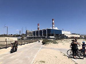
Scattergood Generating Station is an electricity-generating facility in the Playa Del Rey area of Los Angeles, California, in proximity to El Segundo and LAX. Scattergood has an 830 MW capacity spread across three steam turbine units. Owned and operated by the Los Angeles Department of Water and Power (LADWP), the station is a coastal landmark of the Santa Monica Bay in southern California. Plans are in place to convert the station to hydrogen power.
Weather in this IP's area
clear sky
11 Celsius
9 Celsius
11 Celsius
14 Celsius
1024 hPa
35 %
1024 hPa
1020 hPa
10000 meters
1.34 m/s
2.68 m/s
74 degree

