162.221.219.159 - IP Lookup: Free IP Address Lookup, Postal Code Lookup, IP Location Lookup, IP ASN, Public IP
Country:
Region:
City:
Location:
Time Zone:
Postal Code:
IP information under different IP Channel
ip-api
Country
Region
City
ASN
Time Zone
ISP
Blacklist
Proxy
Latitude
Longitude
Postal
Route
Luminati
Country
Region
ky
City
versailles
ASN
Time Zone
America/New_York
ISP
AS-CMN
Latitude
Longitude
Postal
IPinfo
Country
Region
City
ASN
Time Zone
ISP
Blacklist
Proxy
Latitude
Longitude
Postal
Route
IP2Location
162.221.219.159Country
Region
kentucky
City
versailles
Time Zone
America/New_York
ISP
Language
User-Agent
Latitude
Longitude
Postal
db-ip
Country
Region
City
ASN
Time Zone
ISP
Blacklist
Proxy
Latitude
Longitude
Postal
Route
ipdata
Country
Region
City
ASN
Time Zone
ISP
Blacklist
Proxy
Latitude
Longitude
Postal
Route
Popular places and events near this IP address

Woodford County, Kentucky
County in Kentucky, United States
Distance: Approx. 1659 meters
Latitude and longitude: 38.04,-84.74
Woodford County is a county located in the U.S. state of Kentucky. As of the 2020 census, the population was 26,871. Its county seat is Versailles.

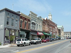
Versailles, Kentucky
City in Kentucky, United States
Distance: Approx. 569 meters
Latitude and longitude: 38.04861111,-84.72583333
Versailles is a home rule-class city in Woodford County, Kentucky, United States. It lies 13 miles (21 kilometers) by road west of Lexington and is part of the Lexington-Fayette Metropolitan Statistical Area. Versailles has a population of 10,534 according to 2024 census estimates.
Bluegrass Railroad and Museum
Distance: Approx. 2545 meters
Latitude and longitude: 38.04709444,-84.758075
The Bluegrass Railroad and Museum is a railroad museum and heritage railroad in Versailles, Kentucky, United States. Operating out of the Woodford County Park, the Railroad offers 11-mile round trip excursions through the horse farms of Kentucky to Tyrone, Kentucky where the train stops at Young's High Bridge and allows passengers to disembark and view Young's High Bridge and the Kentucky River valley area. The railroad uses diesel locomotives, of which it has four operational and two for static display.
Woodford County High School (Kentucky)
Public school in Versailles, Kentucky, United States
Distance: Approx. 1090 meters
Latitude and longitude: 38.06222222,-84.73222222
Woodford County High School is a public high school located in Versailles, Kentucky. Since 1963, it has been the only public high school in Woodford County, serving grades 9–12.
Lane's End Farm
Thoroughbred horse breeding farm in Versailles, Kentucky
Distance: Approx. 5100 meters
Latitude and longitude: 38.09694444,-84.71527778
Lane's End Farm is a Thoroughbred horse breeding farm in Versailles, Kentucky established in 1979. The original land was part of Bosque Bonita Farm and was originally owned by Abraham Buford, a Confederate Army general. The land was later bought by horseman John H. Morris.

Cleveland House
Historic house in Kentucky, United States
Distance: Approx. 180 meters
Latitude and longitude: 38.0525,-84.73194444
The Cleveland House is located in Versailles, Kentucky. Originally the Cleveland Orphan Home, it was an orphanage that incorporated in 1869, remaining in operation until the 1950s. The original 1875 house was made of brick in classic revival style architecture.
Big Poplar Tree, Kentucky
Unincorporated community in Kentucky, United States
Distance: Approx. 2643 meters
Latitude and longitude: 38.07416667,-84.7425
Big Poplar Tree is an unincorporated community located in Woodford County, Kentucky, United States.

Pisgah, Kentucky
Unincorporated community in Woodford County, Kentucky, US
Distance: Approx. 6581 meters
Latitude and longitude: 38.05666667,-84.655
Pisgah is an unincorporated community in Woodford County, in the U.S. state of Kentucky.

Belle Reve Farm
Horse farm in Kentucky owned by William Shatner.
Distance: Approx. 4867 meters
Latitude and longitude: 38.0451,-84.6752
Belle Reve Farm is a horse farm located in Versailles, Kentucky that was owned by actor William Shatner, a breeder of American Saddlebred show horses. His stallion Sultan's Great Day was a two-time world's champion performer, and the farm's premier breeding stallion until his death in 2004. Great Day sired 95 foals that have won 342 ribbons at the World's Championship Horse Show in Louisville, KY. Great Day was named Saddle Horse Report’s leading sire of world's champions in 1994 and 1996, and was a Top 10 sire throughout his career.

Big Spring Church
United States historic place
Distance: Approx. 1143 meters
Latitude and longitude: 38.0425,-84.73222222
The Big Spring Church, located at 121 Rose Hill St. in Versailles in Woodford County, Kentucky, USA, was built in 1819. It was listed on the National Register of Historic Places in 1975.
Airy Mount
United States historic place
Distance: Approx. 4891 meters
Latitude and longitude: 38.02699,-84.77523
Airy Mount, near Versailles, Kentucky, is a historic Georgian house dating from 1796. It was listed on the National Register of Historic Places in 1978. It is notable for its mural painted by French immigrant "Alfred Cohen, who left Marseilles, France, with two brothers in the 1820s and settled in Midway, in the northeast corner of Woodford County.

Carter House (Versailles, Kentucky)
United States historic place
Distance: Approx. 135 meters
Latitude and longitude: 38.05138889,-84.73
The Carter House, at 110 Morgan St. in Versailles, Kentucky, was built in 1792. It was listed on the National Register of Historic Places in 1975.
Weather in this IP's area
mist
1 Celsius
-4 Celsius
0 Celsius
1 Celsius
1023 hPa
93 %
1023 hPa
990 hPa
1609 meters
4.12 m/s
290 degree
100 %