Country:
Region:
City:
Latitude and Longitude:
Time Zone:
Postal Code:
IP information under different IP Channel
ip-api
Country
Region
City
ASN
Time Zone
ISP
Blacklist
Proxy
Latitude
Longitude
Postal
Route
Luminati
Country
Region
id
City
ammon
ASN
Time Zone
America/Boise
ISP
SUMOFIBER-IDAHO
Latitude
Longitude
Postal
IPinfo
Country
Region
City
ASN
Time Zone
ISP
Blacklist
Proxy
Latitude
Longitude
Postal
Route
db-ip
Country
Region
City
ASN
Time Zone
ISP
Blacklist
Proxy
Latitude
Longitude
Postal
Route
ipdata
Country
Region
City
ASN
Time Zone
ISP
Blacklist
Proxy
Latitude
Longitude
Postal
Route
Popular places and events near this IP address

Ammon, Idaho
City in Idaho, United States
Distance: Approx. 395 meters
Latitude and longitude: 43.47638889,-111.96805556
Ammon is a suburb city in Bonneville County, Idaho, United States. As of the 2010 US Census, the population of Ammon was 13,816. By the 2020 census, Ammon's population had grown to 17,694.
College of Eastern Idaho
Community college in Idaho Falls, Idaho, U.S.
Distance: Approx. 1415 meters
Latitude and longitude: 43.48547,-111.98647
College of Eastern Idaho (CEI) is a public community college in Idaho Falls, Idaho. It was founded in 1969 as Eastern Idaho Vocational Technical School and later became a technical college called Eastern Idaho Technical College. In May 2017, Bonneville County residents voted to create a community college district, allowing Eastern Idaho Technical College to become a community college.
Hillcrest High School (Idaho)
Public school in Ammon, Idaho, United States
Distance: Approx. 826 meters
Latitude and longitude: 43.471,-111.977
Hillcrest High School is a four-year public high school in Ammon, Idaho, east of Idaho Falls. Opened in 1992, it was the second high school in the Bonneville School District. The school mascot is the Knight and the colors are red, black, and white.

Idaho Falls High School
Public school in Idaho Falls, Idaho, United States
Distance: Approx. 4391 meters
Latitude and longitude: 43.4925,-112.023
Idaho Falls High School (IFHS) is a four-year public secondary school in central Idaho Falls, Idaho, USA. The current building opened in 1952, though the school itself has been in operation since 1897. Idaho Falls is the older of the two traditional high schools, the other is Skyline, in the Idaho Falls School District#91. The school colors are orange and black and its teams are the Tigers; the mascot is known as Tigger.
Bonneville High School (Idaho Falls, Idaho)
Public school in Bonneville County, Idaho, United States
Distance: Approx. 5378 meters
Latitude and longitude: 43.526,-111.971
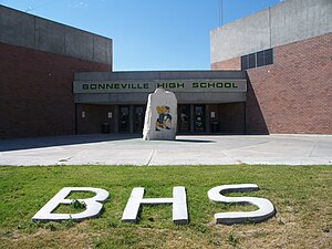
Bonneville High School is a four-year public secondary school near Idaho Falls, Idaho. Northeast of the city, it opened in 1951 and is the original high school of the Bonneville Joint School District #93, which consolidated ten smaller districts east of Idaho Falls. The original building for high school was turned into a junior high in 1977 when the current Bonneville High School was built.
KNBL
Radio station in Idaho, United States
Distance: Approx. 5075 meters
Latitude and longitude: 43.52074722,-111.99330278
KNBL (1260 AM) is a radio station broadcasting a variety hits format. Licensed to Idaho Falls, Idaho, United States, the station serves the Idaho Falls–Pocatello area.
Lincoln, Idaho
Distance: Approx. 3990 meters
Latitude and longitude: 43.51305556,-111.96444444
Lincoln is a census-designated place in Bonneville County, Idaho located just east of Idaho Falls, southwest of Iona and north of Ammon. As of the 2010 census, its population was 3,647. Lincoln has an area of 1.465 square miles (3.79 km2), all of it land.

Holy Rosary Church (Idaho Falls, Idaho)
Historic church in Idaho, United States
Distance: Approx. 4748 meters
Latitude and longitude: 43.48958333,-112.02905556
The Holy Rosary Church on E. Ninth St. in Idaho Falls, Idaho was built in 1948. It was listed on the National Register of Historic Places in 2002.

First Presbyterian Church (Idaho Falls, Idaho)
Historic Presbyterian church in Idaho Falls, Idaho, US
Distance: Approx. 5207 meters
Latitude and longitude: 43.48944444,-112.035
First Presbyterian Church is a historic Presbyterian church at 325 Elm Street in Idaho Falls, Idaho. It was built during 1918 to 1920 and was added to the National Register in 1978. It was deemed architecturally significant as "a good example of the Neo-classical revival style"; its "dome and Ionic portico are impressive by Idaho's standards." It is the only building in Idaho designed by Uniontown, Pennsylvania ecclesiastic architect J. C. Fulton.

Trinity Methodist Church (Idaho Falls, Idaho)
Historic church in Idaho, United States
Distance: Approx. 5382 meters
Latitude and longitude: 43.49027778,-112.03694444
Trinity Methodist Church is a historic church at 237 N. Water Avenue in Idaho Falls, Idaho. It was built during 1916 to 1917 and was added to the National Register in 1977. It is a "massive rusticated stone structure in the Tudor-Gothic style." It was built of stone quarried north of Heise.

Grand Teton Mall
Shopping mall in Idaho Falls, Idaho
Distance: Approx. 1274 meters
Latitude and longitude: 43.4798,-111.9881
The Grand Teton Mall is a shopping mall located in Idaho Falls, Idaho, that opened in 1984. The anchor tenants are Alturas Preparatory Academy, Dick's Sporting Goods, Dillard's, and JCPenney.

Idaho Falls Public Library
United States historic place
Distance: Approx. 5404 meters
Latitude and longitude: 43.49027778,-112.03722222
The Idaho Falls Public Library, at Elm and Eastern Streets in Idaho Falls, Idaho, was built in 1916 as a Carnegie library and was expanded later. The library operated here until 1977 when it moved a few blocks away. The historic building was listed on the National Register of Historic Places in 1984.
Weather in this IP's area
overcast clouds
3 Celsius
-1 Celsius
3 Celsius
3 Celsius
1000 hPa
70 %
1000 hPa
841 hPa
10000 meters
5.14 m/s
150 degree
100 %
07:22:23
17:03:03
