162.220.152.71 - IP Lookup: Free IP Address Lookup, Postal Code Lookup, IP Location Lookup, IP ASN, Public IP
Country:
Region:
City:
Location:
Time Zone:
Postal Code:
IP information under different IP Channel
ip-api
Country
Region
City
ASN
Time Zone
ISP
Blacklist
Proxy
Latitude
Longitude
Postal
Route
Luminati
Country
Region
il
City
pawpaw
ASN
Time Zone
America/Chicago
ISP
SN-2006
Latitude
Longitude
Postal
IPinfo
Country
Region
City
ASN
Time Zone
ISP
Blacklist
Proxy
Latitude
Longitude
Postal
Route
IP2Location
162.220.152.71Country
Region
illinois
City
amboy
Time Zone
America/Chicago
ISP
Language
User-Agent
Latitude
Longitude
Postal
db-ip
Country
Region
City
ASN
Time Zone
ISP
Blacklist
Proxy
Latitude
Longitude
Postal
Route
ipdata
Country
Region
City
ASN
Time Zone
ISP
Blacklist
Proxy
Latitude
Longitude
Postal
Route
Popular places and events near this IP address

Lee County, Illinois
County in Illinois, United States
Distance: Approx. 4644 meters
Latitude and longitude: 41.75,-89.3
Lee County is a county located in the U.S. state of Illinois. According to the 2020 census, it has a population of 34,145. Its county seat is Dixon.

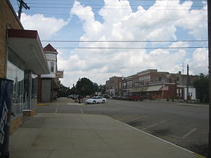
Amboy, Illinois
City in Illinois, United States
Distance: Approx. 340 meters
Latitude and longitude: 41.71444444,-89.33277778
Amboy is a city in Lee County, Illinois, United States, along the Green River. The population was 2,500 at the 2010 census. The chain of Carson Pirie Scott & Co.
Green River Ordnance Plant
Distance: Approx. 5649 meters
Latitude and longitude: 41.7333333,-89.3916667
The Green River Ordnance Plant, also known as the Green River Arsenal, was a large munitions factory complex between Dixon and Amboy in Lee County, Illinois.
Woodhaven Lakes
Distance: Approx. 7384 meters
Latitude and longitude: 41.658387,-89.280695
Woodhaven Lakes is a privately owned camping resort, located in Sublette, Illinois in the United States. Established in 1971 as a gated, members-only campground, Woodhaven Lakes comprises 1,756 acres (7.11 km2) of woodlands, seven man-made lakes, and over 15 miles (24 km) of hiking trails.

Northern Illinois
Region in the U.S. state of Illinois
Distance: Approx. 7657 meters
Latitude and longitude: 41.75,-89.25
Northern Illinois is a region generally covering the northern third of the U.S. state of Illinois. The region is by far the most populous of Illinois, with nearly 9.7 million residents as of 2010.

Amboy Township, Lee County, Illinois
Township in Illinois, United States
Distance: Approx. 1130 meters
Latitude and longitude: 41.71527778,-89.34222222
Amboy Township is one of twenty-two townships in Lee County, Illinois, USA. As of the 2010 census, its population was 3,108 and it contained 1,360 housing units.

Lee Center Township, Lee County, Illinois
Township in Illinois, United States
Distance: Approx. 7952 meters
Latitude and longitude: 41.70833333,-89.23333333
Lee Center Township is located in Lee County, Illinois. As of the 2010 census, its population was 593 and it contained 269 housing units.

May Township, Lee County, Illinois
Township in Illinois, United States
Distance: Approx. 7858 meters
Latitude and longitude: 41.64363,-89.326344
May Township is located in Lee County, Illinois. As of the 2010 census, its population was 304 and it contained 141 housing units. May Township was formed from Hamilton Township in September, 1854.

Amboy station
United States historic place
Distance: Approx. 293 meters
Latitude and longitude: 41.71416667,-89.33222222
Amboy station is a former rail station in the city of Amboy, Lee County, Illinois, United States. The building was constructed as a headquarters building for the Illinois Central Railroad as well as a public train station for the fledgling city of Amboy in 1876. It was designed by railroad staff architect James Nocquet after a fire destroyed the original Illinois Central offices on the site.
Binghampton, Illinois
Unincorporated community in Illinois, United States
Distance: Approx. 2080 meters
Latitude and longitude: 41.71666667,-89.30388889
Binghampton is an unincorporated community in Lee County, Illinois, United States.
Lee Center, Illinois
Unincorporated community in Illinois, United States
Distance: Approx. 5573 meters
Latitude and longitude: 41.7475,-89.27861111
Lee Center is an unincorporated community in Lee County, Illinois, United States, located 13 miles (21 km) southeast of Dixon. Lee Center has a post office with ZIP code 61331. It used to have its own little railroad, the Lee County Central Electric Railway.
Amboy High School
Comprehensive public high school in Amboy, Lee County, Illinois, USA
Distance: Approx. 749 meters
Latitude and longitude: 41.7199,-89.3335
Amboy High School is a public four-year high school located at 11 East Hawley Avenue in Amboy, Illinois, a small city of Lee County, Illinois, in the Midwestern United States. It is part of Amboy Community Unit School District 272, which serves the communities of Amboy, Sublette, Harmon, and Eldena, and includes Amboy Junior High School, and Amboy Central Elementary School. The campus is 12 miles southeast of Dixon, Illinois and serves a mixed small city, village, and rural residential community.
Weather in this IP's area
scattered clouds
-4 Celsius
-7 Celsius
-5 Celsius
-4 Celsius
1010 hPa
65 %
1010 hPa
980 hPa
10000 meters
1.79 m/s
2.68 m/s
262 degree
39 %