162.219.1.78 - IP Lookup: Free IP Address Lookup, Postal Code Lookup, IP Location Lookup, IP ASN, Public IP
Country:
Region:
City:
Location:
Time Zone:
Postal Code:
ISP:
ASN:
language:
User-Agent:
Proxy IP:
Blacklist:
IP information under different IP Channel
ip-api
Country
Region
City
ASN
Time Zone
ISP
Blacklist
Proxy
Latitude
Longitude
Postal
Route
db-ip
Country
Region
City
ASN
Time Zone
ISP
Blacklist
Proxy
Latitude
Longitude
Postal
Route
IPinfo
Country
Region
City
ASN
Time Zone
ISP
Blacklist
Proxy
Latitude
Longitude
Postal
Route
IP2Location
162.219.1.78Country
Region
ontario
City
waterloo
Time Zone
America/Toronto
ISP
Language
User-Agent
Latitude
Longitude
Postal
ipdata
Country
Region
City
ASN
Time Zone
ISP
Blacklist
Proxy
Latitude
Longitude
Postal
Route
Popular places and events near this IP address
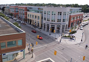
Waterloo, Ontario
City in Ontario, Canada
Distance: Approx. 604 meters
Latitude and longitude: 43.46666667,-80.51666667
Waterloo is a city in the Canadian province of Ontario. It is one of three cities in the Regional Municipality of Waterloo (formerly Waterloo County). Waterloo is situated about 94 km (58 mi) west-southwest of Toronto, but it is not considered to be part of the Greater Toronto Area (GTA).
Kitchener-Waterloo Collegiate and Vocational School
Secondary school in Kitchener, Ontario, Canada
Distance: Approx. 778 meters
Latitude and longitude: 43.4558,-80.50861944
Kitchener-Waterloo Collegiate and Vocational School, commonly called Kitchener Collegiate Institute or KCI, is a public secondary school in Kitchener, Ontario, Canada. It is a member of the Waterloo Region District School Board. The school dates from 1855, making it one of the oldest high schools in Kitchener and Waterloo.
Grand River Hospital
Hospital in Ontario, Canada
Distance: Approx. 597 meters
Latitude and longitude: 43.4564,-80.5122
Grand River Hospital is a hospital located in Kitchener, Ontario, Canada. The hospital operates two campuses, Kitchener-Waterloo Health Centre and Freeport Health Centre, which were independent hospitals that merged to form Grand River Hospital in April 1995. The hospital has over 650 beds and 15 specialized programs and services: surgery, children's program, childbirth, medical imaging, mental health and addictions, withdrawal management, medicine, stroke, complex continuing care, rehabilitation, cancer, critical care, renal, emergency, pharmacy and lab.

Elizabeth Ziegler Public School
Primary school in Waterloo, Ontario, Canada
Distance: Approx. 377 meters
Latitude and longitude: 43.464618,-80.511884
Elizabeth Ziegler Public School is an elementary school located in Waterloo, Ontario, at 90 Moore Avenue South, roughly one kilometre east of Waterloo's city centre. As of 2009, the school serves junior kindergarten through grade 6. Its principal is currently Ms.

CIGI Campus
Hub of academic study and research
Distance: Approx. 960 meters
Latitude and longitude: 43.46361111,-80.52555556
The CIGI Campus, located in Waterloo, Ontario, is a hub of academic study and policy-based research in global governance and international affairs. Currently, the campus contains its namesake Centre for International Governance Innovation (CIGI), a global think tank previously housed in the former Seagram Museum, and the Balsillie School of International Affairs (BSIA).

Balsillie School of International Affairs
International affairs school in Waterloo, Canada
Distance: Approx. 946 meters
Latitude and longitude: 43.46388889,-80.52527778
The Balsillie School of International Affairs (BSIA) is a centre for advanced research and teaching on global governance and international public policy, located in Waterloo, Ontario. As one of the largest social sciences initiatives in Canada, the school is a collaborative partnership between the University of Waterloo, Wilfrid Laurier University, and the Centre for International Governance Innovation. The BSIA is an affiliate member of the Association of Professional Schools of International Affairs, a group of schools that educate leaders in international affairs.

Huether Hotel
Historic building in Waterloo, Ontario
Distance: Approx. 952 meters
Latitude and longitude: 43.46694,-80.5232
The Huether Hotel (also known as Ewald House from 1911–1934 and Hotel Kent from 1934–1980s) is a historic building in Waterloo, Ontario, Canada. Originally built in 1855, renovations beginning in the 1870s established the building in the High Victorian style. Starting as a hotel and home for the Lion Brewery, the building today houses a café, restaurant and pub with the brewery now located next door.

Willis Way station
Light rail station in Waterloo, Ontario
Distance: Approx. 775 meters
Latitude and longitude: 43.46228,-80.52354
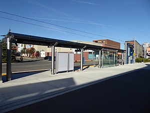
Willis Way is a stop on the Region of Waterloo's Ion rapid transit system. It is located on Caroline Street in Waterloo, at Willis Way. It opened in 2019.

Waterloo Public Square station
Light rail station in Waterloo, Ontario
Distance: Approx. 772 meters
Latitude and longitude: 43.46414,-80.52289
Waterloo Public Square is a stop on the Region of Waterloo's Ion rapid transit system. It is located on the Waterloo Spur rail line in Waterloo, between Willis Way and Erb Street at King Street, and at the north end of its namesake, the Waterloo Public Square. It opened in 2019.

Allen station (Waterloo)
Light rail station in Waterloo, Ontario
Distance: Approx. 425 meters
Latitude and longitude: 43.46015,-80.51886
Allen is a stop on the Region of Waterloo's Ion rapid transit system. It is located in the median of King Street in Waterloo, between Allen and John Streets. It opened in 2019.

Grand River Hospital station
Light rail station in Kitchener, Ontario
Distance: Approx. 501 meters
Latitude and longitude: 43.4573,-80.51217
Grand River Hospital is a stop on the Region of Waterloo's Ion rapid transit system. It is located in the median of King Street in Kitchener, between Pine and Mount Hope Streets, just north of its namesake, the KW Site of Grand River Hospital. It opened in 2019.
Erb-Kumpf House
Historic building in Waterloo, Ontario
Distance: Approx. 461 meters
Latitude and longitude: 43.46101,-80.51965
The Erb-Kumpf House (also known as the Kumpf House and the Abraham Erb House) is a two-storey house located on 172 King Street South in Waterloo, Ontario, Canada. The oldest portion of the house was constructed circa 1812 by Abraham Erb, the founder of Waterloo, likely making it the oldest home or one of the oldest homes in the city. In 1979, the Erb-Kumpf House was designated as a heritage home under the Ontario Heritage Act by the City of Waterloo.
Weather in this IP's area
broken clouds
-10 Celsius
-16 Celsius
-10 Celsius
-10 Celsius
1022 hPa
91 %
1022 hPa
978 hPa
10000 meters
3.13 m/s
3.58 m/s
270 degree
55 %


