162.218.42.212 - IP Lookup: Free IP Address Lookup, Postal Code Lookup, IP Location Lookup, IP ASN, Public IP
Country:
Region:
City:
Location:
Time Zone:
Postal Code:
ISP:
ASN:
language:
User-Agent:
Proxy IP:
Blacklist:
IP information under different IP Channel
ip-api
Country
Region
City
ASN
Time Zone
ISP
Blacklist
Proxy
Latitude
Longitude
Postal
Route
db-ip
Country
Region
City
ASN
Time Zone
ISP
Blacklist
Proxy
Latitude
Longitude
Postal
Route
IPinfo
Country
Region
City
ASN
Time Zone
ISP
Blacklist
Proxy
Latitude
Longitude
Postal
Route
IP2Location
162.218.42.212Country
Region
minnesota
City
milan
Time Zone
America/Chicago
ISP
Language
User-Agent
Latitude
Longitude
Postal
ipdata
Country
Region
City
ASN
Time Zone
ISP
Blacklist
Proxy
Latitude
Longitude
Postal
Route
Popular places and events near this IP address
Big Bend Township, Chippewa County, Minnesota
Township in Minnesota, United States
Distance: Approx. 9996 meters
Latitude and longitude: 45.12305556,-95.78722222
Big Bend Township is a township in Chippewa County, Minnesota, United States. The population was 257 at the 2000 census.
Kragero Township, Chippewa County, Minnesota
Township in Minnesota, United States
Distance: Approx. 1363 meters
Latitude and longitude: 45.09861111,-95.90638889
Kragero Township is a township in Chippewa County, Minnesota, United States. The population was 164 at the 2000 census.
Milan, Minnesota
City in Minnesota, United States
Distance: Approx. 340 meters
Latitude and longitude: 45.11277778,-95.91166667
Milan ( MY-lən) is a city in northwest Chippewa County, Minnesota, United States. The population was 428 at the 2020 census.
Edison Township, Swift County, Minnesota
Township in Minnesota, United States
Distance: Approx. 9786 meters
Latitude and longitude: 45.19777778,-95.91
Edison Township is a township in Swift County, Minnesota, United States. The population was 131 at the 2000 census.

Lac qui Parle River
River in Minnesota, United States
Distance: Approx. 9648 meters
Latitude and longitude: 45.02638889,-95.88027778
The Lac qui Parle River is a tributary of the Minnesota River, 118 miles (190 km) long, in southwestern Minnesota in the United States. A number of tributaries of the river, including its largest, the West Branch Lac qui Parle River, also flow in eastern South Dakota. Via the Minnesota River, the Lac qui Parle River is part of the watershed of the Mississippi River, draining an area of 1,156 square miles (2,990 km2) in an agricultural region.

Lac qui Parle
Reservoir in Lac qui Parle County and Swift County, Minnesota United States
Distance: Approx. 5627 meters
Latitude and longitude: 45.1,-95.98333333
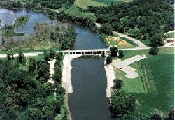
Lac qui Parle is a lake located in western Minnesota, United States, which was widened by the damming of the Minnesota River. The dam was built by the Works Progress Administration (WPA) in 1939. It was reconstructed in 1996.
Davis County, Minnesota
Distance: Approx. 9278 meters
Latitude and longitude: 45.15,-96.01666667
Davis County was a county in Minnesota, created in 1855 from Cass, Nicollet, Pierce and Sibley counties. In 1862 the county was disbanded and what was left was merged into Chippewa and Lac qui Parle Counties. Davis County was attached to Stearns and Lac qui Parle Counties for county and or judicial purposes.
Fort Renville
Historic fur-trading post
Distance: Approx. 9051 meters
Latitude and longitude: 45.03236111,-95.87847222
Fort Renville, originally called Fort Adam, was a fur-trading post established by Joseph Renville and built in 1826. The fort was used as a trading post for the Columbia Fur Company, which was later purchased by the American Fur Company. The American Fur Company continued to use the post until 1846, when it moved to another site.

Arv Hus Museum
Museum in Milan, Minnesota
Distance: Approx. 200 meters
Latitude and longitude: 45.111389,-95.911667
The Arv Hus Museum is a cultural heritage center located in Milan, Minnesota. Established in 1984, the museum's name translates from Norwegian to "Heritage House." The Arv Hus Museum showcases the artistic traditions brought by Norwegian immigrants and local history of the region, with a particular focus on Norwegian Rosemaling, a decorative painting technique. The museum was established in 1984 by Billy Thompson who started the museum in a building that was once a harness shop run by Thompson's great-grandfather.
Weather in this IP's area
overcast clouds
-5 Celsius
-12 Celsius
-5 Celsius
-5 Celsius
1010 hPa
71 %
1010 hPa
970 hPa
10000 meters
11.84 m/s
16.65 m/s
330 degree
94 %

