162.217.187.151 - IP Lookup: Free IP Address Lookup, Postal Code Lookup, IP Location Lookup, IP ASN, Public IP
Country:
Region:
City:
Location:
Time Zone:
Postal Code:
IP information under different IP Channel
ip-api
Country
Region
City
ASN
Time Zone
ISP
Blacklist
Proxy
Latitude
Longitude
Postal
Route
Luminati
Country
Region
il
City
chicago
ASN
Time Zone
America/Chicago
ISP
COOK-COUNTY
Latitude
Longitude
Postal
IPinfo
Country
Region
City
ASN
Time Zone
ISP
Blacklist
Proxy
Latitude
Longitude
Postal
Route
IP2Location
162.217.187.151Country
Region
illinois
City
oak lawn
Time Zone
America/Chicago
ISP
Language
User-Agent
Latitude
Longitude
Postal
db-ip
Country
Region
City
ASN
Time Zone
ISP
Blacklist
Proxy
Latitude
Longitude
Postal
Route
ipdata
Country
Region
City
ASN
Time Zone
ISP
Blacklist
Proxy
Latitude
Longitude
Postal
Route
Popular places and events near this IP address

Chicago Ridge, Illinois
Village in Illinois, United States
Distance: Approx. 1944 meters
Latitude and longitude: 41.7025,-87.77861111
Chicago Ridge is a village in Cook County, Illinois, United States. Per the 2020 census, the population was 14,433. It is a suburb of Chicago.

Oak Lawn, Illinois
Village in Illinois, United States
Distance: Approx. 604 meters
Latitude and longitude: 41.715,-87.75333333
Oak Lawn is a village in Cook County, Illinois, United States. The population was 58,362 at the 2020 census. Oak Lawn is a suburb of Chicago, located southwest of the city.

Chicago Ridge Mall
Shopping mall in Illinois, United States
Distance: Approx. 2066 meters
Latitude and longitude: 41.716,-87.782
Chicago Ridge Mall, formerly Westfield Chicago Ridge from 2004 to 2012, is a shopping mall in Chicago Ridge, Illinois. The mall features Kohl's, Dick's Sporting Goods, and Burlington as its anchor stores. The mall also has four junior anchors: Aldi, Old Navy, Michaels, and AMC Theatres.

Worth Township, Cook County, Illinois
Township in Illinois, United States
Distance: Approx. 2644 meters
Latitude and longitude: 41.68916667,-87.74527778
Worth Township is one of 29 townships in Cook County, Illinois. As of the 2020 census, its population was 152,934, with its most populous municipalities including Oak Lawn (pop. 58,362), Evergreen Park (19,943), Alsip (pop.

Frank McErlane
Distance: Approx. 2673 meters
Latitude and longitude: 41.688931,-87.771089
Frank McErlane (1894–1932) was a Prohibition-era Irish-American organized crime figure. He led the Saltis-McErlane Gang, allied with Rusyn American gangster Joseph Saltis and the Johnny Torrio-Al Capone led Chicago Outfit, against rival Irish-American bootleggers, the Southside O'Donnell Gang. He is credited with introducing the Thompson submachine gun to Chicago's underworld.
Richard Cain
American police officer (1931–1973)
Distance: Approx. 2630 meters
Latitude and longitude: 41.689372,-87.771133
Richard Cain (October 4, 1931 – December 20, 1973), also known as Richard Scalzitti, was a notoriously corrupt Chicago police officer and a close associate of Mafia boss Sam Giancana.

Richard B. Vail
American politician
Distance: Approx. 2627 meters
Latitude and longitude: 41.689228,-87.7706
Richard Bernard Vail (August 31, 1895 – July 29, 1955) was an American businessman and U.S. Representative from Illinois.
Harold L. Richards High School
Public school in Oak Lawn, Illinois, United States
Distance: Approx. 1238 meters
Latitude and longitude: 41.6998,-87.7572
Harold L. Richards High School is a co-ed public high school in Oak Lawn, Illinois, a suburb of Chicago, and is a member of Illinois School District 218. The school opened in 1965, named for District Superintendent Dr. Harold Leland Richards who served in that capacity for 33 years from 1935-1968.

Oak Lawn station
Train station in Oak Lawn, Illinois
Distance: Approx. 1246 meters
Latitude and longitude: 41.7195,-87.7485
Oak Lawn is a station on Metra's SouthWest Service in Oak Lawn, Illinois. The station is 14.7 miles (23.7 km) away from Chicago Union Station, the northern terminus of the line. In Metra's zone-based fare system, Oak Lawn is in zone 3.

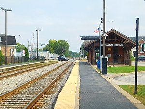
Chicago Ridge station
Commuter rail station in Chicago Ridge, Illinois
Distance: Approx. 2025 meters
Latitude and longitude: 41.7034,-87.7803
Chicago Ridge is a station on Metra's SouthWest Service in Chicago Ridge, Illinois. The station is 16.6 miles (26.7 km) away from Chicago Union Station, the northern terminus of the line. In Metra's zone-based fare system, Chicago Ridge is in zone 3.

Advocate Children's Hospital
Hospital in Illinois, United States
Distance: Approx. 2589 meters
Latitude and longitude: 41.723584,-87.731987
Advocate Children's Hospital (ACH) is an academic pediatric acute care children's hospital located in Oak Lawn and Park Ridge, Illinois. The hospital has 259 pediatric beds and 150 bassinets between its two campuses. Advocate Children's operates a number of residency programs, which train newly graduated physicians in various pediatric specialties and subspecialties.
Advocate Christ Medical Center
Hospital in Illinois, United States
Distance: Approx. 2439 meters
Latitude and longitude: 41.7212,-87.7322
Advocate Christ Medical Center (ACMC) is a 788-bed teaching hospital located in Oak Lawn, Illinois, a suburb of Chicago. Founded in 1960, Advocate Christ Medical Center is a part of Advocate Aurora Health. In the most recent year with available data, the hospital had 40,517 admissions, 3,738 deliveries, 102,279 ED visits, 334,958 outpatient visits, and 24,745 surgeries.
Weather in this IP's area
few clouds
-4 Celsius
-9 Celsius
-4 Celsius
-4 Celsius
1024 hPa
51 %
1024 hPa
999 hPa
10000 meters
4.39 m/s
9.23 m/s
299 degree
14 %