162.216.231.59 - IP Lookup: Free IP Address Lookup, Postal Code Lookup, IP Location Lookup, IP ASN, Public IP
Country:
Region:
City:
Location:
Time Zone:
Postal Code:
IP information under different IP Channel
ip-api
Country
Region
City
ASN
Time Zone
ISP
Blacklist
Proxy
Latitude
Longitude
Postal
Route
Luminati
Country
ASN
Time Zone
America/Chicago
ISP
G-Core Labs S.A.
Latitude
Longitude
Postal
IPinfo
Country
Region
City
ASN
Time Zone
ISP
Blacklist
Proxy
Latitude
Longitude
Postal
Route
IP2Location
162.216.231.59Country
Region
california
City
san francisco
Time Zone
America/Los_Angeles
ISP
Language
User-Agent
Latitude
Longitude
Postal
db-ip
Country
Region
City
ASN
Time Zone
ISP
Blacklist
Proxy
Latitude
Longitude
Postal
Route
ipdata
Country
Region
City
ASN
Time Zone
ISP
Blacklist
Proxy
Latitude
Longitude
Postal
Route
Popular places and events near this IP address

WildAid
Environmental organization
Distance: Approx. 105 meters
Latitude and longitude: 37.791944,-122.401667
WildAid is an environmental organization based in San Francisco, California, United States. WildAid focuses on reducing the demand for wildlife products. WildAid works with Asian, Western celebrities and business leaders to dissuade people from purchasing wildlife products via public service announcements and educational initiatives hence reaching hundreds of millions of people per year.

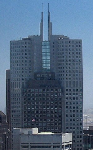
One Sansome Street
Skyscraper in San Francisco, California
Distance: Approx. 107 meters
Latitude and longitude: 37.790417,-122.401278
One Sansome Street, also known as Citigroup Center, is an office skyscraper located at the intersection of Sutter and Sansome Streets in the Financial District of San Francisco, California, United States, near Market Street. The 168 m (551 ft), 41 floor, 587,473 sq ft (54,578.0 m2) office tower was completed in 1984.
345 California Center
48-story office tower in the financial district of San Francisco
Distance: Approx. 136 meters
Latitude and longitude: 37.7925,-122.4005
345 California Center is a 48-story office tower in the financial district of San Francisco, California. Completed in 1986, the 211.8 m (695 ft) tower is the fifth tallest in the city after the Salesforce Tower, Transamerica Pyramid, 181 Fremont, and 555 California Street if the spires are included. It was originally proposed to be 30 m (98 ft) taller.

One Bush Plaza
Office building in San Francisco
Distance: Approx. 78 meters
Latitude and longitude: 37.791,-122.4
One Bush Plaza, also known as the Crown Zellerbach Building, is an office building in the western United States in San Francisco, California. Located on Bush Street and Battery Street at Market Street in the Financial District, the 20-story, 308-foot (94 m) building was completed in 1959.

Shell Building (San Francisco)
Commercial offices in San Francisco, California
Distance: Approx. 82 meters
Latitude and longitude: 37.7915,-122.3999
The Shell Building is an office tower in the Financial District of San Francisco, California. The 28-story, 115.22 m (378.0 ft), building is located at 100 Bush Street, at Battery Street. It was designed by George W. Kelham and built in 1929, in the architectural style of Gothic Moderne, Moderne and Art Deco.

225 Bush Street
Building in San Francisco
Distance: Approx. 77 meters
Latitude and longitude: 37.79086,-122.40147
225 Bush Street, originally known as the Standard Oil Building, is a 328-foot (100 m), 25-floor office building in the financial district of San Francisco. The building includes 21 floors of office space, 1 floor of retail, 1 storage floor and 2 basement levels including the garage. It was the tallest building in the city from its completion in 1922 until 1925.

Mills Building and Tower
Commercial offices in San Francisco, California
Distance: Approx. 43 meters
Latitude and longitude: 37.79127,-122.40129
The Mills Building and Tower is a two-building complex following the Chicago school with Romanesque design elements in the Financial District of San Francisco, California. The structures were declared San Francisco Designated Landmark #76, and were listed on the National Register of Historic Places in 1974.

180 Montgomery Street
Commercial offices in San Francisco, California
Distance: Approx. 124 meters
Latitude and longitude: 37.790766,-122.402034
180 Montgomery Street is a 25-story, 98 m (322 ft). Class A office building in the financial district of San Francisco, California. The building serves as the corporate headquarters for Bank of the West, and has offices for other major tenants such as, Ameriprise Financial, Berlitz, Hanjin Shipping, Kforce, Valimail, Lexmark, Prudential Insurance, the Union Labor Life Insurance Company, and Western Union.

Stevenson Place
Office building
Distance: Approx. 44 meters
Latitude and longitude: 37.7913,-122.4013
Stevenson Place is a 24-story, 103 m (338 ft) Class-A office building located at 71 Stevenson Street in the Financial District of San Francisco, California. Construction of the building began in 1985 and was completed in 1987 and was designed by the architecture firm Kaplan Mclaughlin Diaz. The building was the winner of the 1987 Prestressed Concrete Institute Competition.
Royal Insurance Building (San Francisco)
Distance: Approx. 116 meters
Latitude and longitude: 37.79228,-122.40126
The Royal Insurance Building is a former office building located at 201 Sansome Street, San Francisco, California, and now converted to condominiums.

Market and 1st Street / Market and Battery stations
Distance: Approx. 113 meters
Latitude and longitude: 37.79119444,-122.39952778
Market and 1st Street (eastbound) and Market and Battery (westbound) stations are a pair of light rail stations in San Francisco, California, United States, serving the San Francisco Municipal Railway F Market & Wharves heritage railway line. They are located on Market Street at the intersections of 1st Street and Battery Street. The low-level platforms are also utilized by several bus and trolleybus routes.
The Shota
Japanese restaurant in San Francisco, California, U.S.
Distance: Approx. 26 meters
Latitude and longitude: 37.791444,-122.401028
The Shota is a Japanese restaurant in San Francisco, California. The restaurant has received a Michelin star.
Weather in this IP's area
haze
8 Celsius
5 Celsius
7 Celsius
9 Celsius
1019 hPa
91 %
1019 hPa
1015 hPa
9656 meters
5.36 m/s
7.6 m/s
107 degree
20 %

