162.212.235.55 - IP Lookup: Free IP Address Lookup, Postal Code Lookup, IP Location Lookup, IP ASN, Public IP
Country:
Region:
City:
Location:
Time Zone:
Postal Code:
ISP:
ASN:
language:
User-Agent:
Proxy IP:
Blacklist:
IP information under different IP Channel
ip-api
Country
Region
City
ASN
Time Zone
ISP
Blacklist
Proxy
Latitude
Longitude
Postal
Route
db-ip
Country
Region
City
ASN
Time Zone
ISP
Blacklist
Proxy
Latitude
Longitude
Postal
Route
IPinfo
Country
Region
City
ASN
Time Zone
ISP
Blacklist
Proxy
Latitude
Longitude
Postal
Route
IP2Location
162.212.235.55Country
Region
quebec
City
montreal
Time Zone
America/Montreal
ISP
Language
User-Agent
Latitude
Longitude
Postal
ipdata
Country
Region
City
ASN
Time Zone
ISP
Blacklist
Proxy
Latitude
Longitude
Postal
Route
Popular places and events near this IP address

Honoré-Beaugrand station
Montreal Metro station
Distance: Approx. 2333 meters
Latitude and longitude: 45.59666667,-73.53555556
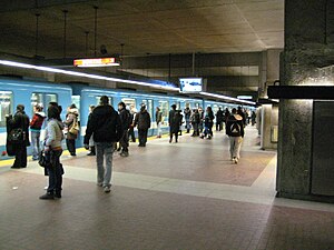
Honoré-Beaugrand station (French pronunciation: [ɔnɔʁe boɡʁɑ̃]) is a Montreal Metro station in the borough of Mercier–Hochelaga-Maisonneuve in Montreal, Quebec, Canada. It is operated by the Société de transport de Montréal (STM) and is the eastern terminus of the Green Line. It is located in the district of Tétreaultville.
Radisson station
Montreal Metro station
Distance: Approx. 3200 meters
Latitude and longitude: 45.58888889,-73.53944444
Radisson station is a Montreal Metro station in the borough of Mercier–Hochelaga-Maisonneuve in Montreal, Quebec, Canada. It is operated by the Société de transport de Montréal (STM) and serves the Green Line. It is in the district of Saint-Jean-de-Dieu.

Montréal-Est
City in Quebec, Canada
Distance: Approx. 2000 meters
Latitude and longitude: 45.63,-73.52
Montreal East (French: Montréal-Est, pronounced [mɔ̃ʁeal ɛst] ) is an on-island suburb in southwestern Quebec, Canada, on the island of Montreal. Montreal-Est has been home to many large oil refineries since 1915.

Anjou, Quebec
Borough in Quebec, Canada
Distance: Approx. 3009 meters
Latitude and longitude: 45.6,-73.55
Anjou (French pronunciation: [ɑ̃ʒu] ) is a borough (arrondissement) of the Canadian city of Montreal. Prior to its 2002 merger it was an independent city. Although it is no longer an independent city, it is still commonly known as known as Ville d'Anjou.

Camille-Laurin (electoral district)
Provincial electoral district in Quebec, Canada
Distance: Approx. 3042 meters
Latitude and longitude: 45.589,-73.536
Camille-Laurin is a provincial electoral district in Quebec, Canada that elects members to the National Assembly of Quebec. The district is located within the Mercier–Hochelaga-Maisonneuve borough of Montreal. It includes territory between the boundary with Pointe-aux-Trembles borough and the Canadian National railway and between mostly Sherbrooke Street and the Anjou borough and the Saint Lawrence River.

Mercier, Montreal
Neighbourhood in Montreal, Quebec, Canada
Distance: Approx. 1838 meters
Latitude and longitude: 45.5958,-73.5163
Mercier (French pronunciation: [mɛʁsje] ) denotes the eastern portion of the Mercier–Hochelaga-Maisonneuve borough of the city of Montreal, Quebec. It consists of two neighbourhoods Mercier-Ouest (Longue-Pointe) and Mercier-Est (Tétreaultville).
Place Versailles
Shopping mall
Distance: Approx. 3005 meters
Latitude and longitude: 45.5918,-73.5407
Place Versailles is a shopping mall located at the corner of Sherbrooke Street East and Highway 25 in the Mercier–Hochelaga-Maisonneuve borough of Montreal, Quebec, Canada. With its 225 stores, it is the largest enclosed shopping centre on the Island of Montreal. Its anchors are Canadian Tire, Maxi, Winners/HomeSense and Bureau en Gros.

Longue-Pointe
Place
Distance: Approx. 3226 meters
Latitude and longitude: 45.58333333,-73.51666667
Longue-Pointe (French pronunciation: [lɔ̃g pwɛ̃t]) was a Montreal neighbourhood now located in the borough of Mercier-Hochelaga-Maisonneuve. The neighborhood was permanently divided by the construction of the Louis-Hippolyte Lafontaine Tunnel. Most of its territory is now part of the Mercier-Ouest while some of the area that fell east of the highway is now within Mercier-Est.

Montreal East Refinery (Shell Canada)
Oil refinery located in Montreal East
Distance: Approx. 1842 meters
Latitude and longitude: 45.62527778,-73.53027778
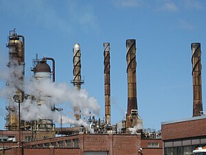
The Montreal East Refinery (French: Raffinerie de Montréal-Est) was an oil refinery located in Montreal East and formerly Shell Canada's largest refinery. In October 2010, refinery operations permanently ceased and the facility was subsequently converted into a storage terminal.

Promenade Bellerive Park
Urban park in Montreal, Canada
Distance: Approx. 1321 meters
Latitude and longitude: 45.6011,-73.51
Promenade Bellerive Park (French: Parc de la Promenade-Bellerive) is an urban park in the Mercier–Hochelaga-Maisonneuve borough of Montreal, Quebec, Canada. It is located in between Notre Dame Street East and the Saint Lawrence River. It is 22 hectares (54 acres) large.

Institut universitaire en santé mentale de Montréal
Hospital in Quebec, Canada
Distance: Approx. 2837 meters
Latitude and longitude: 45.5886,-73.529
Institut universitaire en santé mentale de Montréal is a psychiatric hospital in Montreal, Quebec, Canada. It is located at 7401 Hochelaga Street in the borough of Mercier–Hochelaga-Maisonneuve. It was established in 1873 and is affiliated with the Université de Montréal Faculty of Medicine.
École secondaire d'Anjou
Public school in Montreal, Quebec, Canada
Distance: Approx. 2226 meters
Latitude and longitude: 45.6026,-73.5406
École secondaire d'Anjou is a francophone public co-educational secondary school located in most part in Mercier-Hochelaga-Maisonneuve borough and in small part in Anjou borough in Montreal. Part of the Commission scolaire de la Pointe-de-l'Île, it was originally in the catholic School board Commission scolaire Jérôme-Le Royer before the 1998 reorganization of School boards from religious communities into linguistic communities in Quebec. École secondaire d'Anjou offers regular and special education programs, welcoming classes, professional programs and adults programs.
Weather in this IP's area
overcast clouds
-6 Celsius
-13 Celsius
-7 Celsius
-6 Celsius
1012 hPa
73 %
1012 hPa
1009 hPa
10000 meters
5.14 m/s
340 degree
100 %
