162.212.234.186 - IP Lookup: Free IP Address Lookup, Postal Code Lookup, IP Location Lookup, IP ASN, Public IP
Country:
Region:
City:
Location:
Time Zone:
Postal Code:
ISP:
ASN:
language:
User-Agent:
Proxy IP:
Blacklist:
IP information under different IP Channel
ip-api
Country
Region
City
ASN
Time Zone
ISP
Blacklist
Proxy
Latitude
Longitude
Postal
Route
db-ip
Country
Region
City
ASN
Time Zone
ISP
Blacklist
Proxy
Latitude
Longitude
Postal
Route
IPinfo
Country
Region
City
ASN
Time Zone
ISP
Blacklist
Proxy
Latitude
Longitude
Postal
Route
IP2Location
162.212.234.186Country
Region
ontario
City
markham
Time Zone
America/Toronto
ISP
Language
User-Agent
Latitude
Longitude
Postal
ipdata
Country
Region
City
ASN
Time Zone
ISP
Blacklist
Proxy
Latitude
Longitude
Postal
Route
Popular places and events near this IP address

Seneca Polytechnic
Public college in Toronto, Ontario, Canada
Distance: Approx. 2090 meters
Latitude and longitude: 43.79555556,-79.34888889
Seneca College of Applied Arts and Technology, branded as Seneca Polytechnic since 2023, is a multi-campus public college in the Greater Toronto Area and Peterborough, Ontario, Canada. It offers full-time and part-time programs at the baccalaureate, diploma, certificate, and graduate levels.

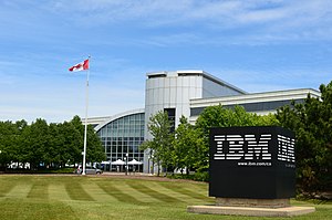
IBM Canada Head Office Building
Head office of IBM Canada
Distance: Approx. 1088 meters
Latitude and longitude: 43.81805556,-79.335
IBM Canada's head offices are currently located in Markham, Ontario and have been there since the early 1980s. The current building IBM occupies is located at 8200 Warden Avenue and shared with existing tenant IBM Toronto Software Lab in 2001. Head office is being moved from 3600 Steeles Avenue East, which was sold in August 2024 and was completed in 1995.

A. Y. Jackson Secondary School (Toronto)
High school in Toronto, Ontario, Canada
Distance: Approx. 1831 meters
Latitude and longitude: 43.8049,-79.3662
A. Y. Jackson Secondary School is a secondary school for grades 9 to 12 in Toronto, Ontario, Canada. It was opened in 1970 by the North York Board of Education, and is now operated by its successor, the Toronto District School Board. The school was named after A. Y. Jackson, a Canadian painter and one of the founders of the Group of Seven.

Canadian Memorial Chiropractic College
Private chiropractic school in Toronto, Ontario
Distance: Approx. 2274 meters
Latitude and longitude: 43.8039,-79.37186
Canadian Memorial Chiropractic College (CMCC) is a Canadian private chiropractic education school in the North York, Toronto, founded in 1945. CMCC awards Doctor of Chiropractic degrees under ministerial consent from the provincial Ministry of Colleges and Universities.
German Mills
Unincorporated community in Ontario, Canada
Distance: Approx. 1708 meters
Latitude and longitude: 43.81611111,-79.36861111
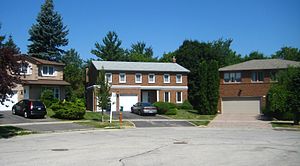
German Mills is a community within the city of Markham in Ontario, Canada. The easternmost community in the historic town of Thornhill, German Mills was named for the early German settlers in the area.

Hillcrest Village
Neighbourhood in Toronto, Ontario, Canada
Distance: Approx. 1841 meters
Latitude and longitude: 43.8,-79.359
Hillcrest Village is a neighbourhood located in Toronto, Ontario, Canada. It is located in the northern district of North York. It is bordered by Finch to the South, Leslie Street to the West, Steeles to the North and Victoria Park to the East.
Dr Norman Bethune Collegiate Institute
Public high school in Toronto, Ontario, Canada
Distance: Approx. 2225 meters
Latitude and longitude: 43.81194444,-79.32
Dr. Norman Bethune Collegiate Institute (also known as Bethune, BCI, or Dr. Norman Bethune CI) is a high school in Toronto, Ontario, Canada.
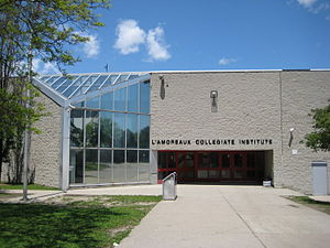
L'Amoreaux Collegiate Institute
Public high school in Toronto, Ontario, Canada
Distance: Approx. 2751 meters
Latitude and longitude: 43.801925,-79.31786389
L'Amoreaux Collegiate Institute (or L'Am for short) is a public high school in Toronto, Ontario, Canada founded in 1973. It is located in the L'Amoreaux neighbourhood of the former suburb of Scarborough. Originally part of the Scarborough Board of Education, it is now consolidated into the Toronto District School Board.
L'Amoreaux
Neighbourhood in Toronto, Ontario, Canada
Distance: Approx. 2813 meters
Latitude and longitude: 43.79444444,-79.32583333
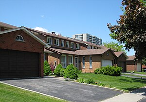
L'Amoreaux is a neighbourhood in Toronto, Ontario, Canada, situated east of Victoria Park Avenue, south of McNicoll Avenue, west of Kennedy Road and north of Huntingwood Drive. L'Amoreaux is named after Josue L'Amoreaux (1738–1834), a French Huguenot loyalist who settled in the area. Prior to the amalgamation of Toronto in 1998, L'Amoreaux was a neighbourhood of the former city of Scarborough, and prior to the amalgamation of municipalities, it formed part of the town of Agincourt.
Sir Ernest MacMillan Senior Public School
School in Scarborough, Toronto, Ontario, Canada
Distance: Approx. 1745 meters
Latitude and longitude: 43.8062,-79.3289
Sir Ernest MacMillan Senior Public School is a seventh- and eighth-grade school in the Scarborough area of Toronto. A triple-track school, it offers programs in Standard English (with Core French), Extended French, and French Immersion. The school is named for Canada's only "Musical Knight".
The Shops on Steeles and 404
Shopping mall in Ontario, Canada
Distance: Approx. 887 meters
Latitude and longitude: 43.813206,-79.358438
The Shops on Steeles and 404 is a small 50-store community mall at the corner of Steeles Avenue East and Don Mills Road in Markham, Ontario. Aside from a few chains, the mall is mostly independent stores.

Odeyto Indigenous Centre
Canadian college student center
Distance: Approx. 2009 meters
Latitude and longitude: 43.796281,-79.348808
Odeyto Indigenous Centre is a purpose-built Indigenous student space on Seneca College's Newnham Campus in North York, Toronto, Canada. Odeyto provides a space where Indigenous students can feel safe and connected to their communities when away from home, while also rediscovering and practicing their traditions. Gow Hasting Architects (project team: Valerie Gow, Jim Burkitt, Graham Bolton, and Courtney Klein) designed the building in partnership with Two Row Architect, a native-owned firm from the Six Nations reserve in southern Ontario.
Weather in this IP's area
scattered clouds
-6 Celsius
-11 Celsius
-6 Celsius
-5 Celsius
1017 hPa
58 %
1017 hPa
992 hPa
10000 meters
3.58 m/s
7.15 m/s
293 degree
43 %


