162.212.226.26 - IP Lookup: Free IP Address Lookup, Postal Code Lookup, IP Location Lookup, IP ASN, Public IP
Country:
Region:
City:
Location:
Time Zone:
Postal Code:
ISP:
ASN:
language:
User-Agent:
Proxy IP:
Blacklist:
IP information under different IP Channel
ip-api
Country
Region
City
ASN
Time Zone
ISP
Blacklist
Proxy
Latitude
Longitude
Postal
Route
db-ip
Country
Region
City
ASN
Time Zone
ISP
Blacklist
Proxy
Latitude
Longitude
Postal
Route
IPinfo
Country
Region
City
ASN
Time Zone
ISP
Blacklist
Proxy
Latitude
Longitude
Postal
Route
IP2Location
162.212.226.26Country
Region
colorado
City
pagosa springs
Time Zone
America/Denver
ISP
Language
User-Agent
Latitude
Longitude
Postal
ipdata
Country
Region
City
ASN
Time Zone
ISP
Blacklist
Proxy
Latitude
Longitude
Postal
Route
Popular places and events near this IP address
Archuleta County, Colorado
County in Colorado, United States
Distance: Approx. 9540 meters
Latitude and longitude: 37.19,-107.05
Archuleta County is a county located in the U.S. state of Colorado. As of the 2020 census, the population was 13,359. The county seat and the only incorporated municipality in the county is Pagosa Springs.

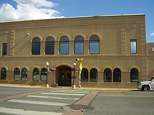
Pagosa Springs, Colorado
Town in Colorado, United States
Distance: Approx. 518 meters
Latitude and longitude: 37.265,-107.00833333
Pagosa Springs (Ute language: Pagwöösa, Navajo language: Tó Sido Háálį́) is a home rule municipality that is the county seat, the most populous community, and the only incorporated municipality in Archuleta County, Colorado, United States. The population was 1,571 at the 2020 census. Approximately 65 percent of the land in Archuleta County is either San Juan National Forest, Weminuche and South San Juan wilderness areas, or Southern Ute Indian reservation land.

Stevens Field
Airport
Distance: Approx. 4507 meters
Latitude and longitude: 37.28806,-107.05502
Stevens Field (IATA: PGO, ICAO: KPSO, FAA LID: PSO) is a public-use, general aviation airport located three miles northwest of the central business district of Pagosa Springs in Archuleta County, Colorado, United States. It is publicly owned by Archuleta County. It has no air traffic control tower or commercial passenger services, but it does have a fixed-base operator (FBO), and it is popular among light sport and general aviation aircraft doing cross country flights, where the airport serves as a general aviation-friendly waypoint, refueling stop, and pilot rest/sleep opportunity.
Pagosa Springs High School
Public high school in Pagosa Springs, Colorado, United States
Distance: Approx. 1648 meters
Latitude and longitude: 37.25583333,-107.01694444
Pagosa Springs High School is a public high school located in Pagosa Springs, Colorado, United States. It is a part of Archuleta County School District 50-JT. The district includes most of Archuleta County. A portion is in Hinsdale County, where it serves Piedra.

Mill Creek (San Juan River tributary)
River in Colorado, United States
Distance: Approx. 2945 meters
Latitude and longitude: 37.24305556,-107.01055556
Mill Creek is a stream in the San Juan National Forest in Archuleta County, Colorado, and a minor left tributary of San Juan River. It flows in a generally southwesterly direction from Mill Creek Canyon, east of Pagosa Springs between Coal Creek and Rio Blanco, to join the San Juan River just sound of Pagosa Springs.
Echo Canyon Reservoir State Wildlife Area
Distance: Approx. 6444 meters
Latitude and longitude: 37.213,-106.994
Echo Canyon Reservoir State Wildlife Area is a fishing lake and birding area in Archuleta County, Colorado. It is stocked with rainbow trout, largemouth bass, yellow perch, green sunfish, and channel catfish.

Pagosa hot springs
Thermal spring
Distance: Approx. 1307 meters
Latitude and longitude: 37.26805556,-107.02444444
Pagosa hot springs (Ute: Pah gosah) is a hot spring system located in the San Juan Basin of Archuleta County, Colorado. The town of Pagosa Springs claim they are the world's deepest known geothermal hot springs.
Pagosa Springs Medical Center
Hospital in Colorado, United States
Distance: Approx. 6320 meters
Latitude and longitude: 37.28527778,-107.07833333
Pagosa Springs Medical Center is a critical access hospital in Pagosa Springs, Colorado, in Archuleta County. The hospital has 11 beds. It is a Level IV trauma center.
Meander Eatery
Restaurant in Pagosa Springs, Colorado, U.S.
Distance: Approx. 1074 meters
Latitude and longitude: 37.26986389,-106.99768056
Meander Eatery is a farm-to-table restaurant in Pagosa Springs, Colorado. It was included in The New York Times's 2024 list of the fifty best restaurants in the United States. The restaurant was established in 2022.
Weather in this IP's area
scattered clouds
-13 Celsius
-17 Celsius
-13 Celsius
-13 Celsius
1034 hPa
41 %
1034 hPa
763 hPa
10000 meters
1.69 m/s
2.01 m/s
34 degree
27 %


