Country:
Region:
City:
Latitude and Longitude:
Time Zone:
Postal Code:
IP information under different IP Channel
ip-api
Country
Region
City
ASN
Time Zone
ISP
Blacklist
Proxy
Latitude
Longitude
Postal
Route
IPinfo
Country
Region
City
ASN
Time Zone
ISP
Blacklist
Proxy
Latitude
Longitude
Postal
Route
MaxMind
Country
Region
City
ASN
Time Zone
ISP
Blacklist
Proxy
Latitude
Longitude
Postal
Route
Luminati
Country
Region
id
City
bellevue
ASN
Time Zone
America/Boise
ISP
ANTHEMBB
Latitude
Longitude
Postal
db-ip
Country
Region
City
ASN
Time Zone
ISP
Blacklist
Proxy
Latitude
Longitude
Postal
Route
ipdata
Country
Region
City
ASN
Time Zone
ISP
Blacklist
Proxy
Latitude
Longitude
Postal
Route
Popular places and events near this IP address

Bellevue, Idaho
City in Idaho, United States
Distance: Approx. 2796 meters
Latitude and longitude: 43.465,-114.25666667
Bellevue is a city in Blaine County in the central part of the U.S. state of Idaho. The population was 2,287 at the 2010 census, up from 1,876 in 2000. It is located in the Wood River Valley, about 18 miles (29 km) south of the resort area of Ketchum and Sun Valley.
Hailey, Idaho
City in and county seat of Blaine County, Idaho, United States
Distance: Approx. 9536 meters
Latitude and longitude: 43.515,-114.30638889
Hailey is a city in and the county seat of Blaine County, in the Wood River Valley of the central part of the U.S. state of Idaho. The population was 7,960 at the 2010 census, up from 6,200 in 2000. Hailey is the site of Friedman Memorial Airport (SUN), the airport for the resort area of Sun Valley/Ketchum, 12 miles (19 km) north.

Friedman Memorial Airport
Airport in Idaho, U.S.
Distance: Approx. 8029 meters
Latitude and longitude: 43.50388889,-114.29555556
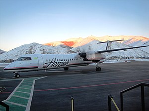
Friedman Memorial Airport (IATA: SUN, ICAO: KSUN, FAA LID: SUN) is a city-owned public-use airport in the northwest United States, located one nautical mile (2 km) southeast of the central business district of Hailey, the county seat of Blaine County, Idaho. The airport is operated by the Friedman Memorial Airport Authority under a joint powers agreement between the city of Hailey and Blaine County. It serves the resort communities of Sun Valley and Ketchum, and the surrounding areas in the Wood River Valley.

Wood River Valley
Distance: Approx. 9498 meters
Latitude and longitude: 43.51472222,-114.30611111
The Wood River Valley is a region in south-central Idaho. Located in Blaine County, it is named after the Big Wood and Little Wood Rivers, which flow through the area. The valley has four incorporated cities: Bellevue, Hailey, Ketchum, and Sun Valley.
Wood River High School (Idaho)
Public school in Hailey, Idaho, United States
Distance: Approx. 9382 meters
Latitude and longitude: 43.518,-114.294
Wood River High School is a public secondary school in Hailey, Idaho, one of two traditional high schools operated by the Blaine County School District #61 (the smaller Carey High School (K-12) is the other). Wood River High School serves the communities of Bellevue, Hailey, Ketchum, and Sun Valley, all in the valley of the Big Wood River, Wood River Middle School, and Wood River High School. and the current campus opened in August 2003.

Bellevue Historic District (Bellevue, Idaho)
Historic district in Idaho, United States
Distance: Approx. 2740 meters
Latitude and longitude: 43.46416667,-114.25805556
Bellevue Historic District is roughly bounded by U.S. 93, Cedar, 4th, and Oak Sts. in Bellevue, Idaho. The Late Victorian style buildings date as far back as 1880, and are significant for their architecture.
Henry Miller House (Bellevue, Idaho)
Historic house in Idaho, United States
Distance: Approx. 843 meters
Latitude and longitude: 43.44638889,-114.25444444
The Henry Miller House near Bellevue, Idaho is a historic house built from silver mining wealth that is listed on the National Register of Historic Places. Lead and silver mining within quartz deposits in the area was initiated in 1879, and on September 22, 1880, claim was filed for what became the Minnie Moore lead and silver mine near Broadford, to the west of Bellevue. Henry E. Miller purchased half ownership of the Minnie Moore mine for $10,000 in 1881; even without accounting for the proceeds of mining for three years, he did well with the investment as the mine was sold to an English company in 1884 for $450,000.

St. Charles of the Valley Catholic Church and Rectory
Historic church in Idaho, United States
Distance: Approx. 9966 meters
Latitude and longitude: 43.51722222,-114.31166667
St. Charles Borromeo Church is a Catholic parish church in Hailey, Idaho, in the Diocese of Boise. Its historic parish church and rectory complex, located at Pine and S. 1st Streets, is listed on the National Register of Historic Places.
Weather in this IP's area
clear sky
9 Celsius
8 Celsius
9 Celsius
9 Celsius
1022 hPa
34 %
1022 hPa
850 hPa
10000 meters
3.09 m/s
290 degree
07:39:34
19:10:37
