162.210.61.169 - IP Lookup: Free IP Address Lookup, Postal Code Lookup, IP Location Lookup, IP ASN, Public IP
Country:
Region:
City:
Location:
Time Zone:
Postal Code:
ISP:
ASN:
language:
User-Agent:
Proxy IP:
Blacklist:
IP information under different IP Channel
ip-api
Country
Region
City
ASN
Time Zone
ISP
Blacklist
Proxy
Latitude
Longitude
Postal
Route
db-ip
Country
Region
City
ASN
Time Zone
ISP
Blacklist
Proxy
Latitude
Longitude
Postal
Route
IPinfo
Country
Region
City
ASN
Time Zone
ISP
Blacklist
Proxy
Latitude
Longitude
Postal
Route
IP2Location
162.210.61.169Country
Region
wisconsin
City
random lake
Time Zone
America/Chicago
ISP
Language
User-Agent
Latitude
Longitude
Postal
ipdata
Country
Region
City
ASN
Time Zone
ISP
Blacklist
Proxy
Latitude
Longitude
Postal
Route
Popular places and events near this IP address

Adell, Wisconsin
Village in Wisconsin, United States
Distance: Approx. 7085 meters
Latitude and longitude: 43.61833333,-87.95138889
Adell is a village in Sheboygan County, Wisconsin, United States. The population was 498 at the 2020 census. It is included in the Sheboygan, Wisconsin Metropolitan Statistical Area.

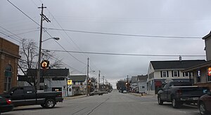
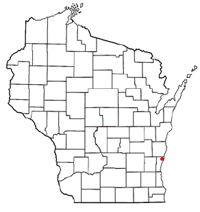
Random Lake, Wisconsin
Village in Wisconsin, United States
Distance: Approx. 644 meters
Latitude and longitude: 43.5525,-87.96027778
Random Lake is a village in Sheboygan County, Wisconsin, United States. The population was 1,594 at the 2010 census. It is part of the Sheboygan, Wisconsin Metropolitan Statistical Area.

Sherman, Sheboygan County, Wisconsin
Town in Wisconsin, United States
Distance: Approx. 4324 meters
Latitude and longitude: 43.58722222,-87.98222222
Sherman is a town in Sheboygan County, Wisconsin, United States whose population was 1,520 at the 2000 census. It is included in the Sheboygan, Wisconsin Metropolitan Statistical Area. The unincorporated communities of Gooseville and Silver Creek are located in the town.

Belgium (town), Wisconsin
Town in Ozaukee County, Wisconsin
Distance: Approx. 8024 meters
Latitude and longitude: 43.49972222,-87.88861111
Belgium is a town in Ozaukee County, Wisconsin, United States. The population was 1,513 at the 2000 census. The Village of Belgium is surrounded on all sides by the town, and the unincorporated communities of Decker, Holy Cross, Lake Church, and Sauk Trail Beach are located in the town, as is the ghost town of Stonehaven.

Fredonia (town), Wisconsin
Town in Ozaukee County, Wisconsin
Distance: Approx. 6492 meters
Latitude and longitude: 43.50055556,-87.98277778
Fredonia is a town in Ozaukee County, Wisconsin, United States. The population was 2,903 at the 2000 census. The Village of Fredonia is surrounded by the town.

Random Lake High School
School in Random Lake, Wisconsin
Distance: Approx. 1577 meters
Latitude and longitude: 43.55461111,-87.97244444
Random Lake High School is a high school for grades 9–12. It is located in Random Lake, Wisconsin on the western side of town and serves approximately 233 students in the area of Southern Sheboygan County and Northern Ozaukee County. The current site of the school was formerly a swamp.
Dacada, Wisconsin
Unincorporated community in Ozaukee County, Wisconsin
Distance: Approx. 3791 meters
Latitude and longitude: 43.54333333,-87.90861111
Dacada is an unincorporated community located in the towns of Belgium and Holland in Ozaukee and Sheboygan counties, Wisconsin, United States. Dacada is east of Random Lake and northwest of Belgium. Dacada was settled by immigrants from Luxembourg in the 1840s and 1850s.

Gooseville, Wisconsin
Unincorporated community in Wisconsin, United States
Distance: Approx. 6586 meters
Latitude and longitude: 43.58722222,-88.02111111
Gooseville is an unincorporated community located in the town of Sherman, in Sheboygan County, Wisconsin, United States.

St. Patrick's Roman Catholic Church (Adell, Wisconsin)
Historic church in Wisconsin, United States
Distance: Approx. 7135 meters
Latitude and longitude: 43.61666667,-87.93027778
St. Patrick's Roman Catholic Church is located in Adell, Wisconsin, a Gothic Revival-styled church with exterior of split fieldstone, built in 1877 to serve the surrounding Irish-immigrant community. It was added to the National Register of Historic Places in 1983 for its architectural significance.

Kneeland-Walker House
Historic house in Wisconsin, United States
Distance: Approx. 6900 meters
Latitude and longitude: 43.50555556,-88.005
The Kneeland-Walker House is a 3-story mansion built in 1890 in Wauwatosa, Wisconsin, styled Queen Anne with Shingle style influence. Still largely intact, and possibly the finest example of Queen Anne architecture in Wauwatosa, it was added to the National Register of Historic Places in 1989.

Gooseville Mill/Grist Mill
United States historic place
Distance: Approx. 6583 meters
Latitude and longitude: 43.58777778,-88.02055556
The Gooseville Mill/Grist Mill is a historic mill on the North Branch Milwaukee River in Gooseville, Wisconsin. The mill was built in 1879 to replace an 1855 mill that had burned down. The mill is a small custom mill with board and batten siding and is typical of the custom mills common in Sheboygan County in the 1800s.
WKJJ-LP/WPJQ-LP
Radio station in Wisconsin, United States
Distance: Approx. 7178 meters
Latitude and longitude: 43.5,-88
WKJJ-LP and WPJQ-LP (101.3 FM) are two shared-time non-commercial low-power radio stations licensed to Milwaukee, Wisconsin. The two stations, both with separate licensees, management and mailing addresses, share different time blocks on one frequency, though both brand together and air similar talk and music programming targeting Milwaukee's African-American community. The two stations, as of September 10, 2018, are silent, as both stations began seeking a new broadcast tower site.
Weather in this IP's area
overcast clouds
4 Celsius
2 Celsius
3 Celsius
5 Celsius
1002 hPa
29 %
1002 hPa
971 hPa
10000 meters
1.79 m/s
5.81 m/s
252 degree
100 %