Country:
Region:
City:
Latitude and Longitude:
Time Zone:
Postal Code:
IP information under different IP Channel
ip-api
Country
Region
City
ASN
Time Zone
ISP
Blacklist
Proxy
Latitude
Longitude
Postal
Route
Luminati
Country
Region
dc
City
washington
ASN
Time Zone
America/New_York
ISP
GPO-NET
Latitude
Longitude
Postal
IPinfo
Country
Region
City
ASN
Time Zone
ISP
Blacklist
Proxy
Latitude
Longitude
Postal
Route
db-ip
Country
Region
City
ASN
Time Zone
ISP
Blacklist
Proxy
Latitude
Longitude
Postal
Route
ipdata
Country
Region
City
ASN
Time Zone
ISP
Blacklist
Proxy
Latitude
Longitude
Postal
Route
Popular places and events near this IP address

Capitol Hill
United States historic place and neighborhood of Washington, D.C.
Distance: Approx. 224 meters
Latitude and longitude: 38.88972222,-77.01111111
Capitol Hill is a neighborhood in Washington, D.C., located in both Northeast D.C. and Southeast D.C.. Bounded by 14th Street SE & NE, F Street NE, Southeast Boulevard SE, South Capitol Street SE. Dominated by the United States Capitol, which sits on the highest point of Capitol Hill, it is one of the oldest historic districts in Washington. Home to around 35,000 people in just under 2 square miles (5 km2), Capitol Hill is also one of the most densely populated neighborhoods.

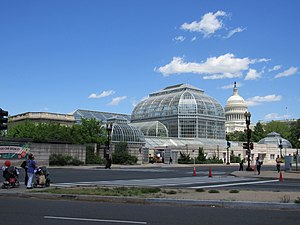
United States Botanic Garden
Botanical garden on the grounds of the United States Capitol in Washington, D.C., USA
Distance: Approx. 209 meters
Latitude and longitude: 38.888,-77.013
The United States Botanic Garden (USBG) is a botanical garden on the grounds of the United States Capitol in Washington, D.C., near the James A. Garfield Monument. The Botanic Garden is supervised by the Congress through the Architect of the Capitol, who is responsible for maintaining the grounds of the United States Capitol. The USBG is open every day of the year, including federal holidays.
Ulysses S. Grant Memorial
Presidential memorial in Washington, D.C.
Distance: Approx. 68 meters
Latitude and longitude: 38.88978889,-77.01291389
The Ulysses S. Grant Memorial is a presidential memorial in Washington, D.C., honoring American Civil War general and 18th president of the United States, Ulysses S. Grant. It sits at the base of Capitol Hill (Union Square, the Mall, 1st Street NW/SW, between Pennsylvania Avenue and Maryland Avenue), below the west front of the United States Capitol. Its central sculpture of Grant on horseback faces west, overlooking the Capitol Reflecting Pool and facing toward the Lincoln Memorial, which honors Grant's wartime president, Abraham Lincoln.

Capitol Christmas Tree
Public Christmas tree in Washington, D.C., U.S.
Distance: Approx. 217 meters
Latitude and longitude: 38.8898,-77.0112
The Capitol Christmas Tree (formerly the Capitol Holiday Tree) is the decorated tree that is erected annually on the West Front Lawn of the United States Capitol, in Washington, D.C., to celebrate the Christmas holiday season. The selection, installation, and decoration of the tree are all overseen by the Superintendent of the Capitol Grounds of the Architect of the Capitol (AOC). The tree is traditionally lit by the Speaker of the United States House of Representatives, accompanied by an essay contest winner during a ceremony at the beginning of December or even at the end of November, and remains lit each night through New Year's Day.

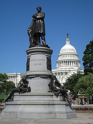
James A. Garfield Monument
Statue by John Quincy Adams Ward in Washington, D.C., U.S.
Distance: Approx. 150 meters
Latitude and longitude: 38.8889848,-77.0123282
The James A. Garfield Monument stands on the grounds of the United States Capitol in Garfield Circle, a traffic circle at First Street and Maryland Avenue SW in Washington, D.C. It is a memorial to U.S. President James A. Garfield, who was elected in 1880 and assassinated in 1881 after serving only four months of his term. The perpetrator was an attorney and disgruntled office-seeker named Charles J. Guiteau. Garfield lived for several weeks after the shooting, but eventually succumbed to his injuries.

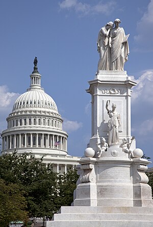
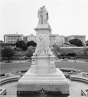
Peace Monument
Monument at the United States Capitol
Distance: Approx. 151 meters
Latitude and longitude: 38.89063333,-77.01233056
The Peace Monument, also known as the Navy Monument, Naval Monument or Navy-Peace Monument, stands on the western edge of the United States Capitol Complex in Washington, D.C. It is in the middle of Peace Circle, where First Street and Pennsylvania Avenue NW intersect. The surrounding area is Union Square, which the monument shares with the Ulysses S. Grant Memorial, James A. Garfield Monument, and the Capitol Reflecting Pool. The front of the monument faces west towards the National Mall while the east side faces the United States Capitol.

Peace Circle
Traffic circle in Washington, D.C.
Distance: Approx. 144 meters
Latitude and longitude: 38.8905,-77.0123
Peace Circle is a traffic circle in Washington, D.C., located at the intersection of Pennsylvania Avenue and First Street NW. At its center is the Peace Monument, also known as the Naval Memorial. It is a monument to the naval deaths during the American Civil War. The monument is topped by the allegorical sculptures of Grief and History.

Capitol Reflecting Pool
Reflecting pool in Washington, D.C., U.S.
Distance: Approx. 0 meters
Latitude and longitude: 38.8898,-77.0137
The Capitol Reflecting Pool is a reflecting pool in Washington, D.C., United States. It lies to the west of the United States Capitol and is the westernmost element of the Capitol grounds (or the easternmost element of the National Mall, according to some reckonings). The Capitol Dome and the Ulysses S. Grant Memorial are reflected in its waters.
Purple Tunnel of Doom
Distance: Approx. 59 meters
Latitude and longitude: 38.8897468,-77.0143747
Purple Tunnel of Doom was the name ascribed to the I-395 Third Street tunnel in downtown Washington, D.C., where thousands of holders of purple tickets lined up to witness the first inauguration of Barack Obama on January 20, 2009. Ticket colors corresponded to assigned viewing areas. Many were not admitted, despite having stood in line for hours.

Union Square (Washington, D.C.)
Public plaza in Washington, D.C.
Distance: Approx. 0 meters
Latitude and longitude: 38.8898,-77.0137
Union Square is an 11-acre public plaza at the foot of Capitol Hill in Washington, D.C., United States. It encompasses the Ulysses S. Grant Memorial (1924) and the 6-acre Capitol Reflecting Pool (1971) and is just west of the United States Capitol building. Views differ as to whether the Square is just east of the National Mall or is itself the eastern end.
Bartholdi Park
Park in Washington, D.C., U.S.
Distance: Approx. 209 meters
Latitude and longitude: 38.888,-77.013
Bartholdi Park is a public park named after French sculptor Frédéric Auguste Bartholdi, who is known primarily for designing the Statue of Liberty. It is located at the corner of Independence Avenue and Washington Avenue. Bartholdi Park is part of the United States Botanic Garden located on the grounds of the United States Capitol.
Killing of Ashli Babbitt
2021 shooting in the U.S. Capitol Building
Distance: Approx. 224 meters
Latitude and longitude: 38.88972222,-77.01111111
On January 6, 2021, Ashli Babbitt was fatally shot during the attack on the United States Capitol. She was part of a crowd of supporters of then U.S. president Donald Trump who breached the United States Capitol building seeking to overturn his defeat in the 2020 presidential election. Babbitt's attempt to climb through a shattered window beside a barricaded door into the Speaker's Lobby was thwarted when she was shot in the left shoulder by a United States Capitol Police (USCP) officer.
Weather in this IP's area
few clouds
15 Celsius
14 Celsius
13 Celsius
16 Celsius
1022 hPa
42 %
1022 hPa
1020 hPa
10000 meters
8.75 m/s
11.83 m/s
10 degree
20 %
06:48:00
16:56:43

