162.118.103.139 - IP Lookup: Free IP Address Lookup, Postal Code Lookup, IP Location Lookup, IP ASN, Public IP
Country:
Region:
City:
Location:
Time Zone:
Postal Code:
ISP:
ASN:
language:
User-Agent:
Proxy IP:
Blacklist:
IP information under different IP Channel
ip-api
Country
Region
City
ASN
Time Zone
ISP
Blacklist
Proxy
Latitude
Longitude
Postal
Route
db-ip
Country
Region
City
ASN
Time Zone
ISP
Blacklist
Proxy
Latitude
Longitude
Postal
Route
IPinfo
Country
Region
City
ASN
Time Zone
ISP
Blacklist
Proxy
Latitude
Longitude
Postal
Route
IP2Location
162.118.103.139Country
Region
south carolina
City
sumter
Time Zone
America/New_York
ISP
Language
User-Agent
Latitude
Longitude
Postal
ipdata
Country
Region
City
ASN
Time Zone
ISP
Blacklist
Proxy
Latitude
Longitude
Postal
Route
Popular places and events near this IP address

Sumter, South Carolina
City in Sumter County, South Carolina, United States
Distance: Approx. 23 meters
Latitude and longitude: 33.92055556,-80.34166667
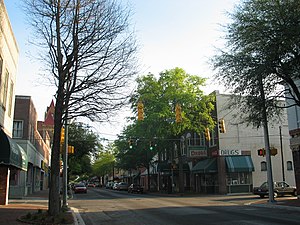
Sumter ( SUM-tər) is a city in and the county seat of Sumter County, South Carolina, United States. The city makes up the Sumter, SC Metropolitan Statistical Area. Sumter County, along with Clarendon and Lee counties, form the core of Sumter–Lee–Clarendon tri-county (or East Midlands) area of South Carolina that includes three counties straddling the border of the Sandhills (or Midlands), Pee Dee, and Lowcountry regions.
Riley Park (Sumter)
Stadium in Sumter, South Carolina, US
Distance: Approx. 1659 meters
Latitude and longitude: 33.934891,-80.345673
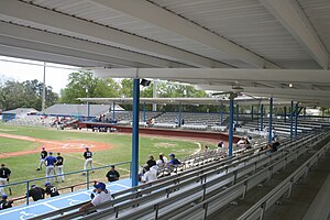
Riley Park is a stadium in Sumter, South Carolina, located at Church Street & DuBose Street, 29150. It is primarily used for baseball, has housed Sumter minor league baseball teams and is currently home to the University of South Carolina Sumter Fire Ants and Morris College Hornet baseball teams.
St. Francis Xavier High School (Sumter, South Carolina)
Private school in Sumter, South Carolina, United States
Distance: Approx. 1484 meters
Latitude and longitude: 33.91916667,-80.3575
St. Francis Xavier High School was a private, Roman Catholic high school in Sumter, South Carolina, United States. It is run independently of the Roman Catholic Diocese of Charleston.
Temple Sinai (Sumter, South Carolina)
Historic Reform synagogue in South Carolina, United States
Distance: Approx. 505 meters
Latitude and longitude: 33.92158333,-80.34677778
Temple Sinai, also known as Congregation Sinai, whose official name is the Sumter Society of Israelites, is an historic Reform Jewish congregation and synagogue, located at 11-13 Church Street, on the corner of West Hampton Avenue, in Sumter, South Carolina, in the United States. Built in 1912 of brick in the Moorish Revival style, Temple Sinai was added to the National Register of Historic Places on January 21, 1999. It also houses the Temple Sinai Jewish History Center that opened in June 2018.
Sumter County Courthouse (South Carolina)
United States historic place
Distance: Approx. 450 meters
Latitude and longitude: 33.92444444,-80.34138889
The Sumter County Courthouse, built in 1907, is an historic courthouse located at 141 North Main Street in the city of Sumter in Sumter County, South Carolina. It was designed in the Beaux Arts style by Darlington native William Augustus Edwards who designed eight other South Carolina courthouses as well as academic buildings at 12 institutions in Florida, Georgia and South Carolina. It was built in an I-shape.
O'Donnell House (Sumter, South Carolina)
Historic house in South Carolina, United States
Distance: Approx. 240 meters
Latitude and longitude: 33.91944444,-80.33916667
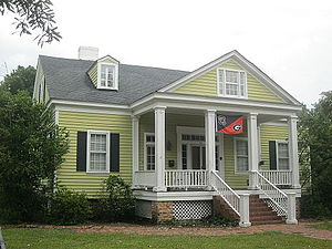
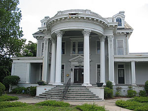
The O'Donnell House in Sumter, South Carolina, also known as Haynsworth-Bogin-O'Donnell House or as Shelley-Brunson Funeral Home, was built in 1840. It was listed on the National Register of Historic Places in 1996.
Henry Lee Scarborough House
Historic house in South Carolina, United States
Distance: Approx. 887 meters
Latitude and longitude: 33.92833333,-80.34055556
Henry Lee Scarborough House, also known as Scarborough Homeplace, is a historic home located at Sumter, Sumter County, South Carolina. It was built in 1908–1909, and is a two-story, three-bay, frame Neo-Classical style dwelling. It features a full height portico supported by four massive columns with Corinthian order capitals.
Elizabeth White House
Historic house in South Carolina, United States
Distance: Approx. 854 meters
Latitude and longitude: 33.92805556,-80.34083333
Elizabeth White House is a historic home in Sumter, Sumter County, South Carolina. It was built about 1854, and is a 1 1/2-story vernacular Greek Revival cottage. The front facade features a pedimented one-story portico supported by four square columns.
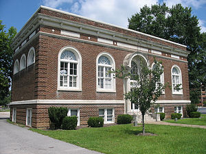
Carnegie Public Library (Sumter, South Carolina)
United States historic place
Distance: Approx. 452 meters
Latitude and longitude: 33.92055556,-80.34638889
Carnegie Public Library is a historic Carnegie library building located at Sumter, Sumter County, South Carolina. It was built in 1916–1917, and is a two-story, brick Beaux-Arts style building. The front facade features four arched windows with limestone surrounds and the main entryway flanked by two Ionic order columns.
Sumter Town Hall-Opera House
United States historic place
Distance: Approx. 51 meters
Latitude and longitude: 33.92083333,-80.34166667
Sumter Town Hall-Opera House, also known as the Sumter Academy of Music, is a historic town hall building located at Sumter, Sumter County, South Carolina. It was built in 1893, and is a four-story, ashlar brick Richardsonian Romanesque style building. It features a four-faced clock tower that serves as a focal point for the entire area.
Sumter Historic District
Historic district in South Carolina, United States
Distance: Approx. 21 meters
Latitude and longitude: 33.92027778,-80.34166667
Sumter Historic District is a national historic district located at Sumter, Sumter County, South Carolina. It encompasses 62 contributing buildings in the central business district of Sumter. It includes buildings that primarily date from 1880 to 1912.

Lincoln High School (Sumter, South Carolina)
United States historic place
Distance: Approx. 530 meters
Latitude and longitude: 33.91888889,-80.34694444
Lincoln High School is a historic school building at 20-26 Council Street in Sumter, South Carolina. A relatively modern structure, it was built in 1937 to serve the community's African-American student population, which it did until the schools were integrated in 1969. The school also served as a focal point for the African American community as a place for civic meetings and social events.
Weather in this IP's area
clear sky
-4 Celsius
-4 Celsius
-4 Celsius
-3 Celsius
1028 hPa
83 %
1028 hPa
1022 hPa
10000 meters
