Country:
 Thailand
Region:
City:
Latitude and Longitude:
Time Zone:
Postal Code:
IP information under different IP Channel
ip-api
Country
Region
City
ASN
Time Zone
ISP
Blacklist
Proxy
Latitude
Longitude
Postal
Route
IPinfo
Country
Region
City
ASN
Time Zone
ISP
Blacklist
Proxy
Latitude
Longitude
Postal
Route
MaxMind
Country
Region
City
ASN
Time Zone
ISP
Blacklist
Proxy
Latitude
Longitude
Postal
Route
Luminati
Country
THASN
Time Zone
Asia/Bangkok
ISP
Symphony Communication Thailand PCL.
Latitude
Longitude
Postal
db-ip
Country
Region
City
ASN
Time Zone
ISP
Blacklist
Proxy
Latitude
Longitude
Postal
Route
ipdata
Country
Region
City
ASN
Time Zone
ISP
Blacklist
Proxy
Latitude
Longitude
Postal
Route
Popular places and events near this IP address
Saint John's International School (Thailand)
Private international school
Distance: Approx. 528 meters
Latitude and longitude: 13.809378,100.562732
Saint John's International School (Thai: โรงเรียนนานาชาติเซนต์จอห์น, RTGS: Rong Rian Nana Chat Sen Chon) (SJIS) was an international school located in Chatuchak District, Bangkok, Thailand. It was established in 1991 by Ajarn Samai Chinnapa within Saint John's Group of Schools and University (established in 1961). The school closed in June 2017.

Chatuchak Park
Public park in Bangkok, Thailand
Distance: Approx. 265 meters
Latitude and longitude: 13.80805556,100.55555556
Chatuchak Park (Thai: สวนจตุจักร, RTGS: Suan Chatuchak, pronounced [sǔa̯n t͡ɕàʔ.tùʔ.t͡ɕàk]) is a public park in the southwest part of Chatuchak District, Bangkok, Thailand. It is also the name of the Chatuchak Park MRT station that lies under the park. Its name is the origin name of Chatuchak district.

Union Mall
Shopping mall in Chatuchak, Bangkok
Distance: Approx. 729 meters
Latitude and longitude: 13.813587,100.561841
Union Mall is a shopping mall in the north of Bangkok, at the Lat Phrao junction. The mall opened in February 2006. It has eight floors with a total of 150,000 square metres (1,600,000 sq ft) of space.

Sun Towers
Distance: Approx. 98 meters
Latitude and longitude: 13.8083,100.5589
Suntowers is a high-rise building complex in the Chatuchak District, Bangkok, Thailand.
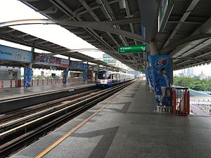
Mo Chit BTS station
Railway station in Bangkok, Thailand
Distance: Approx. 771 meters
Latitude and longitude: 13.80258333,100.55383333
Mo Chit Station (Thai: สถานีหมอชิต, pronounced [sā.tʰǎː.nīː mɔ̌ː t͡ɕʰít]) is a BTS Skytrain station, on the Sukhumvit Line in Chatuchak District, Bangkok, Thailand. The station is on the Phahon Yothin Highway between Soi Phahon Yothin 18 and Soi Phahon Yothin 20. The station is named after the former Mo Chit Bus Terminal, which previously occupied the area, and was the northern terminus of the Sukhumvit Line until 9 August 2019 when Ha Yaek Lat Phrao BTS station opened.
Hall of Railway Heritage
Distance: Approx. 338 meters
Latitude and longitude: 13.811056,100.556938
Hall of Railway Heritage (Thai: หอเกียรติภูมิรถไฟ) used to be a museum in Bangkok, Thailand, which is now defunct. It was a museum dedicated to trains and the railway. It was located on the western side of Chatuchak Park adjacent to Kamphaeng Phet Road.
Samui Centre of Learning
International school in Thailand
Distance: Approx. 528 meters
Latitude and longitude: 13.809378,100.562732
Samui Centre of Learning (Thai: โรงเรียนนานาชาติเอสซีแอล, RTGS: Rong Rian Nana Chat Aet Si Aaen), Koh Samui, Thailand, (SCL) closed permanently in April 2018. It was an international school established in 2004 by Phillip Olson, Rachel Anderson and Roz Thompson. The school offered a mixed international curriculum from nursery to secondary (nursery-Year 11).
Phahon Yothin MRT station
Railway station in Bangkok, Thailand
Distance: Approx. 679 meters
Latitude and longitude: 13.8129,100.562
Phahon Yothin station (Thai: สถานีพหลโยธิน, pronounced [sā.tʰǎː.nīː pʰā.hǒn jōː.tʰīn]) is a Bangkok MRT station on the Blue Line located under Lat Phrao Road and Phahon Yothin Road, which the station is named after, near Lat Phrao Square. The station is important for people who live in Northern Bangkok such as the Don Mueang, Lak Si and Bang Khen districts. Its symbol color is yellow., and connect to the BTS Sukhumvit Line at Ha Yaek Lat Phrao station.

Chatuchak Park MRT station
Railway station in Bangkok, Thailand
Distance: Approx. 750 meters
Latitude and longitude: 13.8027,100.554
Chatuchak Park station (Thai: สถานีสวนจตุจักร, RTGS: Sathani Suan Chatuchak, pronounced [sā.tʰǎː.nīː sǔa̯n t͡ɕàʔ.tùʔ.t͡ɕàk]) is a Bangkok MRT station on the Blue Line. It is located under the eastern part of Chatuchak Park. It is also located near the eastern exit of the Chatuchak Weekend Market.

Wachirabenchathat Park
Park in Bangkok, Thailand
Distance: Approx. 605 meters
Latitude and longitude: 13.812,100.554
Wachirabenchathat Park, or often spelled Vachirabenjatas Park (Thai: สวนวชิรเบญจทัศ, RTGS: Suan Wachirabenchathat, pronounced [sǔan wá(ʔ).tɕʰī.rá(ʔ).bēn.tɕā.tʰát]), also popularly known as State Railway Public Park (สวนรถไฟ, RTGS: Suan Rotfai, pronounced [sǔan rót.fāj]) is a name of public park in Chatuchak district, Bangkok, Thailand. The park borders on the Queen Sirikit Park and Chatuchak Park, and it is also the largest park of the complex, bounded by Kamphaeng Phet 3 road and Kamphaeng Phet 2 road with Soi Nikhom Rotfai Sai 1 near PTT Head Office and Ministry of Energy. It is one of the most popular parks in Bangkok.

Lat Phrao Intersection
Road intersection in Bangkok, Thailand
Distance: Approx. 592 meters
Latitude and longitude: 13.81333333,100.55944444
Lat Phrao Intersection (Thai: ห้าแยกลาดพร้าว, pronounced [hâː jɛ̂ːk lâːt pʰráːw]) is a major road junction in Chatuchak District of the Thai capital Bangkok. It is where Phahonyothin and Vibhavadi Rangsit roads—the city's two main northward highways—cross each other, and is also the beginning of Lat Phrao Road, which leads eastward through its highly populated suburbs. The junction carries the second-highest amount of road traffic in the city.

Mo Chit Bus Terminal
Distance: Approx. 823 meters
Latitude and longitude: 13.80166667,100.55444444
The (old) Mo Chit Bus Terminal was the main bus station serving northern and northeastern routes of long-distance buses travelling to and from Bangkok. It was active from 1967 to 1998, when its operations moved to the Bangkok Bus Terminal (Chatuchak), which then became known as New Mo Chit. The site of the old bus station now serves as the main depot of the BTS skytrain system, as well as one of its parking areas.
Weather in this IP's area
scattered clouds
33 Celsius
38 Celsius
32 Celsius
33 Celsius
1005 hPa
55 %
1005 hPa
1004 hPa
10000 meters
6.17 m/s
230 degree
40 %
06:06:38
18:24:38