161.170.228.202 - IP Lookup: Free IP Address Lookup, Postal Code Lookup, IP Location Lookup, IP ASN, Public IP
Country:
Region:
City:
Location:
Time Zone:
Postal Code:
IP information under different IP Channel
ip-api
Country
Region
City
ASN
Time Zone
ISP
Blacklist
Proxy
Latitude
Longitude
Postal
Route
Luminati
Country
ASN
Time Zone
America/Chicago
ISP
ASN-CXA-ALL-CCI-22773-RDC
Latitude
Longitude
Postal
IPinfo
Country
Region
City
ASN
Time Zone
ISP
Blacklist
Proxy
Latitude
Longitude
Postal
Route
IP2Location
161.170.228.202Country
Region
arkansas
City
fayetteville
Time Zone
America/Chicago
ISP
Language
User-Agent
Latitude
Longitude
Postal
db-ip
Country
Region
City
ASN
Time Zone
ISP
Blacklist
Proxy
Latitude
Longitude
Postal
Route
ipdata
Country
Region
City
ASN
Time Zone
ISP
Blacklist
Proxy
Latitude
Longitude
Postal
Route
Popular places and events near this IP address

Fayetteville, Arkansas
City in Arkansas, United States
Distance: Approx. 29 meters
Latitude and longitude: 36.0625,-94.1575
Fayetteville () is the second-most populous city in the U.S. state of Arkansas, the county seat of Washington County, and the most populous city in Northwest Arkansas. The city had a population of 93,949 as of the 2020 census, which was estimated to have increased to 101,680 by 2023. The city is on the outskirts of the Boston Mountains, within the Ozarks.
Maxine's Tap Room
Distance: Approx. 345 meters
Latitude and longitude: 36.063965,-94.160648
Maxine's Tap Room is a historic bar in Fayetteville, Arkansas.
Lynn Shelton American Legion Post No. 27
United States historic place
Distance: Approx. 73 meters
Latitude and longitude: 36.06194444,-94.15722222
The Lynn Shelton American Legion Post No. 27 is a historic clubhouse at 28 South College Avenue in Fayetteville, Arkansas. It is a two-story stone building, designed by local architect T. Ewing Shelton and built in 1939–40.

Washington County Courthouse (Arkansas)
Courthouse in Arkansas
Distance: Approx. 29 meters
Latitude and longitude: 36.0625,-94.1575
The Washington County Courthouse is the name of a current courthouse and that of a historic one in Fayetteville, Arkansas, the county seat of Washington County. The historic building, built in 1905, was listed on the National Register of Historic Places in 1972. The historic courthouse is the fifth building to serve Washington County, with the prior buildings located on the Historic Square where the Old Post Office is today.

Fayetteville Historic Square
United States historic place
Distance: Approx. 231 meters
Latitude and longitude: 36.06222222,-94.15972222
The Fayetteville Historic Square (usually shortened to Fayetteville Square or just The Square), in Fayetteville, Arkansas, includes the original Fayetteville post office, the Old Bank of Fayetteville Building, the Lewis Brothers Building, the Mrs. Young Building, and the Guisinger Building. These buildings are listed in the National Register of Historic Places.

Battle of Fayetteville (1863)
Battle of the American Civil War
Distance: Approx. 466 meters
Latitude and longitude: 36.06677778,-94.15688889
The Battle of Fayetteville, also known as the Action at Fayetteville, took place during the American Civil War on April 18, 1863, in Fayetteville, Arkansas.

Washington County Jail (Fayetteville, Arkansas)
United States historic place
Distance: Approx. 107 meters
Latitude and longitude: 36.06166667,-94.1575
The Washington County Jail is a historic former civic building at 90 South College Avenue in Fayetteville, Arkansas. Built in 1896, this building was the fourth to serve as county jail, and was in use until 1973, making it the longest tenured in county history. The Romanesque Revival building was designed by W. B. Reese, and is locally unusual and distinctive for its medieval appearance.

Fayetteville Confederate Cemetery
Historic cemetery in Washington County, Arkansas
Distance: Approx. 420 meters
Latitude and longitude: 36.06138889,-94.15277778
Fayetteville Confederate Cemetery is a cemetery for soldiers of the Confederate States located on the eastern side of Fayetteville in Washington County, Arkansas. Added to the National Register of Historic Places (NRHP) in 1993, the cemetery encompasses 3.5 acres (1.4 ha).

Ridge House (Fayetteville, Arkansas)
Historic house in Arkansas, United States
Distance: Approx. 76 meters
Latitude and longitude: 36.06277778,-94.15638889
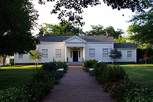
The Ridge House is a historic house at 230 West Center street in Fayetteville, Arkansas. It is owned by the Washington County Historical Society, and is open for tours by appointment. At the core of this two-story clapboarded house is a log dog trot structure, built c.

John Paul Hammerschmidt Federal Building
Office building in Fayetteville, Arkansas
Distance: Approx. 169 meters
Latitude and longitude: 36.061586,-94.158599
The John Paul Hammerschmidt Federal Building, located 1/2 block off the Fayetteville Historic Square in downtown Fayetteville, Arkansas is home to the Fayetteville division of the United States District Court for the Western District of Arkansas.
Ellis Building
United States historic place
Distance: Approx. 403 meters
Latitude and longitude: 36.065,-94.16055556
The Ellis Building is a historic commercial building at 208 North Block Avenue in Fayetteville, Arkansas. It is a single-story brick building, with a hip roof that has a rounded top section. The roof's shape is obscured from the front by a low stepped parapet.
Arkansas College (Fayetteville, Arkansas)
Distance: Approx. 323 meters
Latitude and longitude: 36.0655,-94.157
Arkansas College was founded in Fayetteville, Arkansas in 1850 by pastor Robert Graham (1822-1901). In 1852, it was the first school to receive a school charter from the state of Arkansas. In 1859, William Baxter became the second president of the college.
Weather in this IP's area
heavy intensity rain
7 Celsius
6 Celsius
6 Celsius
8 Celsius
1021 hPa
94 %
1021 hPa
970 hPa
4828 meters
1.54 m/s
60 degree
100 %
