161.164.189.17 - IP Lookup: Free IP Address Lookup, Postal Code Lookup, IP Location Lookup, IP ASN, Public IP
Country:
Region:
City:
Location:
Time Zone:
Postal Code:
IP information under different IP Channel
ip-api
Country
Region
City
ASN
Time Zone
ISP
Blacklist
Proxy
Latitude
Longitude
Postal
Route
Luminati
Country
ASN
Time Zone
America/Chicago
ISP
MILLICOM CABLE COSTA RICA S.A.
Latitude
Longitude
Postal
IPinfo
Country
Region
City
ASN
Time Zone
ISP
Blacklist
Proxy
Latitude
Longitude
Postal
Route
IP2Location
161.164.189.17Country
Region
arkansas
City
bentonville
Time Zone
America/Chicago
ISP
Language
User-Agent
Latitude
Longitude
Postal
db-ip
Country
Region
City
ASN
Time Zone
ISP
Blacklist
Proxy
Latitude
Longitude
Postal
Route
ipdata
Country
Region
City
ASN
Time Zone
ISP
Blacklist
Proxy
Latitude
Longitude
Postal
Route
Popular places and events near this IP address

Bentonville High School
Public school in Bentonville, Arkansas, United States
Distance: Approx. 3351 meters
Latitude and longitude: 36.35055556,-94.19555556
Bentonville High School (BHS) is a public high school in Bentonville, Arkansas, United States. Founded in 1910, the school provides education for students in grades nine through twelve. It is one of two high schools of the Bentonville School District.
Walmart NW Arkansas Championship
Golf tournament
Distance: Approx. 3268 meters
Latitude and longitude: 36.297,-94.199
The Walmart NW Arkansas Championship is an annual women's professional golf tournament on the LPGA Tour in Rogers, Arkansas, north of Fayetteville. First played seventeen years ago in 2007, all editions of the tournament have been played at Pinnacle Country Club. Procter & Gamble (P&G), a manufacturer of a wide range of consumer goods, became the title sponsor in 2008.
Township 5, Benton County, Arkansas
Township in Arkansas, United States
Distance: Approx. 3944 meters
Latitude and longitude: 36.33583333,-94.14055556
Township 5 is one of thirteen current townships in Benton County, Arkansas, USA. As of the 2010 census, its total population was 12,792.

Pinnacle Hills Promenade
Retail lifestyle center, Rogers, Arkansas, U.S.
Distance: Approx. 2105 meters
Latitude and longitude: 36.30444,-94.17529
Pinnacle Hills Promenade is a retail lifestyle center in Rogers, Arkansas. Opened in 2006, it features Bass Pro Shops, Dillard's, J. C. Penney, Target, and Best Buy as its anchor stores. It also includes a Malco Theatres movie theater and Dave & Buster's.

Walmart Arkansas Music Pavilion
Outdoor amphitheater, Rogers, Arkansas, USA
Distance: Approx. 2212 meters
Latitude and longitude: 36.30292,-94.1838
The Walmart Arkansas Music Pavilion (originally known as the Arkansas Music Pavilion and commonly known as the Walmart AMP) is an outdoor amphitheater located in Rogers, Arkansas. The venue opened in June 2005 as a semi-permanent venue, becoming a permanent venue in 2014. Its capacity is now 11,000 fans.
James House (Rogers, Arkansas)
Historic house in Arkansas, United States
Distance: Approx. 2920 meters
Latitude and longitude: 36.3077,-94.2081
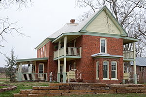
The James House is a historic house on Benton County Route 51 (S. Rainbow Road), between Osage Creek and Sunbridge Lane outside Rogers, Arkansas. Built c. 1903, the house is a high-quality brick version of a locally distinctive architectural style known as a "Prow house". It is an American Foursquare two-story structure with a truncated pyramidal roof, with a gable-roofed section that projects forward, giving the house a T shape with the stem facing forward.

Lillard-Sprague House
Historic house in Arkansas, United States
Distance: Approx. 3767 meters
Latitude and longitude: 36.28944444,-94.18916667
The Lillard-Sprague House was a historic house on Pleasant Grove Street in Rogers, Arkansas. Built in 1907, it was a wood-frame example of a prow house, a local style with T-shaped layout where the stem of the T projects forward. In this instance, the projecting section was surrounded by a single-story wraparound porch, supported by Tuscan columns on stone piers.
Putman Cemetery
Historic cemetery in Arkansas, United States
Distance: Approx. 1637 meters
Latitude and longitude: 36.33638889,-94.18805556
The Putnam Cemetery is a historic cemetery on SE Metro Parkway, just south of Walton Boulevard, in Bentonville, Arkansas. Now completely surrounded by commercial development, this small cemetery (less than 0.5 acres (0.20 ha)) is ringed by an iron fence with an arch identifying it, and is located just behind hotels that front on Walton Boulevard. The cemetery was established in 1860, and was the family burial ground of the Putnam family, who were some of Benton County's earliest settlers.

Razorback Regional Greenway
Off-road shared-use trail in Northwest Arkansas
Distance: Approx. 1650 meters
Latitude and longitude: 36.33565,-94.19035
The Northwest Arkansas Razorback Regional Greenway (usually shortened to Razorback Regional Greenway or just Greenway in Northwest Arkansas) is a 40 miles (64 km) primarily off-road shared-use trail in Northwest Arkansas. Dedicated on May 2, 2015, the Greenway connects Kessler Mountain Regional Park in Fayetteville, Arkansas to north of Lake Bella Vista in Bella Vista, Arkansas, while also serving schools, businesses and other cultural amenities along the route. In 2023 the Greenway was designated as a National Recreation Trail and was added to the National Trail System.
Arkansas Anime Festival
Anime Convention
Distance: Approx. 2818 meters
Latitude and longitude: 36.33611111,-94.20805556
Arkansas Anime Festival (A2F) is an annual three-day anime convention held in June/July at the Four Points by Sheraton Bentonville in Bentonville, Arkansas. It is the largest anime convention in the state of Arkansas and is family friendly.
Osage Spring
Distance: Approx. 861 meters
Latitude and longitude: 36.315,-94.18055556
Osage Spring is a spring in Benton County in northwest Arkansas. The spring lies one mile southwest of the city of Rogers. The spring stream flows to the northwest and enters Osage Creek about one quarter mile from its source.

Pinnacle Country Club
Distance: Approx. 3268 meters
Latitude and longitude: 36.297,-94.199
Pinnacle Country Club is a private country club and golf course in the Southern United States, located in Rogers, Arkansas, within the Northwest Arkansas metro. Founded 37 years ago in 1988 as Champions Country Club, the course opened in 1990. Originally designed by Don Sechrest and tour pro Bruce Lietzke, it was redesigned by Randy Heckenkemper in 2008.
Weather in this IP's area
clear sky
-8 Celsius
-14 Celsius
-9 Celsius
-8 Celsius
1038 hPa
80 %
1038 hPa
987 hPa
10000 meters
3.6 m/s
320 degree

