161.132.49.195 - IP Lookup: Free IP Address Lookup, Postal Code Lookup, IP Location Lookup, IP ASN, Public IP
Country:
Region:
City:
Location:
Time Zone:
Postal Code:
ISP:
ASN:
language:
User-Agent:
Proxy IP:
Blacklist:
IP information under different IP Channel
ip-api
Country
Region
City
ASN
Time Zone
ISP
Blacklist
Proxy
Latitude
Longitude
Postal
Route
db-ip
Country
Region
City
ASN
Time Zone
ISP
Blacklist
Proxy
Latitude
Longitude
Postal
Route
IPinfo
Country
Region
City
ASN
Time Zone
ISP
Blacklist
Proxy
Latitude
Longitude
Postal
Route
IP2Location
161.132.49.195Country
Region
apurimac
City
san pedro de cachora
Time Zone
America/Lima
ISP
Language
User-Agent
Latitude
Longitude
Postal
ipdata
Country
Region
City
ASN
Time Zone
ISP
Blacklist
Proxy
Latitude
Longitude
Postal
Route
Popular places and events near this IP address
Abancay
Town in Apurímac, Peru
Distance: Approx. 5 meters
Latitude and longitude: -13.63333333,-72.88333333
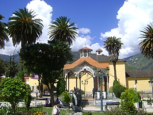
Abancay (from Quechua language: Hamanqay, Amanqay, or Amankay, meaning lily), founded in 1572 as Santiago de los Reyes de Abancay, is a city in southern-central Peru. It is the capital of both the Apurímac Region and the Abancay Province, and serves an important cultural, economic, and political role in Apurímac.

Ampay National Sanctuary
Distance: Approx. 6088 meters
Latitude and longitude: -13.579,-72.89
Ampay National Sanctuary (Santuario Nacional de Ampay) is a wildlife sanctuary established in 1987. It is located in the district of Tamburco, just north of the city of Abancay, Peru. Its 36.35 square kilometres (14.03 sq mi), which include Mount Ampay, protect the Pachachaca River basin and several endangered plant species, being the most representative the conifer called Intimpa (Podocarpus glomeratus).
Abancay province
Province in Apurímac, Peru
Distance: Approx. 261 meters
Latitude and longitude: -13.634,-72.881
Abancay is one of seven provinces of the Apurímac Region in Peru. The capital of the province is the city of Abancay.

Abancay District
District in Apurímac, Peru
Distance: Approx. 246 meters
Latitude and longitude: -13.63388889,-72.88111111
Abancay District is one of the nine districts of the Abancay Province in Peru.
Tamburco District
District in Apurímac, Peru
Distance: Approx. 2248 meters
Latitude and longitude: -13.61694444,-72.87111111
Tamburco District is one of the nine districts of the province Abancay in Peru.
Battle of Abancay
Battle that took place during the Spanish conquest of Peru
Distance: Approx. 5 meters
Latitude and longitude: -13.63333333,-72.88333333
The Battle of Abancay took place during the Spanish conquest of Peru. Alonso de Alvarado, sent by Francisco Pizarro to relieve the siege of Cusco, was camped at Jauja with five hundred men. He guarded the bridge and a ford on the Rio de Abancay, awaiting Almagro's men.
Universidad Nacional Micaela Bastidas de Apurímac
Distance: Approx. 2456 meters
Latitude and longitude: -13.617,-72.868
Universidad Nacional Micaela Bastidas de Apurímac is a university in Abancay, Peru.
Lake Uspaccocha
Lake in Peru
Distance: Approx. 6574 meters
Latitude and longitude: -13.57444444,-72.88833333
Lake Uspaccocha or Uspaycocha (possibly from Quechua uspha, uchpha ash, rest of combustion, qucha lake, lagoon, "ash lake") is a lake in the Andes of Peru located in the Apurímac Region, Abancay Province, Abancay District. It is situated in the Ampay National Sanctuary, at 3750 meters above sea level, north of the city of Abancay.
Estadio Monumental de Condebamba
Multi-use stadium in Abancay
Distance: Approx. 1235 meters
Latitude and longitude: -13.6339,-72.8719
Estadio Monumental de Condebamba is a multi-use stadium in Abancay, Peru. It is currently used mostly for football matches and is the home stadium of Deportivo Educación of the Copa Perú. The stadium holds 12,000 spectators.
Usnu Muqu
Archaeological site in Peru
Distance: Approx. 1810 meters
Latitude and longitude: -13.62111111,-72.87222222
Usnu Muqu (Quechua usnu altar; a special platform for important celebrations, muqu hill, "usnu hill", also spelled Usno Moqo, Usnomoqo) is an archaeological site in Peru. It is located in the Apurímac Region, Abancay Province, Tamburco District, near the main square of Tamburco.

Ampay
Mountain in Peru
Distance: Approx. 9827 meters
Latitude and longitude: -13.55944444,-72.93305556
Ampay is a 5,235-metre-high (17,175 ft) mountain in the Andes of Peru. It is located in the Apurímac Region, Abancay Province, on the border of the districts of Abancay, Huanipaca and Tamburco. The mountain lies in the Ampay National Sanctuary.

Q'illu Q'asa
Mountain in Peru
Distance: Approx. 7516 meters
Latitude and longitude: -13.575,-72.91833333
Q'illu Q'asa (Quechua q'illu yellow, q'asa mountain pass, "yellow mountain pass", hispanicized spelling Jellojasa) is a mountain in the Andes of Peru, about 5,000 metres (16,404 ft) high. It is located in the Apurímac Region, Abancay Province, on the border of the districts of Abancay and Tamburco. Q'illu Q'asa lies southeast of Ampay and west of a lake named Usphaqucha.
Weather in this IP's area
overcast clouds
13 Celsius
13 Celsius
13 Celsius
13 Celsius
1017 hPa
92 %
1017 hPa
691 hPa
10000 meters
0.84 m/s
1.44 m/s
299 degree
100 %

