161.132.47.185 - IP Lookup: Free IP Address Lookup, Postal Code Lookup, IP Location Lookup, IP ASN, Public IP
Country:
Region:
City:
Location:
Time Zone:
Postal Code:
IP information under different IP Channel
ip-api
Country
Region
City
ASN
Time Zone
ISP
Blacklist
Proxy
Latitude
Longitude
Postal
Route
Luminati
Country
ASN
Time Zone
America/Lima
ISP
Red Cientifica Peruana
Latitude
Longitude
Postal
IPinfo
Country
Region
City
ASN
Time Zone
ISP
Blacklist
Proxy
Latitude
Longitude
Postal
Route
IP2Location
161.132.47.185Country
Region
puno
City
desaguadero
Time Zone
America/Lima
ISP
Language
User-Agent
Latitude
Longitude
Postal
db-ip
Country
Region
City
ASN
Time Zone
ISP
Blacklist
Proxy
Latitude
Longitude
Postal
Route
ipdata
Country
Region
City
ASN
Time Zone
ISP
Blacklist
Proxy
Latitude
Longitude
Postal
Route
Popular places and events near this IP address

Zepita
Distance: Approx. 9594 meters
Latitude and longitude: -16.5,-69.1
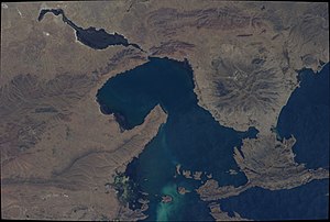
Zepita is a town in the Chucuito Province south of Lake Titicaca in the Puno Region of Peru. It has a population of 19,884.
Desaguadero District
District in Puno, Peru
Distance: Approx. 594 meters
Latitude and longitude: -16.5648,-69.0472
Desaguadero District is one of seven districts of the province Chucuito in Puno Region, Peru.

Desaguadero, Bolivia-Peru
Place in Puno Region
Distance: Approx. 901 meters
Latitude and longitude: -16.56666667,-69.03333333
Desaguadero (Spanish for "channel, drain for drawing off superfluous water") or Chaka Marka (Aymara and Quechua for "bridge village") is a town on the Bolivian-Peruvian border. On the Bolivian side it is situated in the La Paz Department, Ingavi Province, Desaguadero Municipality, Desaguadero Canton. On the Peruvian side it lies in the Puno Region, Chucuito Province, Desaguadero District.
Desaguadero Municipality
Municipal section in La Paz Department, Bolivia
Distance: Approx. 9817 meters
Latitude and longitude: -16.6167,-68.9667
Desaguadero Municipality is the fourth municipal section of Ingavi Province in La Paz Department, Bolivia. Its capital is Desaguadero.

Janq'u Jaqhi (Ingavi)
Mountain in Bolivia
Distance: Approx. 8101 meters
Latitude and longitude: -16.59833333,-68.97388889
Janq'u Jaqhi (Aymara janq'u white, jaqhi precipice, cliff, "white cliff", also spelled Jankho Jakke) is a 4,254-metre-high (13,957 ft) mountain in the Chilla-Kimsa Chata mountain range in the Andes of Bolivia. It is situated in the La Paz Department, Ingavi Province, Desaguadero Municipality. Janq'u Jaqhi lies south of Wiñaymarka Lake, the southern branch of Lake Titicaca.

Jilarata (La Paz)
Mountain in the Bolivian Andes
Distance: Approx. 6622 meters
Latitude and longitude: -16.60416667,-68.99444444
Jilarata is a 4,355-metre-high (14,288 ft) mountain in the Chilla-Kimsa Chata mountain range in the Andes of Bolivia. It is located in the La Paz Department, Ingavi Province, Desaguadero Municipality. Jilarata lies south of Wiñaymarka Lake, the southern branch of Lake Titicaca, near Desaguadero and the Peruvian border.
Weather in this IP's area
overcast clouds
11 Celsius
10 Celsius
11 Celsius
11 Celsius
1015 hPa
70 %
1015 hPa
653 hPa
10000 meters
3.76 m/s
3.55 m/s
353 degree
100 %
