161.132.42.199 - IP Lookup: Free IP Address Lookup, Postal Code Lookup, IP Location Lookup, IP ASN, Public IP
Country:
Region:
City:
Location:
Time Zone:
Postal Code:
IP information under different IP Channel
ip-api
Country
Region
City
ASN
Time Zone
ISP
Blacklist
Proxy
Latitude
Longitude
Postal
Route
Luminati
Country
ASN
Time Zone
America/Lima
ISP
Red Cientifica Peruana
Latitude
Longitude
Postal
IPinfo
Country
Region
City
ASN
Time Zone
ISP
Blacklist
Proxy
Latitude
Longitude
Postal
Route
IP2Location
161.132.42.199Country
Region
puno
City
puno
Time Zone
America/Lima
ISP
Language
User-Agent
Latitude
Longitude
Postal
db-ip
Country
Region
City
ASN
Time Zone
ISP
Blacklist
Proxy
Latitude
Longitude
Postal
Route
ipdata
Country
Region
City
ASN
Time Zone
ISP
Blacklist
Proxy
Latitude
Longitude
Postal
Route
Popular places and events near this IP address
Puno
City in south-eastern Peru
Distance: Approx. 1525 meters
Latitude and longitude: -15.84333333,-70.02361111
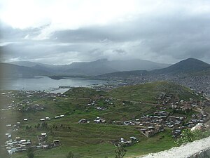
Puno (Aymara and Quechua: Punu) is a city in southeastern Peru, located on the shore of Lake Titicaca. It is the capital city of the Puno Region and the Puno Province with a population of approximately 140,839 (2015 estimate). The city was established in 1668 by viceroy Pedro Antonio Fernández de Castro as capital of the province of Paucarcolla with the name San Juan Bautista de Puno.

Puno province
Province in Puno, Peru
Distance: Approx. 1525 meters
Latitude and longitude: -15.84333333,-70.02361111
Puno is a province in the Puno Region, in southeastern Peru. It borders the provinces of Huancane, San Román, El Collao and the Moquegua Region's province of General Sánchez Cerro. Its capital is the city of Puno, which is located at the edge of Lake Titicaca, the world's highest navigable lake.

Yavari (ship)
British-built Peruvian iron steamship
Distance: Approx. 3963 meters
Latitude and longitude: -15.8259,-69.9971
Yavari is a British-built iron steamship commissioned (along with her sister ship Yapura) by the Peruvian government in 1861 for use on Lake Titicaca by the Peruvian Navy. She is named after the Javary River in the Loreto Region of Peru, bordering the Amazonas State (Brazil), and was the first steamship to cross the highest navigable waters in the world. Currently the ship functions as a museum and bed and breakfast with bunk accommodation and is the oldest iron lake steamer afloat.

Estadio E. Torres Belón
Distance: Approx. 1272 meters
Latitude and longitude: -15.83691,-70.022028
Estadio Enrique Torres Belón is a multi-purpose stadium in Puno, Peru. It is currently used by football team Alfonso Ugarte. The stadium is built out of stone and has a capacity of 20,000 people.

Puno District
District in Puno, Peru
Distance: Approx. 1445 meters
Latitude and longitude: -15.8396,-70.0215
Puno District is one of the districts of the Puno Province in the Puno Region of Peru. Its seat is Puno.
Cathedral Basilica of St. Charles Borromeo, Puno
Distance: Approx. 976 meters
Latitude and longitude: -15.84111111,-70.02916667
The Catedral Basílica San Carlos Borromeo or Puno Cathedral is a Catholic church in the city of Puno in south-eastern Peru. It is in the Andean Baroque architectural tradition, and is the seat of the Roman Catholic Diocese of Puno. The church was built in 1757.
Waru Waru
South American type of raised field agriculture
Distance: Approx. 5560 meters
Latitude and longitude: -15.78361111,-70.02805556
Waru Waru is an Aymara term for the agricultural technique developed by pre-Hispanic people in the Andes region of South America from Ecuador to Bolivia; this regional agricultural technique is also referred to as camellones in Spanish. Functionally similar agricultural techniques have been developed in other parts of the world, all of which fall under the broad category of raised field agriculture. This type of altiplano field agriculture consists of parallel canals alternated by raised planting beds, which would be strategically located on floodplains or near a water source so that the fields could be properly irrigated.

Esteves (island)
Distance: Approx. 2586 meters
Latitude and longitude: -15.8272,-70.01
Esteves (Spanish: Isla Esteves) is an island in the Peruvian part of Lake Titicaca near the city of Puno in Puno Province, Puno Department. The Island has only one road, Sesquicentenario, but has a dirt road that encircles the island, as well as two helicopter landings.

SS Coya
Steamship on Lake Titicaca, Peru
Distance: Approx. 3467 meters
Latitude and longitude: -15.82456915,-70.00222929
SS Coya is a 19th-century iron-hulled steamship on Lake Titicaca in Peru. After a long history carrying freight and passengers she is currently a floating restaurant.

Glorioso Colegio Nacional de San Carlos
Distance: Approx. 793 meters
Latitude and longitude: -15.8376,-70.0274
Glorious National School of Saint Charles was created by decree of Simón Bolivar on 7 August 1825 in Puno, Peru. The school situated in the urban radius of the city of Puno and pertaining to the Unit of Local Educational Management Puno (UGEL Puno), according to the Resolution Directoral Number 674-99-DREP, has by code modulate the 0240184 and 441640 by code of school venue.
Weather in this IP's area
overcast clouds
14 Celsius
13 Celsius
14 Celsius
14 Celsius
1015 hPa
70 %
1015 hPa
650 hPa
10000 meters
3.61 m/s
2.68 m/s
87 degree
100 %

