161.129.136.19 - IP Lookup: Free IP Address Lookup, Postal Code Lookup, IP Location Lookup, IP ASN, Public IP
Country:
Region:
City:
Location:
Time Zone:
Postal Code:
ISP:
ASN:
language:
User-Agent:
Proxy IP:
Blacklist:
IP information under different IP Channel
ip-api
Country
Region
City
ASN
Time Zone
ISP
Blacklist
Proxy
Latitude
Longitude
Postal
Route
db-ip
Country
Region
City
ASN
Time Zone
ISP
Blacklist
Proxy
Latitude
Longitude
Postal
Route
IPinfo
Country
Region
City
ASN
Time Zone
ISP
Blacklist
Proxy
Latitude
Longitude
Postal
Route
IP2Location
161.129.136.19Country
Region
new jersey
City
hackensack
Time Zone
America/New_York
ISP
Language
User-Agent
Latitude
Longitude
Postal
ipdata
Country
Region
City
ASN
Time Zone
ISP
Blacklist
Proxy
Latitude
Longitude
Postal
Route
Popular places and events near this IP address

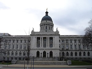
Hackensack, New Jersey
City in Bergen County, New Jersey, US
Distance: Approx. 406 meters
Latitude and longitude: 40.889398,-74.045698
Hackensack is the most populous municipality and the county seat of Bergen County, in the U.S. state of New Jersey. The area was officially named New Barbadoes Township until 1921, but has informally been known as Hackensack since at least the 18th century. As of the 2020 United States census, the city's population was 46,030, its highest decennial count ever and an increase of 3,020 (+7.0%) from the 2010 census count of 43,010, which in turn reflected an increase of 333 (+0.8%) from the 42,677 counted in the 2000 census.
Hackensack High School
High school in Bergen County, New Jersey, US
Distance: Approx. 340 meters
Latitude and longitude: 40.88505,-74.052119
Hackensack High School is a four-year comprehensive public high school located in Hackensack, in the U.S. state of New Jersey, operating as part of the Hackensack Public Schools. Hackensack High School serves students from the Bergen County, New Jersey, communities of Hackensack, South Hackensack (80 students in 2011–12), Rochelle Park (120 students). As of the 2023–24 school year, the school had an enrollment of 1,726 students and 138.3 classroom teachers (on an FTE basis), for a student–teacher ratio of 12.5:1.
New Barbadoes Township, New Jersey
Distance: Approx. 267 meters
Latitude and longitude: 40.89,-74.05
New Barbadoes Township was a township that was formed in 1710 and existed in its largest extent prior to the American Revolutionary War in Bergen County, New Jersey. The Township was created from territories that had been part of Essex County that were transferred by royal decree to Bergen County. After many departures, secessions and deannexations over the centuries, New Barbadoes Township exists presently as Hackensack, which adopted its present name in 1921.
Hackensack Public Schools
School district in New Jersey, US
Distance: Approx. 720 meters
Latitude and longitude: 40.889732,-74.041821
The Hackensack Public Schools are a comprehensive community public school district that serves students in pre-kindergarten through twelfth grade from the City of Hackensack, in Bergen County, in the U.S. state of New Jersey. As of the 2021–22 school year, the district, comprising six schools, had an enrollment of 5,483 students and 415.8 classroom teachers (on an FTE basis), for a student–teacher ratio of 13.2:1. The district is classified by the New Jersey Department of Education as being in District Factor Group "CD", the sixth-highest of eight groupings.

Hackensack University Medical Center
Hospital in New Jersey, U.S.
Distance: Approx. 745 meters
Latitude and longitude: 40.88416667,-74.0575
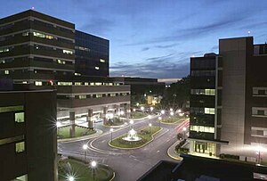
Hackensack University Medical Center (HUMC) is a 950-bed non-profit, research and teaching hospital providing tertiary and healthcare needs located seven miles (11 km) west of New York City, in Hackensack, Bergen County, New Jersey, United States. As of 2019, it ranks as the second-largest hospital in New Jersey and No. 59 in the US. HUMC is the largest hospital in the Hackensack Meridian Health Health System.

Anderson Street station
NJ Transit rail station
Distance: Approx. 863 meters
Latitude and longitude: 40.89416667,-74.04444444
Anderson Street is a New Jersey Transit rail station on the Pascack Valley Line. The station is one of two rail stations in Hackensack (the other being Essex Street) and located at Anderson Street near Linden Street. The station house was built in 1869 (and opened on September 9, 1869) by the Hackensack and New York Railroad on a track extension from Passaic Street in Hackensack.

Anderson Outkitchen
United States historic place
Distance: Approx. 810 meters
Latitude and longitude: 40.8875,-74.04027778
The Anderson Outkitchen is located in Hackensack, Bergen County, New Jersey, United States. The outkitchen was added to the National Register of Historic Places on August 8, 1985.
Bergen County Christian Academy
Christian school in Bergen County, New Jersey, United States
Distance: Approx. 822 meters
Latitude and longitude: 40.892203,-74.042258
Bergen County Christian Academy (BCCA) is a private Christian school located in Hackensack, Bergen County, New Jersey, United States. Bergen County Christian Academy was founded in 1973 as Hackensack Christian Schools, a ministry of First Baptist Church of Hackensack. Hackensack Christian was reestablished as Bergen County Christian Academy in 2016.

Hackensack Gospel Church
Church in New Jersey , United States
Distance: Approx. 822 meters
Latitude and longitude: 40.891898,-74.041958
Hackensack Gospel Church previously known as the First Baptist Church of Hackensack is a non-denominational church located in Hackensack, New Jersey. It is a campus of the Hawthorne Gospel Church. The campus covers a full city block of land and includes a 500-seat worship auditorium, a school offering pre-kindergarten through grade 12, a day camp, and a library.

Hackensack station (New York, Susquehanna and Western Railroad)
Former railway station in New Jersey, US
Distance: Approx. 726 meters
Latitude and longitude: 40.883879,-74.04282
Hackensack was a railroad station in Hackensack, New Jersey on the New York, Susquehanna and Western Railway Main Line, which provided passenger service between the 1870s and 1960s. The station at Main and Mercer Streets opened in 1872; it was replaced with one at River Street in 1950. Public Service trolley lines served both stations.

Joseph M. Sanzari Children's Hospital
Hospital in New Jersey, United States
Distance: Approx. 609 meters
Latitude and longitude: 40.884716,-74.056052
The Joseph M. Sanzari Children's Hospital (JMSCH) at Hackensack University Medical Center is a pediatric acute care hospital with 105 beds. It is a designated New Jersey children's hospital and full institutional member of the National Association of Children's Hospitals. It is affiliated with the Hackensack Meridian School of Medicine, Rutgers University New Jersey Medical School, University of Medicine and Dentistry of New Jersey-New Jersey Medical School in Newark, and is a member of the Hackensack Meridian Health system.
John Theurer Cancer Center
Hospital in New Jersey, United States
Distance: Approx. 466 meters
Latitude and longitude: 40.8843,-74.0533
John Theurer Cancer Center (JTCC) at the Hackensack University Medical Center (HUMC), and part of the Hackensack Meridian Health (HMH), specializes in oncology services and treatments. It is known for being the first site approved to use cell-based gene therapy to treat patients with certain types of large B-cell lymphoma who have not responded or relapsed after at least two other kinds of treatment; it initiated the first CAR T-cell therapy clinical trials and is a member of the NCI-approved Georgetown Lombardi Comprehensive Cancer Center. Other areas of concentration include bone marrow transplants, stem cell transplantation, lymphoma, leukemia, multiple myeloma, neuro-oncology, cutaneous malignancy, gastrointestinal, geriatric, head and neck, thoracic, urologic, breast, and gynecologic.
Weather in this IP's area
broken clouds
-9 Celsius
-15 Celsius
-10 Celsius
-8 Celsius
1032 hPa
51 %
1032 hPa
1027 hPa
10000 meters
4.63 m/s
260 degree
75 %