161.12.75.214 - IP Lookup: Free IP Address Lookup, Postal Code Lookup, IP Location Lookup, IP ASN, Public IP
Country:
 Great Britain
Region:
City:
Location:
Time Zone:
Postal Code:
ISP:
ASN:
language:
User-Agent:
Proxy IP:
Blacklist:
IP information under different IP Channel
ip-api
Country
Region
City
ASN
Time Zone
ISP
Blacklist
Proxy
Latitude
Longitude
Postal
Route
db-ip
Country
Region
City
ASN
Time Zone
ISP
Blacklist
Proxy
Latitude
Longitude
Postal
Route
IPinfo
Country
Region
City
ASN
Time Zone
ISP
Blacklist
Proxy
Latitude
Longitude
Postal
Route
IP2Location
161.12.75.214Country
gbRegion
scotland
City
perth
Time Zone
Europe/London
ISP
Language
User-Agent
Latitude
Longitude
Postal
ipdata
Country
Region
City
ASN
Time Zone
ISP
Blacklist
Proxy
Latitude
Longitude
Postal
Route
Popular places and events near this IP address

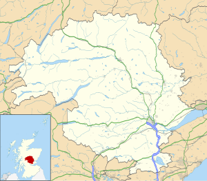
Perth, Scotland
City in central Scotland
Distance: Approx. 138 meters
Latitude and longitude: 56.39583333,-3.43333333
Perth (; Scottish Gaelic: Peairt [pʰɛrˠʃtʲ]) is a centrally located Scottish city, on the banks of the River Tay. It is the administrative centre of Perth and Kinross council area and is the historic county town of Perthshire. It had a population of about 47,430 in 2018.
Perth and Kinross
Council area of Scotland
Distance: Approx. 138 meters
Latitude and longitude: 56.39583333,-3.43333333
Perth and Kinross (Scots: Pairth an Kinross; Scottish Gaelic: Peairt agus Ceann Rois) is one of the 32 council areas of Scotland, and a lieutenancy area. It is bordered by Highland and Aberdeenshire to the north, Angus, Dundee, and Fife to the east, Clackmannanshire to the south, and Stirling and Argyll and Bute to the west. Geographically the area is split by the Highland Boundary Fault into a more mountainous northern part and a flatter southern part.

Blackfriars, Perth
Dominican friary in Scotland
Distance: Approx. 96 meters
Latitude and longitude: 56.396,-3.432
The Church of the Friars Preachers of Blessed Virgin and Saint Dominic at Perth, commonly called "Blackfriars", was a mendicant friary of the Dominican Order of the Catholic Church founded in the 13th century at Perth, Scotland. The Dominicans ("Black friars") were said by Walter Bower to have been brought to Scotland in 1230 by King Alexander II of Scotland, while John Spottiswood held that they were brought to Scotland by William de Malveisin, Bishop of St Andrews. Later tradition held that the Perth Dominican friary was founded by King Alexander II. The Pontifical Offices of St Andrews listed the friary as having been dedicated on 13 May 1240.

Perth City Hall
City hall in Perth, Perth and Kinross, Scotland
Distance: Approx. 146 meters
Latitude and longitude: 56.3959,-3.4294
Perth City Hall is a civic building in King Edward Street, Perth, Scotland. Built in 1914, it is a Category B listed building. The building served as a music hall before closing in 2005 and being replaced by Perth Concert Hall.

Vennels of Perth
Small streets and footpaths in Perth, Scotland
Distance: Approx. 163 meters
Latitude and longitude: 56.396545,-3.43036
The vennels of Perth are a collection of small medieval streets in the city of Perth, Scotland. Similar to York's Snickelways, vennels are a public right-of-way passageway between the gables of buildings which can, in effect, be a minor street. In Scotland, the term originated in royal burghs created in the twelfth century, the word deriving from the Old French word venelle meaning "alley" or "lane".

A989 road
Road in Scotland
Distance: Approx. 167 meters
Latitude and longitude: 56.396635,-3.43219
The A989 is a road in Perth, Scotland. Also known as the Perth Inner Ring Road, due to its circumnavigation of the city centre, it is 1.93 miles (3.11 km) long. Perth's city centre is around 0.5 miles (0.80 km) long and wide.

Perth mercat cross
Scottish memorial cross
Distance: Approx. 102 meters
Latitude and longitude: 56.39587,-3.43026
Perth mercat cross is located on King Edward Street in the Scottish city of Perth, Perth and Kinross. Erected in 1913, in memory of Edward VII, it stands immediately to the west of Perth City Hall, which was completed a year later, between it and St John's Centre. King Edward Street was created between 1901 and 1902.

St John's Shopping Centre, Perth
Shopping mall in Perth and Kinross, Scotland
Distance: Approx. 97 meters
Latitude and longitude: 56.39605,-3.43107
St John's Shopping Centre is a shopping mall in Perth, Scotland. Situated between (and with entrances from) South Street (to the south), King Edward Street (to the east), Scott Street (to the west) and the pedestrianised section of the High Street (to the north), it was built between 1985 and 1987. It cost around £20 million.

Guildhall, Perth
Historic site in Perth, Scotland
Distance: Approx. 186 meters
Latitude and longitude: 56.3965,-3.4295
Perth Guildhall is a building at today's 102–106 High Street, Perth, Scotland. The structure, which stands at the corner of High Street and King Edward Street, a block north of Perth City Hall, is Category B listed, dating to 1907. It stands on the site of a former guildhall that existed between 1722 and 1907.

Scott Street Methodist Church
Church in Perth and Kinross, Scotland
Distance: Approx. 76 meters
Latitude and longitude: 56.3949,-3.4325
Scott Street Methodist Church is located in Perth, Perth and Kinross, Scotland. Standing in the city centre, it was completed in 1880, and is now a Category C listed building. The church was designed by architect Alexander Petrie.
Perth Museum
City museum in Perth, Scotland
Distance: Approx. 143 meters
Latitude and longitude: 56.39585,-3.4294
Perth Museum is a museum which opened on 30 March 2024. The museum is housed within Perth City Hall and aims showcase the city’s important collections to tell the tale of Scotland through the prism of Perth, the former capital of Scotland. The museum faces King Edward Street but is accessed from St John's Place.

Siege of Perth (1339)
Siege of Perth, Scotland
Distance: Approx. 138 meters
Latitude and longitude: 56.39583333,-3.43333333
The siege of Perth was conducted from June to August 1339 as part of the Wars of Scottish Independence. The siege was conducted by forces loyal to David II of Scotland and commanded by Robert Stewart, the Guardian of Scotland. The defending forces were acting on behalf of Edward Balliol and were commanded by Thomas Ughtred.
Weather in this IP's area
broken clouds
4 Celsius
1 Celsius
4 Celsius
5 Celsius
1027 hPa
76 %
1027 hPa
1010 hPa
10000 meters
3.83 m/s
6.3 m/s
90 degree
76 %