161.108.130.127 - IP Lookup: Free IP Address Lookup, Postal Code Lookup, IP Location Lookup, IP ASN, Public IP
Country:
Region:
City:
Location:
Time Zone:
Postal Code:
ISP:
ASN:
language:
User-Agent:
Proxy IP:
Blacklist:
IP information under different IP Channel
ip-api
Country
Region
City
ASN
Time Zone
ISP
Blacklist
Proxy
Latitude
Longitude
Postal
Route
db-ip
Country
Region
City
ASN
Time Zone
ISP
Blacklist
Proxy
Latitude
Longitude
Postal
Route
IPinfo
Country
Region
City
ASN
Time Zone
ISP
Blacklist
Proxy
Latitude
Longitude
Postal
Route
IP2Location
161.108.130.127Country
Region
south carolina
City
fort mill
Time Zone
America/New_York
ISP
Language
User-Agent
Latitude
Longitude
Postal
ipdata
Country
Region
City
ASN
Time Zone
ISP
Blacklist
Proxy
Latitude
Longitude
Postal
Route
Popular places and events near this IP address
CrossRidge Center
Mixed-use development in South Carolina
Distance: Approx. 3937 meters
Latitude and longitude: 34.96361111,-80.85111111
CrossRidge Center is a mixed-use development located in Indian Land, South Carolina. Development of the site can be traced back to 2003, when discussions first began. A major phase of development was announced in 2018.
Southern Evangelical Seminary
Christian college in North Carolina, U.S.
Distance: Approx. 4886 meters
Latitude and longitude: 35.04215,-80.86178
Southern Evangelical Seminary is a Christian college and seminary in Charlotte, North Carolina, United States.

Indian Land, South Carolina
Unincorporated community in South Carolina, United States
Distance: Approx. 481 meters
Latitude and longitude: 35.00194444,-80.85666667
Indian Land is an unincorporated community in the northernmost part (the "Panhandle") of Lancaster County, South Carolina, United States. It lies six miles east of Fort Mill, and west of the villages of Marvin and Waxhaw, North Carolina. While not incorporated, the community is assigned with the ZIP code 29707.

Ardrey Kell High School
American public school in North Carolina
Distance: Approx. 4686 meters
Latitude and longitude: 35.03028,-80.82607
Ardrey Kell High School is a public high school serving grades 9–12 in the Ballantyne area of Charlotte, North Carolina, United States. The school is part of Charlotte-Mecklenburg Schools district.

Unity Presbyterian Church Complex
Historic church in South Carolina, United States
Distance: Approx. 7239 meters
Latitude and longitude: 35.00916667,-80.93777778
Unity Presbyterian Church Complex is a historic church in Fort Mill, South Carolina. It was built in 1881 and added to the National Register of Historic Places in 1992.
Marvin Ridge High School
American public school in North Carolina
Distance: Approx. 6345 meters
Latitude and longitude: 34.9743,-80.7964
Marvin Ridge High School (commonly Marvin, Marvin Ridge, or MRHS) is a public high school in Marvin, North Carolina, USA serving students in grades 9–12. The school is part of the Union County Public School system. The school occupies a two-story building with a full auditorium and fully air-conditioned gym.
Horizon Lines
Distance: Approx. 3827 meters
Latitude and longitude: 35.015268,-80.822992
Horizon Lines, Inc. was an American domestic ocean shipping and logistics company headquartered in Charlotte, North Carolina. It was the largest Jones Act-compliant maritime shipping and logistics company, and accounted for approximately 37 per cent of all U.S. container shipments linking the continental United States to Alaska, Hawaii and Puerto Rico.

Banks-Mack House
Historic house in South Carolina, United States
Distance: Approx. 7208 meters
Latitude and longitude: 35.00305556,-80.93833333
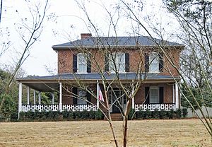
Banks-Mack House is a historic home located at Fort Mill, York County, South Carolina. It was built about 1871, and enlarged and renovated in the Classical Revival style in 1910. It is a two-story, frame dwelling with a one-story, hip roofed wraparound porch.

Mack-Belk House
Historic house in South Carolina, United States
Distance: Approx. 6947 meters
Latitude and longitude: 35.00666667,-80.935
Mack-Belk House is a historic home located at Fort Mill, York County, South Carolina. It consists of a one-story rear section built in the 1860s, with a two-story, three-bay, brick main block built about 1890. It features a one-story, hip roofed wraparound porch with Late Victorian design elements.

National Guard Armory (Fort Mill, South Carolina)
United States historic place
Distance: Approx. 7369 meters
Latitude and longitude: 35.00944444,-80.93916667
National Guard Armory is a historic National Guard armory located at Fort Mill, York County, South Carolina.
James A. Blakeney House
Historic house in North Carolina, United States
Distance: Approx. 5985 meters
Latitude and longitude: 35.04,-80.81805556
The James A. Blakeney House is a historic house located near Providence, Mecklenburg County, North Carolina. It was built in 1905–1906, and is a two-story, three-bay, Colonial Revival style frame farmhouse with a one-story rear kitchen wing. It has a multiple cross-gable slate roof and a broad hip roofed wraparound porch.
Belair, South Carolina
Settlement in South Carolina, United States
Distance: Approx. 5072 meters
Latitude and longitude: 34.95333333,-80.85055556
Belair is an unincorporated community in Lancaster County, in the U.S. state of South Carolina.
Weather in this IP's area
light rain
3 Celsius
0 Celsius
2 Celsius
3 Celsius
1020 hPa
94 %
1020 hPa
996 hPa
10000 meters
2.57 m/s
60 degree
100 %