Country:
 Singapore
Region:
City:
Latitude and Longitude:
Time Zone:
Postal Code:
IP information under different IP Channel
ip-api
Country
Region
City
ASN
Time Zone
ISP
Blacklist
Proxy
Latitude
Longitude
Postal
Route
IPinfo
Country
Region
City
ASN
Time Zone
ISP
Blacklist
Proxy
Latitude
Longitude
Postal
Route
MaxMind
Country
Region
City
ASN
Time Zone
ISP
Blacklist
Proxy
Latitude
Longitude
Postal
Route
Luminati
Country
SGASN
Time Zone
Asia/Singapore
ISP
GOVERNMENT TECHNOLOGY AGENCY
Latitude
Longitude
Postal
db-ip
Country
Region
City
ASN
Time Zone
ISP
Blacklist
Proxy
Latitude
Longitude
Postal
Route
ipdata
Country
Region
City
ASN
Time Zone
ISP
Blacklist
Proxy
Latitude
Longitude
Postal
Route
Popular places and events near this IP address

Pasir Panjang MRT station
Mass Rapid Transit station in Singapore
Distance: Approx. 980 meters
Latitude and longitude: 1.276167,103.791358
Pasir Panjang MRT station is an underground Mass Rapid Transit (MRT) station on the Circle line. As the name suggests, it is located in Pasir Panjang at the southern part of Queenstown planning area, Singapore. This station is situated underneath Pasir Panjang Road and Labrador Viaduct (West Coast Highway), next to the Pasir Panjang Food Centre, Currency House and Pasir Panjang container terminal.

Telok Blangah MRT station
Mass Rapid Transit station in Singapore
Distance: Approx. 1162 meters
Latitude and longitude: 1.270572,103.809678
Telok Blangah MRT station is an underground Mass Rapid Transit (MRT) station on the Circle line, situated in Bukit Merah planning area, Singapore. It is located along Telok Blangah Road near the junction of Henderson Road, and primarily serves the residential neighbourhood of Telok Blangah. The station is named after the nearby Telok Blangah estate, which was derived from Blangah in Malay meaning a stopping place, or Blanga referring to an Indian clay cooking pot in reference to the shape of the bay behind Keppel Harbour.

Labrador Park MRT station
Mass Rapid Transit station in Singapore
Distance: Approx. 407 meters
Latitude and longitude: 1.272267,103.802908
Labrador Park MRT station is an underground Mass Rapid Transit (MRT) station on the Circle line, located within Bukit Merah planning area, Singapore. Built underneath Telok Blangah Road near the junctions of Alexandra Road and Labrador Villa Road, this station was named after the nearby Labrador Nature Reserve. It is the nearest MRT station to the PSA Building and Gillman Barracks, the latter of which is now home to numerous art galleries.

Labrador Nature Reserve
Distance: Approx. 830 meters
Latitude and longitude: 1.26722222,103.80166667
Labrador Nature Reserve (Chinese: 拉柏多自然保护区, Malay: Kawasan Simpanan Alam Semulajadi Labrador), also known locally as Labrador Park (拉柏多公园, Taman Labrador), is located in the southern part of mainland Singapore. It is home to the only rocky sea-cliff on the mainland that is accessible to the public. Since 2002, 10 hectares of coastal secondary-type vegetation and its rocky shore have been gazetted as a nature reserve and its flora and fauna preserved by NParks.

Fort Pasir Panjang
Colonial Singapore defensive structure
Distance: Approx. 1005 meters
Latitude and longitude: 1.26594167,103.80289444
Fort Pasir Panjang or Labrador Battery is located within Labrador Park at the southern tip of Singapore island. It was one of the 11 coastal artillery forts built by the British in the 19th century to defend the western passageway into Keppel Harbour against piracy and foreign naval powers. During the 1942 Battle of Pasir Panjang, the fort played a supporting role but a limited one in defending the Malay Regiments against the Japanese invasion at Bukit Chandu.

MTower
Integrated development in Singapore
Distance: Approx. 173 meters
Latitude and longitude: 1.2735,103.8012
mTower, formerly known as PSA Building, is an integrated development in Singapore, comprising a 40-storey office building and a 3-storey retail centre, Alexandra Retail Centre. It is located at Alexandra Road, Singapore. The building also houses Singapore's Ministry of Transport and the Maritime and Port Authority of Singapore.
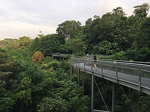
Southern Ridges
10km trail in southern Singapore
Distance: Approx. 955 meters
Latitude and longitude: 1.279,103.8073
The Southern Ridges comprise 10 kilometres (6.2 mi) of trails connecting three parks along the southern ridge of Singapore. Some of the attractions along these trails include its greenery and the connecting bridges. This project linked up the parks between the Kent Ridge Park and HarbourFront.

Reflections at Bukit Chandu
Distance: Approx. 1047 meters
Latitude and longitude: 1.2791,103.7918
Reflections at Bukit Chandu is a World War II interpretive centre developed and managed by the National Archives of Singapore, located on Bukit Chandu (Malay for "Opium Hill") off Pasir Panjang Road in Singapore. The centre was officially opened by Singapore's Deputy Prime Minister Tony Tan on 15 February 2002. This date also marks the 60th anniversary of the fall of Singapore in 1942.
Singapore Raffles Music College
Distance: Approx. 128 meters
Latitude and longitude: 1.2752,103.7991
Singapore Raffles Music College (Abbreviation: SRMC; Chinese: 新加坡莱佛士音乐学院; pinyin: Xīnjiāpō Láifoshi Yīnyuè Xuéyuan) is one of Singapore’s leading educational institution specializing in Music, Dance and Business (Creative Industries). Established in 2001, SRMC is registered with the SkillsFuture Singapore (SSG) and was awarded the EduTrust 4-Year award in 2021, certifying that SRMC has reached high standards in key areas of management and provision of educational services. It enrolled its first students in 2006.
Taipei Representative Office in Singapore
Political representative office in Singapore
Distance: Approx. 169 meters
Latitude and longitude: 1.273575,103.801214
The Taipei Representative Office in Singapore (TRO; Chinese: 駐新加坡台北代表處; pinyin: Zhù Xīnjiāpō Táiběi Dàibiǎo Chù) is the representative office of the Republic of China in Singapore. Its counterpart body in Taiwan is the Singapore Trade Office in Taipei. The office is located within mTower at 460 Alexandra Road, Singapore.

Gillman Barracks
Cultural hub in Singapore
Distance: Approx. 634 meters
Latitude and longitude: 1.27805556,103.80444444
Gillman Barracks is a contemporary arts cluster in Singapore that is home to international art galleries, restaurants and the NTU Centre for Contemporary Art Singapore, which are all housed in conserved colonial barracks. Gillman Barracks lies near to Alexandra Road, and the 6.4-hectare (16-acre) site covers Lock Road and Malan Road amid greenery. Gillman Barracks is jointly developed by the Singapore Economic Development Board, JTC Corporation and the National Arts Council.

The Interlace
Apartment complex in Singapore
Distance: Approx. 971 meters
Latitude and longitude: 1.28259,103.80324
The Interlace is a 1,040-unit apartment building complex located at the boundary between Bukit Merah and Queenstown, Singapore. Noteworthy for its break from the typical tower design in cities with high population densities, it resembles Jenga blocks irregularly stacked upon each other. Designed by The Office for Metropolitan Architecture (OMA), it was awarded the World Building of the Year title at the 2015 World Architecture Festival.
Weather in this IP's area
light rain
27 Celsius
27 Celsius
26 Celsius
27 Celsius
1011 hPa
88 %
1011 hPa
1008 hPa
10000 meters
1.03 m/s
20 degree
75 %
06:47:07
18:52:04