160.25.25.22 - IP Lookup: Free IP Address Lookup, Postal Code Lookup, IP Location Lookup, IP ASN, Public IP
Country:
Region:
City:
Location:
Time Zone:
Postal Code:
ISP:
ASN:
language:
User-Agent:
Proxy IP:
Blacklist:
IP information under different IP Channel
ip-api
Country
Region
City
ASN
Time Zone
ISP
Blacklist
Proxy
Latitude
Longitude
Postal
Route
db-ip
Country
Region
City
ASN
Time Zone
ISP
Blacklist
Proxy
Latitude
Longitude
Postal
Route
IPinfo
Country
Region
City
ASN
Time Zone
ISP
Blacklist
Proxy
Latitude
Longitude
Postal
Route
IP2Location
160.25.25.22Country
Region
jharkhand
City
jasidih
Time Zone
Asia/Kolkata
ISP
Language
User-Agent
Latitude
Longitude
Postal
ipdata
Country
Region
City
ASN
Time Zone
ISP
Blacklist
Proxy
Latitude
Longitude
Postal
Route
Popular places and events near this IP address

Jasidih
Satellite Town in Jharkhand, India
Distance: Approx. 634 meters
Latitude and longitude: 24.522,86.6477
Jasidih is a satellite town of Deoghar in the Deoghar subdivision of the Deoghar district in the Indian state of Jharkhand. This town's railway station connects Deoghar to other cities.

Baidyanath Temple
Hindu Temple in Deoghar, Jharkhand, India
Distance: Approx. 5737 meters
Latitude and longitude: 24.4925,86.7
Baidyanath Temple (IAST: Baidyãnath), also known as Baba Baidyanath Dham, is a Hindu temple dedicated to Shiva. It is located in Deoghar, in the Santhal Parganas division of the Indian state of Jharkhand. The temple complex comprises the central shrine of Baba Baidyanath along with 21 additional temples.

Ramakrishna Mission Vidyapith, Deoghar
Residential boys' senior secondary school
Distance: Approx. 4832 meters
Latitude and longitude: 24.50555556,86.69611111
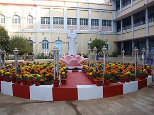
Ramakrishna Mission Vidyapith, Deoghar is a residential boys' senior secondary school in Deoghar, Jharkhand, India, established in 1922. It is the oldest institute of Ramakrishna Mission, and used to be visited by brother disciples of Swami Vivekananda. Swami Jayantananda is the present secretary, and Swami Divyasudhananda is the current principal of the school.
Satar, Deoghar
Distance: Approx. 3368 meters
Latitude and longitude: 24.4865,86.652
Satar (24.4865°N 86.6520°E / 24.4865; 86.6520) is a village in Deoghar district of Jharkhand state of India.

Jasidih Junction railway station
Railway station in Jharkhand, India
Distance: Approx. 657 meters
Latitude and longitude: 24.51472222,86.64388889
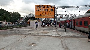
Jasidih Junction (station code: JSME) is the fourth busiest railway station in terms of train frequencies and population after Dhanbad , Tatanagar and Ranchi and serving as the satellite station of Deoghar city in the Deoghar district in the Indian state of Jharkhand. Many premium trains halt here like Howrah Rajdhani (via Patna) , Howrah - New Delhi Duronto , Poorva Express, Kolkata - Patna Garib Rath , Shalimar Patna Duronto Express and recently launched Patna-Howrah Vande Bharat Express and Varanasi-Baidyanathdham Vande Bharat Express. It has also been included under the Amrit Bharat Station Scheme and is waiting to be upgraded with world-class services.
Deoghar (community development block)
Community development block in Jharkhand, India
Distance: Approx. 6180 meters
Latitude and longitude: 24.48638889,86.70111111
Deoghar is a community development block that forms an administrative division in the Deoghar subdivision, of the Deoghar district, Jharkhand state, India.

Saint Francis School Deoghar
Missionary school
Distance: Approx. 5477 meters
Latitude and longitude: 24.4836,86.69
Saint Francis School (or St. Francis School) is a Catholic school in the temple-town of Baidyanathdham, Deoghar, etc.
Birla Institute of Technology, Deoghar
Extension Center of Birla Institute of Technology, Mesra
Distance: Approx. 794 meters
Latitude and longitude: 24.5136868,86.6571006
Birla Institute of Technology, Deoghar is an educational centre offering undergraduate courses located in Deoghar, Jharkhand, India.

Deoghar Junction railway station
Railway junction station in Jharkhand
Distance: Approx. 4661 meters
Latitude and longitude: 24.5119976,86.6957309
Deoghar Junction Railway Station (station code DGHR) is the main railway station serving the city of Deoghar in Deoghar district, Jharkhand.

Satsang Ashram
Headquarters of the Satsang movement, in Deoghar, India
Distance: Approx. 4560 meters
Latitude and longitude: 24.48,86.67
Satsang Ashram is the headquarters of the Satsang movement started by Thakur Anukulchandra in India and across the world. The Satsang Ashram has become a major place of attraction in Deoghar for all kinds of people in the society. The township surrounding the ashram is known as Satsang Nagar and has a dedicated Indian railways passenger halt for the ease of devotees visiting the place.

Baidyanath Dham (Nepal)
Hindu pilgrimage site in Nepal
Distance: Approx. 5735 meters
Latitude and longitude: 24.49248,86.69997
Baidyanath Dham, one of the four Shrines of Nepal, is a shrine of Lord Shiva located in Achham District in the confluence of the Budhi Ganga and Saraswati rivers in Achham district. The shrine has a school to teach Ved called Ved Bidyashram. In 2020, the government allocated NPR 2 million for Baidyanath Dham to upgrade Ved Bidyashram.

Deoghar subdivision
Subdivision in Jharkhand, India
Distance: Approx. 5549 meters
Latitude and longitude: 24.487,86.694
Deoghar subdivision is an administrative subdivision of the Deoghar district in the Santhal Pargana division in the state of Jharkhand, India.
Weather in this IP's area
clear sky
15 Celsius
14 Celsius
15 Celsius
15 Celsius
1019 hPa
55 %
1019 hPa
989 hPa
10000 meters
1.83 m/s
1.87 m/s
346 degree